Auckland ports

The ports of Auckland are the port facilities of the New Zealand city of Auckland . With a few exceptions, the ports are managed by Ports of Ackland (POAL) , owned by the Auckland Regional Council and the successor to the Auckland Harbor Board .
This company manages Auckland's commercial cargo and cruise ports. The ferry terminals, the recreational marinas and also the company owned Chelsea Wharf are not operated by POAL.
Infrastructure
Auckland has two trading ports if you don't count the ferry terminals. There are also two inland ports connected to them for inland navigation. POAL employs 568 full-time equivalents in all facilities and is in operation around the clock.
Auckland Harbor
The Port of Auckland is a large international container and trading port located on the natural harbor of Waitemata Harbor . It is located in the central and eastern part of the Auckland waterfront district , north of the Auckland business center. The 55 hectares of quays and storage areas (mostly for containers, vehicles and other general cargo) are almost exclusively on artificial land, most of which is in the former Commercial Bay , Official Bay and Mechanics Bay .
The kays are from west to east:
- Wynyard Wharf (also known as 'Tank Farm' or 'Western Reclamation', west of the Viaduct Basin) . This area is largely used for chemical handling and liquid storage and is expected to become a mixed area and park over the next few decades )
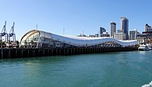
- Princes Wharf (residential development, cruise terminal)
- Queens Wharf (proposed additional cruise ship terminal)
- Captain Cook Wharf
- Marsden Wharf
- Bledisloe Wharf (the New Zealand Stadium was originally to be built here)
- Jellicoe Wharf
- Freyburg Wharf
- Fergusson Wharf (a very large container handling area built on reclaimed land from the 1960s)
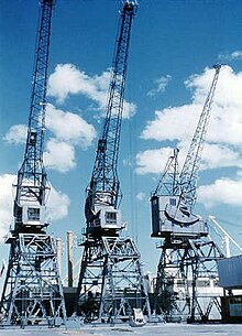
In 2006, POAL bought three large container cranes from Zhenhua Port Machinery Company in China for NZ $ 27 million . These are now located at the Axis Intermodal Terminal on Fergusson wharf together with two cranes that were purchased in 2001 . The new cranes are the largest in New Zealand, each weighing 1,250 tonnes, 103 m high and 56 jib length. You can lift two 20-foot containers at the same time at speeds of up to 150 m per minute. They were bought in order to achieve the loading capacity and unloading required for post-Panamax ships. Their diesel-electric generators are also intended to provide emergency power for refrigerated containers in the event of a power failure.
Onehunga port
This second port is smaller and is located at Onehunga on Manukau Harbor south of Auckland City . Although it is much closer to the industrial areas of southern Auckland and Manukau City , it is less important than the Auckland port. This is due to the shallow water depth of the port access in the Manukau and the few extensive port facilities. It is mainly used for the re-shipment of goods with coastal ships within New Zealand, for example for the delivery of cement from Westport .
Chelsea Wharf
This port is not part of the POAL facilities. Located in Birkenhead , North Shore City , it serves the Chelsea Sugar Refinery , which has been in operation since 1884 . The nine hectares of land were first leased by POAL, then bought by Chelsea in 1997. Ships with unrefined sugar (mainly from Australia) arrive here every six weeks and since they usually exceed 500 gross register tonnes, the ships have to take on board a pilot from the Ports of Auckland harbor surveillance .
envelope
freight
About 1,600 merchant ships call at the port annually. Auckland is New Zealand's largest trading port. Its annual turnover was NZ $ 20 billion. and thus significantly exceeds its biggest competitors such as the port of Tauranga . Ports of Auckland handled 60% of New Zealand's imports and 40% of its exports in 2006 by value. The port also recorded 50% of the North Island's container handling and 37% of the total New Zealand container handling (2007). It handled 4 million tons of general cargo (2006) and 773,160 TEU (container unit, which corresponds to a 20-foot sea container) (2007).
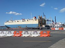
In addition, around 166,000 used vehicles were imported through the port in 2006. These were mostly relatively new Japanese cars that were retired in Japan due to the very strict technical requirements of the Japanese road traffic authorities. Due to the strict regulations of the New Zealand MAF with regard to biosecurity, vehicles and many other goods have to be decontaminated, which greatly increases handling times.
Cruise ships
In the 2005/2006 season, POAL handled 48 cruise ships at the Overseas Passenger Terminal on Princes Wharf . More than 100,000 passengers passed through the port, mainly for short shore excursions to Auckland and the surrounding area. It is estimated that total revenue of around NZ $ 1 million per cruise ship visit. For 2007/2008 73 ships were forecast.
The largest ship to visit Auckland so far was the Queen Mary 2 in early 2007. However, due to its size, it was handled at Jellicoe Wharf in the cargo area of the port. The largest volume of passengers in one day took place in February 2007 when the Statendam and the Sapphire Princess in Auckland carried 8,000 passengers from and on board, which corresponds to the number of passengers of 19 Boeing 747 jumbo jets .
Economic role
Research has shown that a third of the local economy and 173,000 jobs in the Auckland area depend directly or indirectly on the port. Ports of Auckland is 100% owned by Auckland Regional Holdings , an Auckland Regional Council investment firm . Dividend payments for the 15 years to 2006 were NZ $ 500 million.
history
Auckland's trade has always been to a great extent dependent on its ports. From the original quays of Commercial Bay in the 1840s , the harbor expanded through land reclamation and redesigned the entire Auckland waterfront during the 19th and 20th centuries , and this continues today particularly on Fergusson Wharf . The port has been New Zealand's largest port since 1924 (the year Onehunga Port was founded ).
19th century
The ports originally built in Commercial Bay and Official Bay were located in tidal areas that made it difficult to build good quays. After control of Waitemata Harbor was transferred to the Auckland Provincial Council in 1853 , the council did much to improve the port facilities. These included the construction of the first Queen Street Wharf , a wharf along Customs Street and a breakwater at Point Britomart .
After the council established the Auckland Harbor Board in 1871 , additional quays were built and extensive land reclamation began. As a result, Freemans Bay and Mechanics Bay lost their natural coastline; Commercial Bay is now the location of a large part of the central business district of Auckland and the Auckland Waterfront and has completely disappeared in the course of history.
The newly reclaimed land allowed the construction of a quay served by the railroad and new shipyards. New facilities were also built on the other side of the harbor at Devonport , including the Calliope Dock , the largest dry dock in the southern hemisphere in 1888 .
20th century
In the early 20th century, commercial and passenger shipping were already very extensive. Large passenger ships came regularly from Europe and the USA. With the Second World War the beginning tourism collapsed again. On the other hand, when the USA entered the war in 1941, they stationed part of their fleet in Auckland and made it necessary to expand the port facilities. In 1943 104 warships and 284 transports docked in Auckland. During the war, the port began to operate around the clock.
After the war, expansion continued with the establishment of Import Wharf and Freyberg Wharv , which opened in 1961. The Overlook Passenger Terminal on Princess Wharf opened. At the end of the 1960s, Fergusson Wharf was built for ships with great drafts to accommodate the beginning container trade. She was completed in 1971, but it wasn't until 1973 that the first container ship docked. After that, however, the container trade developed more rapidly, and with it container handling.
In 1988 the Auckland Harbor Board and the Port Authority were transferred to a newly established company, Ports of Auckland , by act of parliament . The changes in management increased productivity, but also led to the loss of jobs in the port. About 20% of the company's shares came into free float when Environment Waikato sold its shares. Auckland Regional Holdings later bought this back, so that in 2005 the Auckland Regional Council became the sole owner.
21st century
The port is the third largest container port in Australasia and New Zealand's largest port. Little was left of the original facilities. The port is expanding and changing rapidly. Further land reclamation is planned to move the transshipment further east. The aim is on the one hand to meet the requirements of future shipping and on the other hand to make the Auckland Waterfront more accessible.
In 2007, a strong increase in shipping traffic was forecast as the Maersk Line chose Auckland as the export hub for the Fonterra Co-operative Group . POAL considered a merger with the port of Tauranga, but this did not materialize. In the same year, the port's handling volume increased by 12.6%, while the operating profit remained almost constant compared to 2006. In 2006 the profit was 55.9 million New Zealand dollars.
Web links
- Ports of Auckland ( Ports of Auckland website)
Individual evidence
- ↑ About Us . Ports of Auckland Limited , 2001, archived from the original on October 14, 2008 ; accessed on August 21, 2014 (English, original website no longer available).
- ↑ a b c Shedding Light on Our Port . (PDF 452 kB) Ports of Auckland Limited , 2006, archived from the original on August 14, 2007 ; accessed on January 17, 2015 (English, original website no longer available).
- ^ A b Queens Wharf a golden opportunity for Auckland - Region Wide , Auckland Regional Council Newsletter , March 2008, p. 4
- ↑ James Ihaka : Giant cranes complete journey from China . In: New Zealand Herald . NZME. Publishing , December 14, 2006, accessed April 15, 2018 .
- ↑ Chelsea Sugar Refinery buys nine hectares leased from Ports of Auckland ( CAFCA website , December 6, 2007)
- ↑ a b Id positive . (PDF 2.3 MB) Axis Immediate , September 2006, archived from the original on May 13, 2010 ; accessed on August 17, 2014 (English, original website no longer available).
- ↑ a b c d Michael Lee : Port creates a vital link in our economy . In: New Zealand Herald . NZME. Publishing , February 14, 2007, accessed April 15, 2018 .
- ↑ a b Welcome to Ports of Auckland . Ports of Auckland , archived from the original on January 25, 2007 ; accessed on April 15, 2018 (English, original website no longer available).
- ↑ a b c d More bulk, less gain for biggest port - Business Herald , September 28, 2007, p. 6
- ^ A tale of two ports . In: New Zealand Herald . NZME. Publishing , October 11, 2006, accessed April 15, 2018 .
- ^ Cruise ship arrivals and departures . Ports of Auckland , archived from the original on October 14, 2008 ; accessed on January 17, 2016 (English, original website no longer available).
- ↑ Newsroom - Cruise ship records shattered with nine ships in one week . Ports of Auckland Limited , archived from the original on October 14, 2008 ; accessed on August 21, 2014 (English, original website no longer available).
- ↑ a b c d e f Company profiles from POAL , from the 'Business History' of the University of Auckland
- ^ A Wheel on Each Corner , The History of the IPENZ Transportation Group 1956-2006 - Douglass, Malcolm; IPENZ Transportation Group 2006, p. 12
Coordinates: 36 ° 50 ′ 37.6 ″ S , 174 ° 46 ′ 36.7 ″ E


