Höingen (Ense)
|
Höingen
Ense municipality
|
|
|---|---|
| Coordinates: 51 ° 29 ′ 7 ″ N , 7 ° 58 ′ 28 ″ E | |
| Height : | 252 m |
| Residents : | 1850 (Dec. 31, 2019) |
| Incorporation : | 1st July 1969 |
| Postal code : | 59469 |
| Area code : | 02938 |
|
Location of Höingen in Ense
|
|
|
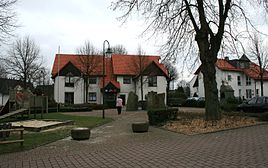
Village square
|
|
Höingen is a district of the municipality of Ense in North Rhine-Westphalia , Germany and belongs to the Soest district . Höingen has 1850 inhabitants.
In the year 793 the village was first mentioned in writing under the name "Hoangi". On July 1, 1969, Höingen was incorporated into the municipality of Ense during the municipal reorganization.
The highest elevation in Höingen is the Fürstenberg at 278.9 m above sea level. NN . On it, the Fürstenberg Castle , the Castle of Oldenburg and prehistoric burial mounds.
Individual evidence
- ↑ Municipality of Ense: Figures, data, facts , accessed on March 2, 2020
- ↑ Martin Bünermann: The communities of the first reorganization program in North Rhine-Westphalia . Deutscher Gemeindeverlag, Cologne 1970, p. 90 .
Web links
Commons : Höingen - collection of images, videos and audio files


