
Hell gate head
| Hell gate head | ||
|---|---|---|
 Höllentorkopf northwest (shadow) and southwest wall (sun) |
||
| height | 2150 m | |
| location | Bavaria , Germany | |
| Mountains | Wetterstein Mountains | |
| Dominance | 0.98 km → Alpspitze | |
| Notch height | 56 m ↓ Hell gate | |
| Coordinates | 47 ° 26 '21 " N , 11 ° 2' 47" E | |
|
||
| rock | Wetterstein lime | |
| Age of the rock | Triad | |
| First ascent | probably shepherds, early 19th century | |
| Normal way | East ridge difficulty level II | |

The Höllentorkopf is a mountain in the Wetterstein Mountains , which closes off the northern foothills of the Alpspitze . Its summit reaches a height of 2150 m .
Location and surroundings
The Höllentorkopf closes the northern foothills of the Alpspitze as a striking corner pillar. While its north-west face and the south-west face drop steeply into Höllental , a ridge runs from the summit to the south-east in the direction of Osterfelder.
The summit of the Höllentorkopf is an ideal vantage point for a view of the Zugspitze , the Höllental , the south walls of the Waxensteinkamm and the Loisach Valley .
Bases and paths
The solid rock, the short distances to the entrances and the ideal accessibility via the Alpspitzbahn mountain station 2050 m make the Höllentorkopf a very popular destination for climbing tours of difficulty IV - VIII- (UIAA) .
The routes on the southwest face can be easily reached from the mountain station via the Rinderscharte and the well-laid out cattle path. The routes of the north and north-east face can be reached via the Hupfleitenjoch 1754 m and the steep path that leads from there in the direction of Knappenhäuser .
The easiest route to the summit of the Höllentorkopf leads over the southeast ridge and is of difficulty II.
Image gallery
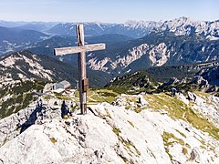
Höllentorkopf summit view towards Osterfelderkopf

Höllentorkopf summit view towards Zugspitze

Höllentorkopf north edge entry (photographed from the north edge)

Höllentorkopf north side

View from the Alpspix
.jpg)
.jpg)


literature
- Stephan Beulke: Wetterstein. A guide for valleys, huts and mountains (= Alpine Club Guide . Series: Northern Limestone Alps. ). Written according to the guidelines of the UIAA. 4th, unchanged edition. Bergverlag Rother, Munich 1996, ISBN 3-7633-1119-X , p. 210 ff.
Web links
Individual evidence
- ↑ Federal Agency for Cartography and Geodesy , State Office for Surveying and Geoinformation Bavaria : Digital Topographical Map 1:50 000, BayernViewer ( Memento of the original from March 4, 2016 in the Internet Archive ) Info: The archive link was inserted automatically and has not yet been checked. Please check the original and archive link according to the instructions and then remove this notice. , accessed September 27, 2010