Hackberg
|
Hackberg
City of Bergisch Gladbach
Coordinates: 50 ° 57 ′ 56 ″ N , 7 ° 10 ′ 32 ″ E
|
||
|---|---|---|
|
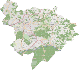
Location of Hackberg in Bergisch Gladbach |
||
|
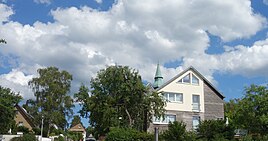
Houses in Hackberg
|
||
Hackberg is a district in the Bensberg district of Bergisch Gladbach .
history
The settlement name Hackberg is recorded in the original cadastre as Auf'm Hackberg . The late medieval settlement is listed in the tax, lease and tribute lists from 1487 under the court and tax district of Bensberg-Freiheit. The field name Hackberg is widespread in Bergisch especially north of the Wupper and describes the fields of the Hauberg economy . In this use, long-term forest use (longer than 12 years) and one to three-year arable use alternate. Additional pasture management is also possible. The planting of the coppice served in particular for the later extraction of the Gerberlohe by peeling the young trunks. Charcoal was extracted from the trunks .
The defining word “hack” is etymologically derived from the Old High German “hacchon” and the Middle High German “hoe” (= chopping and breaking up the fields) and describes the corresponding agricultural activities of digging .
Individual evidence
- ^ Andree Schulte, Bergisch Gladbach, city history in street names , published by the Bergisch Gladbach city archive, volume 3, and by the Bergisches Geschichtsverein department Rhein-Berg e. V., Volume 11, Bergisch Gladbach 1995, p. 325, ISBN 3-9804448-0-5

