Hausselberg
| Hausselberg | ||
|---|---|---|
|
Heath near Haußelberg |
||
| height | 117 m above sea level NHN | |
| location | Lueneburg Heath | |
| Coordinates | 52 ° 51 '35 " N , 10 ° 11' 0" E | |
|
|
||
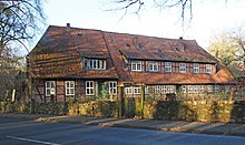
The Haußelberg is a 117 m above sea level high mountain in the Lüneburg Heath in the district of Celle . It is a popular vantage point in the otherwise very flat landscape in the Südheide Nature Park . The Heidschnuckenweg leads over the Haußelberg.
history
In 1820, the then King George IV commissioned the professor of astronomy and director of the observatory at the University of Göttingen, Carl Friedrich Gauß , to measure the Kingdom of Hanover . The mathematician Gauß also used the mountain summit of the Haußelberg as one of the triangular points to the Falkenberg further west near Wardböhmen (150 m above sea level) and to the north located Wilseder Berg (169 m above sea level) as further triangle points . The Haußelberg, Falkenberg and Breitehorn (Breithorn) (118 m above sea level), south of Unterlüß , formed additional triangles ; Haußelberg, Wulfsode (municipality of Wriedel) and Falkenberg; as well as Haußelberg, Wulfsode and Wilseder Berg.
It must be assumed that the Breitehorn, Haußelberg or Falkenberg points, all of which are now in the forest, were then on free, unwooded hilltops, probably surrounded by heathland. It was not until the major systematic afforestation in the second half of the 19th century that the wooded landscape was created today.
During the survey, Carl Friedrich Gauß used the method of least squares to compensate for observation errors. With a theodolite by Georg Friedrich von Reichenbach and the vice-heliotrope he invented to use sunlight for measurement signals. Part of the triangular network of the Gaussian degree measurement and the vice-heliotrope were also shown on the reverse of the 10 DM banknote of the fourth series of the Deutsche Mark.
In 2005 , a new Gauss stone was erected on the Haußelberg near the original TP stone .
Gauss lived for ten days on the "von der Ohe" farm in Oberohe (today the municipality of Faßberg ) while he was taking the measurements on the Haußelberg . In a letter to his friend Dr. He writes to Olbers :
“ ... A family lived there, whose head is written by Peter Hinrich von der Ohe zur Ohe, whose property is perhaps a square mile, but whose children tend to the pigs. Some comforts are not known there, for example a mirror, a toilet or the like ... "
There used to be a wooden fire watch tower on the summit, but it has not existed since around 1970. The tower had a triangular floor plan with a side length of approx. 7 m.


