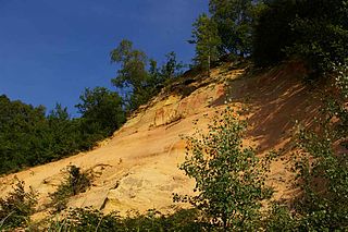
Hilden-Lintorfer sand terraces
| Hilden-Lintorfer sand terraces | |||
|---|---|---|---|
| In the Leichlingen sand mountains | |||
| Systematics according to | Handbook of the natural spatial structure of Germany | ||
| Greater region 1st order | North German Lowlands | ||
| Greater region 2nd order | Lower Rhine lowlands and Cologne Bay | ||
| Main unit group | 55 → Lower Rhine Bay |
||
| About main unit | 550 → Bergische Heideterrasse |
||
| Natural space |
550.1 → Hilden-Lintorfer sand terraces |
||
| Geographical location | |||
| Coordinates | 51 ° 13 '6 " N , 6 ° 54' 47" E | ||
|
|||
| local community | Leverkusen , Düsseldorf , Solingen | ||
| circle | District of Mettmann , Rheinisch-Bergischer Kreis | ||
| state | North Rhine-Westphalia | ||
| Country | Germany | ||
The Hilden-Lintorfer sand terraces are a natural space unit with the order number 550.1 and belong to the superordinate natural space main unit 550 ( Bergische Heideterrasse ).
The natural area extends as a long but narrow strip on the western edge of the neighboring Rhenish Slate Mountains from southern Mülheim an der Ruhr in the north to northeast Leverkusen in the south. Parts of Ratingen (with the core city and the eponymous district of Lintorf ), the extreme east of Düsseldorf , the town center of Erkrath , the east of Hilden and Langenfeld (Rhineland) and the extreme west of Solingen and Leichlingen also belong to the natural area.
It forms the cultural-geographical transition from the heights of the Bergisches Land to the more flat natural areas of the Lower Rhine . It consists of mighty diluvial drift sand covers and, in places, tertiary sands from the Upper Oligocene . These cover the two steps of the central Rhine terraces (55 to 50 m and 90 to 60 m), but also partially cover the lower Rhine terraces in the west and the main terrace (100 m) in the east. Weathering processes transferred the sands to light, loamy sandy soils that are not very productive for agriculture. Therefore, outside of the built-up areas, forest areas with oak-birch forests predominate .
In the 19th century, large heathland landscapes formed in natural areas due to degeneration , of which the Ratinger Stadtwald , Hilden and Ohligser Heide are the largest areas that have been preserved and have now been largely reforested. With a few exceptions ( Wenzelnberg , Spürklenberg , Kellerhansberg ) , the drifting sands that were blown into large dunes in the Leichlinger Sandberge have already been mined for the purpose of sand extraction.
structure
The Hilden-Lintorfer sand terraces are divided into subordinate natural areas:
- 550.1 Hilden-Lintorfer sand terraces
- 550.10 Bürriger Heide
- 550.11 Wuppertal estuary
- 550.12 Hilden Middle Terraces
- 550.13 Dusseldorf mouth
- 550.14 Gerresheim Bay
- 550.15 Aaper steep slope
- 550.16 Lintorf sand terraces

