Hlybokyj Potik
| Hlybokyj Potik | ||
| Глибокий Потік | ||

|
|
|
| Basic data | ||
|---|---|---|
| Oblast : | Zakarpattia Oblast | |
| Rajon : | Tyachiv Raion | |
| Height : | 332 m | |
| Area : | 0.48 km² | |
| Residents : | 5,531 (2004) | |
| Population density : | 11,523 inhabitants per km² | |
| Postcodes : | 90574 | |
| Area code : | +380 3134 | |
| Geographic location : | 48 ° 3 ' N , 23 ° 54' E | |
| KOATUU : | 2124481601 | |
| Administrative structure : | 1 village | |
| Address: | вул. Центральна 90 90 574 с. Глибокий Потік |
|
| Statistical information | ||
|
|
||
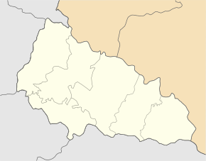
Hlybokyj Potik ( Ukrainian Глибокий Потік ; Russian Глубокий Поток Gluboki Potok , Slovak Glubokyj Potok , Hungarian Szorospatak ) is a village in the Ukrainian Zakarpattia Oblast in the historical region of Maramureș (2004) with about 5500.
The village, founded at the beginning of the 19th century, forms an independent district council in the southeast of the Tyachiv Rajon .
Hlybokyj Potik is on 332 m height on the banks of Bezkou ( Бецкоу even Hlybokyj Potik called), 9 km downstream at Nyschnja Apscha in the Apschyzja ( Апшиця ), a tributary of the Tisza river , flows. The Rajon center of Tyachiv is about 30 km to the west and the Oblast center of Uzhhorod 170 km to the northwest of Hlybokyj Potik.
Individual evidence
- ^ Hlybokyj Potik on the official website of the Verkhovna Rada ; accessed on August 1, 2017 (Ukrainian)
- ↑ Cities and Villages in the Transcarpathian Region - Hlybokyj Potik ; accessed on August 1, 2017 (Ukrainian)

