Hnylche (Radywyliw)
| Hnyltsche | ||
| Гнильче | ||

|
|
|
| Basic data | ||
|---|---|---|
| Oblast : | Rivne Oblast | |
| Rajon : | Radyvyliv district | |
| Height : | 221 m | |
| Area : | 10.10 km² | |
| Residents : | 57 (2001) | |
| Population density : | 6 inhabitants per km² | |
| Postcodes : | 35541 | |
| Area code : | +380 3633 | |
| Geographic location : | 50 ° 10 ′ N , 25 ° 21 ′ E | |
| KOATUU : | 5625884804 | |
| Administrative structure : | 6 villages | |
| Mayor : | Volodymyr Protas | |
| Address: | вул. Довга 68 35541 с. Крупець |
|
| Statistical information | ||
|
|
||
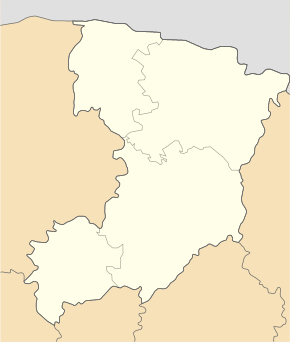
Hnyltsche ( Ukrainian Гнильче ; Russian Gniltsche , Polish Hnilcza ) is a village in the Ukraine in the Rivne Oblast , it is located south of the Baranska river about 3 kilometers east of the Rajon capital Radywyliw .
On December 15, 2015, the village became a part of the newly founded rural community Krupez ( Крупецька сільська громада Krupezka silska hromada ), until then it was part of the Krupez district council .
The village was mentioned in writing for the first time in 1560 and was in the aristocratic republic of Poland-Lithuania , Ruthenian Voivodeship , until the Third Partition of Poland in 1795 . Then it came to the Russian Empire and was incorporated into the Volhynian governorate . After the end of the First World War , the borders were redrawn, the place came to the Second Polish Republic and from 1934 was incorporated into the Gmina Krupiec , Powiat Dubno , Volyn Voivodeship . During the Second World War , the place came to the Soviet Union in September 1939 and was incorporated into the Ukrainian SSR , after the beginning of the German-Soviet War , the place came under German rule in the Reichskommissariat Ukraine , general district Volhynien-Podolia , district Dubno , but was after at the end of the Second World War re-affiliated to the Ukrainian SSR.
Since 1991 Hnylche has been part of today's Ukraine.
Web links
- Hnilcza . In: Filip Sulimierski, Władysław Walewski (eds.): Słownik geograficzny Królestwa Polskiego i innych krajów słowiańskich . tape 15 , part 1: Abablewo – Januszowo . Walewskiego, Warsaw 1900, p. 563 (Polish, edu.pl ).
Individual evidence
- ↑ Відповідно до Закону України "Про добровільне об'єднання територіальних громад" у Рівненській області у Радивилівському районі Боратинська, Крупецька, Михайлівська та Ситненська сільські ради рішеннями від 29 жовтня, листопада 13, 3 і 15 грудня 2015
- ↑ Rizzi Zannoni, Karta Podola, znaczney części Wołynia, płynienie Dniestru od Uścia, aż do Chocima y Ładowa, Bogu od swego zrzodła, aż do Ładyczyna, pogranicze Mołdawy, Bracuskiekiego Kziegoows Bełows .; 1772

