Hochberg (Chiemgau)
| Hochberg | ||
|---|---|---|
|
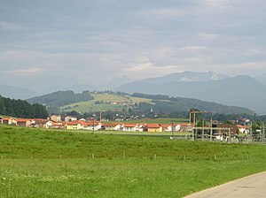
The Hochberg (in the foreground Geißing, a district of Traunstein) |
||
| height | 775.6 m above sea level NN | |
| location | Chiemgau , Bavaria , Germany | |
| Mountains | Chiemgau Alps | |
| Coordinates | 47 ° 50 ′ 29 ″ N , 12 ° 39 ′ 19 ″ E | |
|
|
||
The Hochberg is the local mountain of the large district town of Traunstein and the municipality of Siegsdorf in Chiemgau . It rises to a height of 775.6 m above sea level. NN directly between Traunstein and Siegsdorf and is the highest point in Chiemgau, apart from the Chiemgau Alps .
geography
The Hochberg is mainly used for agriculture, but is also an important local recreation area. Accordingly, it is only sparsely populated. On its summit there is an inn and a transmission mast for the Bavarian radio . The Hochberg is known as one of the most beautiful vantage points in the Chiemgau, from which on a clear day you can see up to 40 km with the naked eye and also have a beautiful view of the Chiemgau and Berchtesgaden Alps . Because of this, as well as the sparse population and thus the lack of disturbing influences (street lighting, buildings), it is also often used as a location by amateur astronomers , mobile CB radio operators and radio amateurs .
Since the Hochberg is immediately followed by other forests and meadows, it is often used as a stage point for hikes. The Traun flows along its west side .
history
The Hochberg came into the possession of the Salzburg Archbishop in 1048 with a forest donation. The area later belonged to the main Lenzensberg team in the Miesenbach district, Traunstein district court. In the course of administrative reform in Bavaria originated with the municipality edict of 1818 the community Hochberg . In 1933 it had 426 inhabitants. The previously independent municipality was dissolved in the course of the municipal reform on July 1, 1972, the northern part was incorporated into the district town of Traunstein, the southern part into the municipality of Siegsdorf .
Hochberg transmitter
- → Main article station Hochberg
On the summit of the Hochberg there is a transmission system for the Bavarian radio . It was planned as a filling station around 1954 and finally built in 1960 to supply the nearby Alpine valleys and the eastern Chiemgau as well as the western Berchtesgadener Land. In good weather and over-range, the transmitter's signal can even reach the high altitude of the Bavarian Forest , and it can even be received regularly in the east of the state capital of Munich .
Individual evidence
- ^ Wilhelm Volkert (ed.): Handbook of Bavarian offices, communities and courts 1799–1980 . CH Beck, Munich 1983, ISBN 3-406-09669-7 , p. 581 .

