Horonda
| Horonda | ||
| Горонда | ||

|
|
|
| Basic data | ||
|---|---|---|
| Oblast : | Zakarpattia Oblast | |
| Rajon : | Mukachevo Raion | |
| Height : | 109 m | |
| Area : | 4.31 km² | |
| Residents : | 4,000 (2004) | |
| Population density : | 928 inhabitants per km² | |
| Postcodes : | 89656 | |
| Area code : | +380 3131 | |
| Geographic location : | 48 ° 23 ' N , 22 ° 34' E | |
| KOATUU : | 2122781801 | |
| Administrative structure : | 1 village | |
| Address: | вул. Духновича 64 89656 с. Горонда |
|
| Website : | City council website | |
| Statistical information | ||
|
|
||
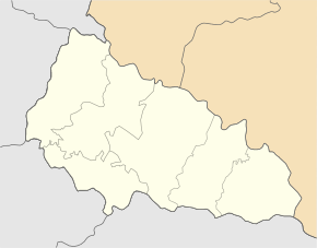
Horonda ( Ukrainian Горонда ; Ruthenian Горонда ; Russian Горонда Goronda , Slovak Goronda , Hungarian Gorond ) is a village in the west of the Ukrainian Zakarpattia Oblast with 4,000 inhabitants (2004).
The 1550 first written mention the village is the only village of the same district municipality in the southwest of Rajon Mukachevo and located 17 km southwest of Mukachevo to the territorial road T-07-10 and T-07-29 .
The village has a train station on the Chop-Mukachevo railway line .
Web links
Commons : Horonda - collection of images
Individual evidence
- ↑ Horonda on the official website of the Verkhovna Rada ; accessed on August 30, 2017 (Ukrainian)
- ↑ history Horonda in history of the towns and villages of the Ukrainian SSR ; accessed on August 30, 2017 (Ukrainian)

