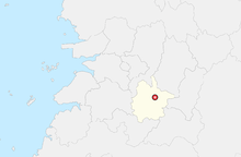
Imsil
| Imsil-gun | |||
|---|---|---|---|
| Korean alphabet : | 임실군 | ||
| Chinese characters : | 任 實 郡 | ||
| Revised Romanization : | Imsil-gun | ||
| McCune-Reischauer : | Imshil-gun | ||
| Basic data | |||
| Province : | Jeollabuk-do | ||
| Coordinates : | 35 ° 37 ′ N , 127 ° 17 ′ E | ||
| Surface: | 596.88 km² | ||
| Residents: | 37,514 (as of 2001) | ||
| Population density : | 63 inhabitants per km² | ||
| Structure: | 1 eup, 11 myeon | ||
| map | |||
|
|||
Imsil County ( kor .: 임실군 , Imsil-gun ) is located in Jeollabuk-do Province . The administrative headquarters are in the city of Imsil-eup.
Lake Okjeongho was created in the west of the district by regulating the Seomjingang River by means of a dam .
Administrative structure
- Imsil-eup (임실읍)
- Cheong-ung-myeon (청웅면)
- Unam-myeon (운암면)
- Sinpyeong-myeon (신평면)
- Seongsu-myeon (성수면)
- Osu-myeon (오수면)
- Sindeok-myeon (신덕면)
- Samgye-myeon (삼계면)
- Gwanchon-myeon (관촌면)
- Gangjin-myeon (강진면)
- Deokchi-myeon (덕치면)
- Jisa-myeon (지사면)
Web links
- Imsil County Website (Korean)

