Jelovica
The Jelovica is a wooded karst plateau in northwestern Slovenia and the most easterly high part of the Julian Alps : tectonic forces that took effect in the fracture zone have lifted it high above the mountains bordering on the east: show that it is a fracture zone the steep slopes on the south and east edge of the plateau. The karst landscape is full of karst dolines, but above all it is forested (the charcoal industry declined between the two world wars). The Jelovica pastures were mainly cleared and farmed on the Save side. During the Second World War , Jelovica provided refuge for the partisans and was the scene of several heavy fighting.
Dražgoše
The village on the terraced southern slope of the Jelovica under the mountain wall of the Dražgoška gora is 793 to 860 m above sea level and is home to 285 residents. The place is known to the Slovenes mainly from the battle between the German Wehrmacht and the partisans of the Cankar battalion from January 9th to 11th, 1942. The village was burned down, 41 villagers shot and the others driven away. After the war the village was rebuilt. At the point where a partisan unit lasted in the battle, there is a monument erected in 1976 (architect B. Kobe, sculptor S. Batič, painter I. Šubic), and there is a small museum nearby . A new St. Lucia Church was built (1966, architect T. Bitenc, painted windows and frescoes by S. Kregar). Four golden altars were saved from the old baroque church ; these masterpieces of wood carving from the 17th century are now exhibited in the museum in Škofja Loka .
Geographical location
As the foothills of the Alps, it is bounded in the west and north by the Save (Sava Dolinka or Wocheiner Save), framed in the east by the villages of Kamna Gorica and Kropa , extends in the south to the village of Selca an der Sora and ends in the southwest in the cut of the Češnjica wild stream. Another village at the foot of the plateau slopes is already uninhabited. The highest peak is the Partisan peak in the southern part of the plateau at 1,441 m above sea level. The northern peaks reach up to 1,100 m above sea level.
Ecology and economy
Iron ore used to be mined in Jelovica , which was smelted and processed in Kropa and Železniki . The landscape of Jelovica is characterized by dense pine forests. It used to be mixed forests consisting of beech , spruce and fir , but fell victim to charcoal production and were cut down. The biodiversity of the plateau is by mountains and moors determined.
Forests and moors
The plateau (1,000 m - 1,400 m) is heavily karstified, interspersed with hollows - both smaller shaft dolines and wider uvals. The forest was cleared on more level terrain and in further hollows in order to gain mountain pastures, which form smaller open areas in the otherwise unpredictable forests. On the Jelovica, two of the lowest raised bogs in Europe are well preserved, the Za Blatom bog (created by silting up a glacial lake) and the Ledine bog (karst plain with seepage); interesting plant species thrive here, e. B. the flowering rush (Scheuchzeria palustris) and the sedge (Carex pauciflora). the forest roads on Jelovica are quite intertwined (orientation problems); From the heavily wooded plain there is a view here and there only on the northern edge above the Radovljica basin and on the southern edge, where the plateau joins the ridge of Ratitovec above the tree line with two main peaks, the Gladki vrh (1,667 m) and the Altemaver (1,678). The view from Ratitovec is considered to be one of the most beautiful in the Slovenian mountains.
State of preservation
Jelovica and Ratitovec both have the status of a special protection area - Natura 2000 area (Ordinance on Special Protection Areas Natura 2000, Official Journal of the RS, No. 49/04, 110/04, 59/07). It is also an Ecologically Significant Area (Official Gazette of the RS, No. 48/04), which means that according to the Nature Conservation Act of the habitat type or part of a larger ecosystem, they are units that make a significant contribution to the preservation of biodiversity.
Marshes that were used for sludge and peat extraction are now classified as nature reserves (Official Gazette of the municipality of Wochein, issue 5/1999)
Metallurgy at the foot of the Jelovica
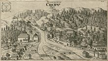
Kamna Gorica and Kropa flourished in the development of old ironworks and blacksmiths in the second half of the 18th century, after which there was a setback due to competition from the modern iron industry. Iron ore was first mined at the foot and on the edges of the Jelovica, later, when these deposits were exhausted, also in the Karawanken and on the Pokljuka . The vast forests on Jelovica served as the source of the huts' great need for charcoal. During the heyday, almost 300 charcoal burners were busy burning coal on the plateau . At that time the ore deposits were already running out, which is why mining and metallurgy soon came to a standstill at the end of the 19th century.
Kropa and Kamna Gorica have preserved some of the characteristics of the iron industry typical of Carniola ; They are closed settlements with the relatively powerful buildings of the former hammer mills , behind which the chaste of the former coal burners, miners and nail smiths crowd.
Web links
Individual evidence
- ↑ Dražgoška battle
- ↑ `` Jelovica, zavetje tišine ''. Institute of the Republic of Slovenia for Nature Conservation, Kranj Regional Unit. In the year 2007
See also
- Dražgoška battle , one of the most important battles in Slovenia during World War II .


