Küchelscheid
| Küchelscheid | ||
|---|---|---|
|
|
||
| State : |
|
|
| Region : | Wallonia | |
| Province : | Liege | |
| District : | Verviers | |
| Municipality : | Butgenbach | |
| Coordinates : | 50 ° 31 ' N , 6 ° 12' E | |
| Residents: | 74 pop. | |
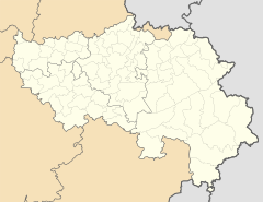
Küchelscheid is a village in the municipality of Bütgenbach in eastern Belgium with 74 inhabitants (2014).
The village lies directly on the border to the German town of Kalterherberg between the Schwarzbach and the Rur and belongs to the territory of the German-speaking Community of Belgium . Leykaul lies between the Rur and the Breitenbach . The only transport connection to the German exclave Ruitzhof leads via Küchelscheid . The Kalterherberg train station is close by on the disused Vennbahn line , which has been converted into the Vennbahnradweg and is integrated into the RAVeL network .
Since 1998, there has been a weather station of the Swiss company Meteosat in Küchelscheid, which is known for its minus temperature records in the Eifel .
history
Since the Middle Ages, the language and state border ran in the valley of Schwarzbach and Breitenbach. With the end of Napoleon's reign, the Rhineland fell to Prussia in 1815. At the time of the Prussians, Küchelscheid-Leykaul belonged to the Rhine province , but was given to Belgium after the First World War by the Treaty of Versailles in 1919. It was part of the German Reich for a few years during the Second World War , but it was liberated again by the Allies in 1944. After the Second World War, on April 1, 1949, the western parts of the village of Leykaul, which formerly belonged to Kalterherberg, as well as several farms were temporarily sacked to Belgium . The village previously consisted of two parts, the main town Küchelscheid and the smaller Leykaul, but was separated after the Second World War. The German-Belgian border treaty of 1956 regulated u. a. the return of certain areas to Germany. This took place on August 28, 1958 ( Federal Law Gazette II p. 262 ).
On the Ferraris map from 1771, only a watermill for grain on the Rur is indicated for this period , but no further settlement.
tourism
Located near the High Fens in a varied landscape, various overnight and dining options have established themselves. The connection to the Vennbahn Cycle Path and the Rurufer Cycle Path leads hikers or cyclists to the town.
The site's campsite was closed in 2014 due to security deficiencies by the mayor of the municipality of Bütgenbach. In the summer of 2017, the facility was still closed and in a desolate condition.
Web links
Individual evidence
- ↑ Website of the municipality of Bütgenbach: Presentation ( memento of the original from October 18, 2014 in the Internet Archive ) Info: The archive link was inserted automatically and has not yet been checked. Please check the original and archive link according to the instructions and then remove this notice.
- ↑ Kachelmann weather station in Küchelscheid
- ↑ Camping as a public nuisance (GrenzEcho of May 11, 2007)


