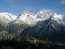
Kalpa (Himachal Pradesh)
| Kalpa | ||
|---|---|---|
|
|
||
| State : |
|
|
| State : | Himachal Pradesh | |
| District : | Kinnaur | |
| Location : | 31 ° 32 ' N , 78 ° 15' E | |
| Height : | 2759 m | |
| Residents : | 1,236 (2011) | |
| Kalpa in June 2015 | ||
Kalpa ( Hindi कालपा, Kālpā) is a place in the Indian state of Himachal Pradesh . Before 1962 the place was called Chini and Kalpa was part of the place. The place is in the district of Kinnaur , 2759 m high above the Satluj valley opposite the holy mountain Kinnaur Kailash , and was its traditional capital.
geography
The place is located on the eastern slope of the Satluj valley. The place is located above the district capital Rekong Peo, which is two kilometers and 450 meters above sea level, and Kothi, which is also close to Rekong Peo . Two and a half kilometers as the crow flies is Shontong , which is also in the valley, but there is no direct road connection to it.
Six and a half kilometers further down the valley is the village of Pangi , also on a hillside , in the other direction Roghi is a good three kilometers from Kalpa.
climate
Kalpa is at 2759 meters high and the climate is influenced accordingly. Winter lasts from October to May, while summer is correspondingly short. The minus record is -15.4 ° C, this was recorded on January 20, 1985. The highest temperature ever measured was on June 25, 2005 with 30.7 ° C.
| Kalpa | ||||||||||||||||||||||||||||||||||||||||||||||||
|---|---|---|---|---|---|---|---|---|---|---|---|---|---|---|---|---|---|---|---|---|---|---|---|---|---|---|---|---|---|---|---|---|---|---|---|---|---|---|---|---|---|---|---|---|---|---|---|---|
| Climate diagram | ||||||||||||||||||||||||||||||||||||||||||||||||
| ||||||||||||||||||||||||||||||||||||||||||||||||
|
Average monthly temperatures and rainfall for Kalpa
Source: India Meteorological Department
|
|||||||||||||||||||||||||||||||||||||||||||||||||||||||||||||||||||||||||||||||||||||||||||||||||||||||||
history
Kalpa, then still called Chini, became known through two summer visits from James Broun-Ramsay, 1st Marquess of Dalhousie , the Governor General and Viceroy of India from 1848 to 1856. He resided in the Old Forest Bungalow that still exists today. The place is also mentioned in the historical novel Kim by the British writer Rudyard Kipling , published in 1901 .
After 1960, Kalpa became the district capital of Kinnaur for a while, and the name Chini probably triggered too many associations with neighboring China at that time to claim territorial claims in the region and the place was renamed in 1962. Today the district capital is in the newly created Rekong Peo , 450 meters below .
population
At the 2011 census there were 1,236 inhabitants in Kalpa, of which 71.36% belonged to the Scheduled Tribes and 8.9% to the Scheduled Castes . With 633 men there was a slight surplus of men. At that time there were 111 children up to six years old and the literacy rate was 76.44%.
education
There is a primary and a secondary school in Kalpa.
Transport links
From Kalpa a 7 km long road connection leading over 22 turns down into the valley to Rekong Peo. Further road connections lead north to Pangi and south-west to Roghi .
Kalpa is approached several times a day by buses of the Himachal Road Transport Corporation , there are several connections to Rekong Peo and direct connections to Shimla and Chandigarh . There is a train station and a regional airport in Shimla and in Chandigarh.
Attractions
There are several Buddhist monasteries in town, including the Hu-Bu-Lan-Kar monastery , which is said to have been founded by Rinchen Sangpo , who lived from 950 to 1055. The Narayan-Nagini Temple is also a good example of local craftsmanship. From Kalpa you can also enjoy a good view of the 6,032 meter high Kinnaur Kailash .
Web links
Individual evidence
- ^ Kalpa Population - Kinnaur, Himachal Pradesh. In: State Census 2011. Census Organization of India, accessed on August 21, 2017 .
- ↑ Kalpa. In: Himachal Pradesh Travel Guide. Accessed August 21, 2017 .
- ↑ a b Historical Importance of Kalpa / Chini in Kinnaur. Hotel Kinner Villa Kalpa, accessed on August 21, 2017 .
- ↑ Ever recorded Maximum and minimum temperatures up to 2010. (PDF; 0.79 KB) India Meteorological Department , archived from the original on May 21, 2013 ; accessed on August 21, 2017 (English).
- ↑ Kalpa Climatological Table Period: 1971–2000. India Meteorological Department , archived from the original on April 15, 2015 ; accessed on August 21, 2017 (English).
- ↑ a b Deepak Sanan, Dhanu Swadi: Exploring Kinnaur and Spiti in the Trans-Himalaya . 2nd, revised edition. Indus Publishing Company , New Delhi 2002, ISBN 81-7387-131-0 , pp. 114–120 ( Exploring Kinnaur & Spiti in the Trans-Himalaya in the Google book search).
- ^ Kalpa Population - Kinnaur, Himachal Pradesh. In: State Census 2011. Census Organization of India, accessed on August 21, 2017 .
- ↑ HRTC Bus Timetable at Kinnaur. Himachal Road Transport Corporation , accessed August 21, 2017 .
- ↑ Kalpa. (No longer available online.) District Kinnaur, archived from the original on August 19, 2017 ; accessed on August 21, 2017 (English). Info: The archive link was inserted automatically and has not yet been checked. Please check the original and archive link according to the instructions and then remove this notice.


