Kaltenbach (Erf)
| Kaltenbach | ||
|
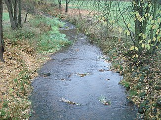
The Kaltenbach in Pfohlbach |
||
| Data | ||
| Water code | DE : 247126 | |
| location |
Odenwald
|
|
| River system | Rhine | |
| Drain over | Erf → Main → Rhine → North Sea | |
| source | south of Walldürn- Glashofen at the sports field 49 ° 36 ′ 51 ″ N , 9 ° 22 ′ 20 ″ E |
|
| Source height | approx. 412 m above sea level NHN | |
| muzzle | in Eichenbühl- Pfohlbach from the left into the Erf coordinates: 49 ° 40 '21 " N , 9 ° 22' 37" E 49 ° 40 '21 " N , 9 ° 22' 37" E |
|
| Mouth height | approx. 176 m above sea level NHN | |
| Height difference | approx. 236 m | |
| Bottom slope | approx. 27 ‰ | |
| length | 8.6 km | |
| Catchment area | 38.47 km² | |
The Kaltenbach is an almost 9-kilometer-long left tributary of the Erf in the Odenwald in Baden-Württemberg and Bavaria .
geography
course
The Kaltenbach rises in Baden-Württemberg at the edge of the forest south of the village of Glashofen in the city of Walldürn, a little east of the line of the Limes at the sports field of the place. It flows through Glashofen to Reinhardsachsen . There it crosses the state border to Bavaria to the municipality of Eichenbühl and takes on the Eichelbach from the right. At the village of Pfohlbach in the municipality, it joins the Erf after 8.6 km, first north-west and then north-east .
Tributaries
- Neusassergraben (left)
- Heidebach (left)
- Field blade (right)
- Stork blade (left)
- Well ditch (right)
- Niederbrunnklinge (left)
- Eichelbach (right)
- Hötterichsklinge (left)
River system Erf
Web links
Commons : Kaltenbach (Erf) - Collection of images, videos and audio files
Individual evidence
- ↑ a b c State Institute for the Environment Baden-Württemberg (LUBW) ( information )
- ↑ Bavaria Atlas of the Bavarian State Government ( notes )

The Kaltenbach (back) flows into the Erf
