Kaltenberg (Verwall Group)
| Kaltenberg | ||
|---|---|---|
|
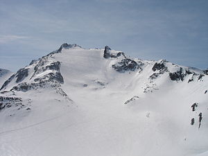
Northern flank of the Kaltenberg with ski tracks |
||
| height | 2896 m above sea level A. | |
| location | Border Tyrol / Vorarlberg | |
| Mountains | Verwall group | |
| Dominance | 0.87 km → Pflunspitze | |
| Notch height | 106 m ↓ notch to Pflunspitze | |
| Coordinates | 47 ° 5 '15 " N , 10 ° 8' 14" E | |
|
|
||
|
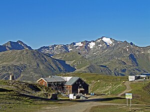
from the Ulmer Hut |
||
The Kaltenberg is a 2896 m high mountain in the Verwall group in Austria. It lies on the border between the federal states of Tyrol and Vorarlberg . According to the ÖK, the 2896 m refer to the east summit, on which the summit cross is also located. The west summit about 50 m away is slightly higher at 2900 m.
The Kaltenberg is located southwest of the Arlberg in the western Verwall group. South of the Kaltenberg are the Pflunspitzen , which are slightly higher at 2912 m . The Kaltenberg Glacier is located on the northern flank of the mountain. Between the tongue of the glacier and the Kracheljoch is the Kaltenbergsee ( 2506 m above sea levelTemplate: height / unknown reference ), which drains into the Maroital and thus into the Rosanna .
The Kaltenberg, also called Maroi Schneeberg after an old name , is best reached via the Kaltenberghütte (2089 m) from Stuben , Langen or St. Christoph . From the hut it goes over the Kracheljoch and with an intermediate descent to the Kaltenberg glacier, finally over a channel secured with a rope to the summit. An alternative to the glacier is the ascent over the north ridge (first grade points ).
Further climbs in summer are the south-west ridge (places II. Degree) from the Neue Reutlinger Hütte (2395 m) and the south-east ridge (difficulty level II) from the Konstanzer hut (1688 m).
In winter, the Kaltenberg is a popular ski tour destination . The starting point for this is the Albonagrat , which can be reached from Stuben by lift. The summit can also be reached from the Kaltenberghütte on touring skis over the Kracheljoch.
literature
- Peter Pindur, Roland Luzian, Andreas Weiskopf: Alpine Club Leader Verwallgruppe , Bergverlag Rother , 10th edition, 2005, ISBN 3-7633-1251-X
Individual evidence
- ↑ ÖK 1:50 000
- ↑ Alpine Club Map 28/2 "Verwallgruppe Mitte", 3rd edition 2009
- ↑ http://vogis.cnv.at/atlas/init.aspx?karte=adressen_u_ortsplan
- ↑ Peter Pindur, Roland Luzian, Andreas Weiskopf: Alpenvereinsführer Verwallgruppe , Bergverlag Rother , 10th edition, 2005, ISBN 3-7633-1251-X


