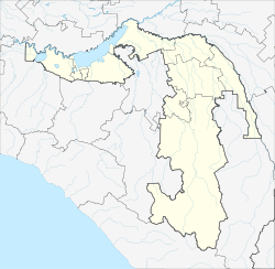
Kamennomostski
settlement
|
||||||||||||||||||||||||||||||||
|
||||||||||||||||||||||||||||||||
|
||||||||||||||||||||||||||||||||
Kamennomostsky ( Russian Каменномостский ; Adyghe Хьэджыкъ, Хьаджыкъо ) is a settlement in the Republic of Adygea ( Russia ) with 7213 inhabitants (as of October 14, 2010).
geography
The settlement is located about 35 km as the crow flies south of the republic capital Maikop on both sides of the Kuban tributary Belaya in the area of the rocky ridge (Skalisty chrebet) on the northern edge of the Greater Caucasus , which reaches heights of over 1000 m southeast of the place .
Kamennomostski belongs to the Maikopski Rajon and is located about 25 km south of its administrative seat Tulski . It is the seat of the rural community Kamennomostskoje selskoje posselenije, to which besides the Kamennomostsky the settlement of Pobeda and the hamlet (chutor) Vessyoly belong. Colloquially, Kamennomostski is often referred to as Chadschoch , a Russified variant of the old Adygeian place name and the name of the place's train station.
history
In place of the old Adyge Auls Chadschiko emerged during the Caucasus War 1817-1864 at a strategically important point of access to the valley of the upper Belaya in 1862 a Cossack -Verteidigungsposten, the 1864 Staniza Kamennomostskaja (of Russian Kamenny most for , Stone Bridge ' ) was raised. From 1873 to 1914 the place had the status of a settlement 8 km to the south of Stanitsa Dachovskaya .
In 1948 Kamennomostskaya received the status of an urban-type settlement , since the 1960s under the current name. Since 2011 it has been a rural settlement again.
Population development
| year | Residents |
|---|---|
| 1959 | 9368 |
| 1970 | 9089 |
| 1979 | 8216 |
| 1989 | 8292 |
| 2002 | 7580 |
| 2010 | 7213 |
Note: census data
traffic
In Kamennomostski is the end point of a railway line from Beloretschensk that was extended from Maykop in 1931 and electrified in 1970 (station name Chadschoch, route km 64). The regional road R254 runs through the town, which , coming from Maikop via Tulski, continues up the Belaya into the Caucasus via Dachowskaya to the small tourist town of Guseripl .
Sons and daughters of the place
- Olesja Aliyeva (* 1977), ski racer
Individual evidence
- ↑ a b Itogi Vserossijskoj perepisi naselenija 2010 goda. Tom 1. Čislennostʹ i razmeščenie naselenija (Results of the All-Russian Census 2010. Volume 1. Number and distribution of the population). Tables 5 , pp. 12-209; 11 , pp. 312–979 (download from the website of the Federal Service for State Statistics of the Russian Federation)


