
Karakoram Highway


The Karakoram Highway or Karakoram Highway (KKH, Urdu شاہراہ قراقرم; Chinese 喀喇昆仑 公路 ) is an international highway connecting Kashgar in the Xinjiang Autonomous Region (western China) with Havelian in northwest Pakistan . The road leads for 1284 km through scenic and culturally very diverse areas, along the mountains of the Pamir , Karakoram , Himalayas and partly the Hindu Kush and is not passable in winter. The road is currently being expanded.
route
The KKH leads past the eight-thousander Nanga Parbat . The highest point of the route is reached at 4693 m at the Khunjerab Pass , which also marks the border between Pakistan and China. The KKH is one of the highest highways in the world .
history
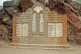
The Karakoram Highway was built jointly by China and Pakistan within about 20 years and completed in 1978. Due to the frequent landslides on the steep mountain slopes and the height, the construction was a great challenge. Officially, 810 Pakistani and 82 Chinese workers were killed during the construction work. The road has also been open to tourism since 1986. On the Chinese side, it is part of the national road 314 , which then leads eastwards from Kashgar to Ürümqi .
After a massive landslide into the Hunza Valley on January 4, 2010, the Attabad Lake that was dammed up as a result has now flooded 22 km (as of May 2010) of the Karakoram Highway. Since it was feared that the dam could break, the upper part of the landslide was removed in three more years and the size of Lake Attabad was reduced again.
In September 2015, the bypass road built by China was opened in the form of several tunnels around Lake Attabad.
expansion
China expanded the now completely asphalted route on the Pakistani side into a multi-lane road. The aim was to reduce the driving time from 30 to 20 hours and to make the route passable in winter and for large trucks. This should increase the export of goods to Pakistan and connect the port of Karachi . The construction cost the equivalent of around $ 400 million. A pipeline was also planned along the road to get natural gas from Iran . In the meantime, residents are complaining that the responsible authorities in Pakistan are not properly maintaining the connection, which is particularly vulnerable to weather damage, so that the freshly renovated street quickly falls into disrepair.
Illustrations
Milestone at the KKH near Besham in Pakistan
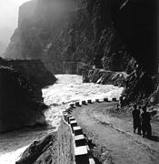
Side street along the Indus

The Karakorum Highway in the autonomous region of Xinjiang in China

The KKH near the city of Passu in Pakistan

Buddhist rock carvings at Chilas at the KKH in Pakistan


literature
- Ahmad H. Dani: Human records at Karakorum Highway . Mr. Books, Islamabad 1995, ISBN 969-35-0646-4 .
- Anke Kausch: Silk Road. From China through the Gobi and Taklamakan deserts over the Karakoram Highway to Pakistan . DuMont, Cologne 2001, ISBN 3-7701-5243-3 (art travel guide).
- Martin Müller: Karakoram Highway. From Pakistan to China on the most exciting high mountain road in the world . Artcolor-Verlag, Hamm 1990, ISBN 3-89261-040-1 .
- Waltraud Sperlich: Dharmadeva was here. in: Adventure Archeology . Spectrum, Heidelberg 2007, 3, 38ff. ISSN 1612-9954
Web links
- Tips and checklists for riding the route by bike
- Hasnain Kazim: Karakoram Highway: China is building the world's highest expressway ; Spiegel-Online, July 20, 2012
- The Karakoram Highway September 2014 - Heart of the Silk Road Travel report by Ute Vogel and Andreas Bläse
Individual evidence
- ↑ Markus Becker: Landslide in Pakistan - Experts fear a huge tidal wave from a dam break. Spiegel online, May 22, 2010, accessed May 26, 2010 .
- ↑ Pakistan PM inaugurates tunnels over Attabad Lake in UK. The Express Tribune, September 14, 2015, accessed March 31, 2016 .
- ↑ Hasnain Kazim: Karakoram Highway: China is building the world's highest expressway. In: Spiegel Online . July 20, 2012, accessed June 9, 2018 .
- ↑ Development challenges in Gilgit-Baltistan thenews.com.pk, accessed on January 2, 2019 (English)