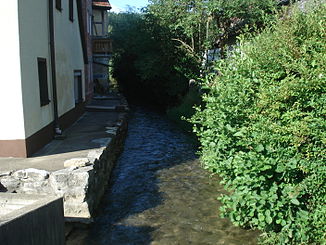
Thosbach
|
Thosbach upper course: Thosmühlbach |
||
|
The Thosbach in Wannbach |
||
| Data | ||
| Water code | DE : 242484 | |
| location |
Franconian Switzerland
|
|
| River system | Rhine | |
| Drain over | Trubach → Wiesent → Regnitz → Main → Rhine → North Sea | |
| source | at Thosmühle 49 ° 45 '30 " N , 11 ° 14' 22" E |
|
| Source height | 381 m above sea level NN | |
| muzzle | near Wannbach in the Trubach coordinates: 49 ° 44 ′ 41 ″ N , 11 ° 12 ′ 40 ″ E 49 ° 44 ′ 41 ″ N , 11 ° 12 ′ 40 ″ E |
|
| Mouth height | below 305 m above sea level NN | |
| Height difference | 76 m | |
| Bottom slope | 25 ‰ | |
| length | 3 km | |
| Left tributaries | Altenthalbach | |
The Thosbach is a right tributary of the Trubach in Franconian Switzerland in Bavaria .
geography
Thosmühlequelle
The Thosbach rises from a karst spring at the Thosmühle . It is a small spring pot that pours several hundred liters of water per second . The spring is one of the strongest karst springs in the northern Franconian Jura and is located in the private fenced area of the Thosmühle fish farm. The stream is used as a feed line for the fish ponds.
The source is identified by the Bavarian State Office for the Environment as geotope 474Q003. See also the list of geotopes in the Forchheim district .
course
As Thosmühlbach, it flows in a south-westerly direction to Urspring . There it picks up the somewhat longer Altenthalbach coming from the east-southeast and bends to the west. In the further course he bears the name Thosbach. In Wannbach it branches out several times and finally flows in a south-westerly direction into the Trubach, which flows there north-west .
Tributaries
- Altenthalbach (left)
See also
Web links
Individual evidence
- ↑ a b Topographic map 1: 10,000 North Bavaria
- ↑ Measured on: BayernAtlas of the Bavarian State Government ( notes )
- ↑ Geotope: Karst spring Thosmühle (accessed on March 22, 2020).
