Trubach
| Trubach | ||
|
The Mühlbach, right arm of the Trubach, in Pretzfeld |
||
| Data | ||
| Water code | DE : 24268 | |
| location |
Franconian Switzerland
|
|
| River system | Rhine | |
| Drain over | Wiesent → Regnitz → Main → Rhine → North Sea | |
| source | in Obertrubach 49 ° 41 ′ 36 ″ N , 11 ° 20 ′ 45 ″ E |
|
| Source height | approx. 436 m above sea level NHN | |
| muzzle | at Pretzfeld in the Wiesent coordinates: 49 ° 45 '11 " N , 11 ° 9' 40" E 49 ° 45 '11 " N , 11 ° 9' 40" E |
|
| Mouth height | 283 m above sea level NHN | |
| Height difference | approx. 153 m | |
| Bottom slope | approx. 7.4 ‰ | |
| length | 20.7 km | |
| Catchment area | 140.11 km² | |
| Discharge at the Bärenthal gauge (43.1% of the catchment area) |
NNQ MNQ MQ MHQ HHQ (1956) |
435 l / s 610 l / s 830 l / s 2.33 m³ / s 12 m³ / s |
| Communities | Obertrubach , Egloffstein , Pretzfeld | |
|
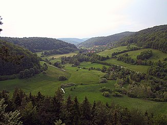
View from "Burggraf" over the Trubach valley near Untertrubach |
||
The Trubach is a year-round water-bearing flowing water of the 2nd order in Upper Franconia . It rises in Franconian Switzerland and flows into the Wiesent from the left at Pretzfeld after about 21 kilometers .
Surname
The prefix Trub- probably comes from the Old High German adjective 'truobi' and Trubach therefore means cloudy oh. In the early 19th century the name “Stuhbach” was used for the upper reaches. It was only below the tributary of the Großenoher Bach that it was referred to as "Trubach" on a map from that time.
After heavy rains, light-colored suspended matter is brought into the stream from the countless small springs or corresponding sediment is swirled up from the bottom, which causes the otherwise clear stream to quickly become cloudy.
geography
Trubach spring
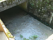
The Trubach spring is located in Obertrubach . It is a karst spring on the southwestern edge of the village, below the rocks. Today's spring is set in concrete and provided with a wooden railing. The Trubach used to arise in one of the karst caves, but this spring dried up over the years.
River course
The Trubach runs in a predominantly north-westerly direction through the Trubach Valley. At Pretzfeld it flows into the Wiesent .
Tributaries
The Trubach has the following tributaries:
- Großenoher Bach (left)
- Hohenschwärzer Graben (left)
- Arles Fountain (left)
- Affterbach (right)
- Äpfelbach (right)
- (Stream from the Hüllergraben ) (left)
- Thosbach (right)
- Weißenbachgraben (right)
- Hetzelsdorfer Bach (left)
Places and sights
The Trubachtal includes the towns of Pretzfeld (Pretzfeld Castle), Hetzelsdorf, Urspringtal, Wolkenstein, Oberzaunsbach, Unterzaunsbach, Hundshaupten (game enclosure and castle ), Wichsenstein (587 m high vantage point), Bieberbach , Egloffstein ( Egloffstein Castle ), Affalterthal , Thuisbrunn ( Thuisbrunner Burg ), the very picturesque Wolfsberg (rock with castle ruins ), Obertrubach .
geology
The largest part of the catchment area lies in the Weißjura of the Franconian Jura . Below Untertrubach, the course of the river and the valley floor soon lie in the Braunjura . At the edge of the upper catchment area there are still individual islands of Upper Cretaceous on the Weißjura cover .
Mills
There are many mills on the Trubach, for example the Hackermühle and the Ziegelmühle.
freetime and recreation
hike
A 19-kilometer hiking trail offers a view of the Trubach Valley and many sights. Canoeing and kayaking are prohibited all year round.
fishing
Fishing is mainly salmonids . Most of the fishing rights are privately owned. Day tickets for fishing license holders are offered on a 1.2 km long section of the Trubach in the area of the village of Schweintal.
Climb
The Trubachtal is one of the larger climbing areas of the Northern Franconian Jura with the Richard Wagner rock, the Hartelstein, the Eldorado, the Fürth tower and the Zehnerstein .
See also
Individual evidence
BayernAtlas ("BA")
Official online waterway map with a suitable section and the layers used here: Course and catchment area of the Trubach
General introduction without default settings and layers: BayernAtlas of the Bavarian State Government ( notes )
- ↑ a b Height queried on the background layer Official map (right click).
- ↑ Labeled as Stuhbach after switching to the historical map .
- ↑ Names of the tributaries according to the inscriptions on the background layer.
- ↑ Geology according to the layer geological map 1: 500,000 .
Water directory Bavaria ("GV")
- ↑ a b Length and catchment area according to: Directory of stream and river areas in Bavaria - Main river area, page 56 of the Bavarian State Office for the Environment, as of 2016 (PDF; 3.3 MB)
Other
- ↑ Bavarian flood news service (as of September 7, 2011)
- ^ Kronach Water Management Office
- ^ Wolf-Armin von Reitzenstein : Lexicon of Franconian place names. Origin and meaning . Upper Franconia, Middle Franconia, Lower Franconia. CH Beck, Munich 2009, ISBN 978-3-406-59131-0 , p. 172 ( limited preview in Google Book search).
- ↑ Trubachtal hiking trail ( Memento from December 23, 2008 in the Internet Archive )
- ↑ Kayak Channel
- ↑ Fly fishing, bottom fishing and spin fishing
literature
- Johann Kaspar Bundschuh : Truppach . In: Geographical Statistical-Topographical Lexicon of Franconia . tape 5 : S-U . Verlag der Stettinische Buchhandlung, Ulm 1802, DNB 790364328 , OCLC 833753112 , Sp. 592 ( digitized version ).
- Topographic map ATK 25 of Bavaria, single sheet cut sheets No. E 10 Ebermannstadt and No. F 10 Eckental
Web links
- Map of the course and catchment area of the Trubach on: BayernAtlas of the Bavarian State Government ( information )
- Aerial view of the Trubach valley from Nuremberg
- Gauge at Bärenthal, HND Bavaria


