
Pretzfeld
| coat of arms | Germany map | |
|---|---|---|

|
Coordinates: 49 ° 45 ' N , 11 ° 10' E |
|
| Basic data | ||
| State : | Bavaria | |
| Administrative region : | Upper Franconia | |
| County : | Forchheim | |
| Height : | 293 m above sea level NHN | |
| Area : | 24.2 km 2 | |
| Residents: | 2356 (Dec. 31, 2019) | |
| Population density : | 97 inhabitants per km 2 | |
| Postal code : | 91362 | |
| Area code : | 09194 | |
| License plate : | FO, EBS , PEG | |
| Community key : | 09 4 74 161 | |
| LOCODE : | DE PZD | |
| Market structure: | 12 districts | |
Market administration address : |
Main street 3 91362 Pretzfeld |
|
| Website : | ||
| Mayor : | Steffen Lipfert (Free Voters) | |
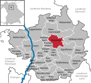
| Location of the Pretzfeld market in the Forchheim district | ||
  |
||

Pretzfeld is a market in the Upper Franconian district of Forchheim .
geography
Geographical location
The municipality is located in the south-western part of Upper Franconia and in Franconian Switzerland . She is known for fruit growing and fruit processing. Of the approx. 2500 ha total area, 1100 ha are forest. The place Pretzfeld is in the west of the municipality, near the confluence of the Trubach in the Wiesent .
Neighboring communities
Neighboring communities are (from the north, starting clockwise) Ebermannstadt , Gößweinstein , Egloffstein , Leutenbach , Kirchehrenbach and Weilersbach .
Community structure

The Pretzfeld market has 13 districts :
|
In addition, there are two properties adjacent to the settlement area of the village of Hardt in the municipality of Pretzfeld, as well as a building near the Thosmühle .
history
middle Ages
Pretzfeld was founded in the 8th century. Like many places that end in -feld , it was probably a supplier for the nearby royal court of Forchheim. At the latest in the reign of Ludwig the German (840-876), the Pretzfeld Church was founded as an original parish .
In 1145 the place name was first mentioned in a document as "Bretevelth". Later Pretzfeld was the seat of a manor of the same name . From 1505 to 1762, the lords of the castle were the Barons Stiebar von Buttenheim , Schliisselberg servants. They were followed from 1764 to 1852 by the Counts of Seinsheim .
Jewish Cemetery
The Jewish cemetery on the Judenberg outside the village, which has existed since the 16th or 17th century, was the burial place for numerous Jewish communities in the Forchheimer Land. The last burial in the partially preserved cemetery took place in 1894. After that, there were no more Jewish families in Pretzfeld. The Jewish cemetery in the Pretzfeld district of Hagenbach was in use until 1934. (See also Hagenbach Synagogue ).
Modern times
With the Rhine Confederation Act 1806, the place came to the Kingdom of Bavaria . In the course of the administrative reforms in Bavaria, the municipality was created with the municipal edict of 1818 . Walter Schottky , who had settled in Pretzfeld Castle in 1943, initiated the establishment of a Siemens laboratory in 1946. The physicist lived in Pretzfeld until his death in 1976.
Territorial reform
Most of today's districts belonged to the district of Ebermannstadt until its dissolution in 1972 . Then Pretzfeld came to the Forchheim district. On July 1, 1976, the Wannbach community was incorporated, and Lützelsdorf was added on March 1, 1977. Hetzelsdorf and parts of the dissolved municipalities of Wichsenstein (Eberhardstein, Pfaffenloh and Urspring) and Zaunsbach (Ober- and Unterzaunsbach) followed on May 1, 1978.
religion
On May 9, 2011, according to the census, 47.7% of the population were Roman Catholic and 41.3% Evangelical Lutheran. 11.0% had another religion or were non-denominational.
politics
Market council
The 2020 local elections resulted in the following distribution of seats in the market town council:
- CSU citizens' block : 2 seats
- SPD and ecologists : 2 seats
- Voting community Pretzfeld-Altreuth: 3 seats
- Free voters Pretzfeld : 3 seats
- Trubachtal-Hagenbach community of voters: 1 seat
- Oberland voter group: 1 seat
- Zaunsbach voter community: 1 seat
- WIR-Together for Pretzfeld and its districts: 1 seat
mayor
Mayor has been Steffen Lipfert (FW) since May 1, 2020. The predecessor since 2008 was Rose Stark (SPD and ecologist). This was followed by Erhard Müller (CSU), who held office from 2002 to 2008.
coat of arms
|
|
Blazon : “Divided; Above in red a growing silver boar spear, below five times split by silver and blue. " |
Community partnerships
There is a community friendship with the community of Bretzfeld in Hohenlohekreis ( Baden-Württemberg ). This started with a misdirected parcel due to the very similar name.
Economy and Infrastructure
economy
The largest closed sweet cherry growing area in Germany and one of the largest in Western Europe extends around the Pretzfeld market . Due to the warm climate on permeable, nutrient-rich soils, there are over 200,000 sweet cherry trees on 1,700 hectares.
In the municipality there are the breweries Nikl-Bräu in Pretzfeld, Meister in Unterzaunsbach and Penning-Zeißler in Hetzelsdorf. There are also several distilleries, one of the best known is the Haas distillery with an annual production of approx. 60 - 70,000 bottles.
From the semiconductor laboratory initiated by Walter Schottky in 1946, a plant for power semiconductors emerged , which last operated as the Infineon subsidiary eupec (European Power-Semiconductor and Electronic Company) before it was closed in 2002.
traffic
The state road 2760/2260 crosses the municipality and the capital from west to east and connects Pretzfeld with the B 470, which runs a good 1 km to the west .
The market town has a stop on the Forchheim – Behringersmühle railway line . Since 1992 it has been integrated into the tariff area of the Greater Nuremberg Transport Association .
Attractions
- The Rococo parish church of St. Kilian was built from 1742 to 1761 by the Bamberg architect Johann Jakob Michael Küchel .
- The Pretzfeld Castle was mentioned in 1145 (or 1182) as the seat of the "Hademar de Bretevelt" (wide field). In its present form it dates from the middle of the 18th century. From 1375 the castle belonged to those of Wiesenthau, from 1522 to those of Stiebar, in 1754 the Bavarian Minister, Count von Seinsheim, received the fief, in 1852 the Nuremberg merchant Kohn bought property, which went to the Herrmann family through marriage, the current owners.
- A mikveh (Jewish women's bath) dates from the middle of the 14th century.
- The Jewish cemetery , which has existed since the 17th century, mainly contains graves from the 18th and 19th centuries. There is also a Jewish cemetery with old tombstones in the village of Hagenbach .
- Attractions

Parish Church of St. Kilian, 2009

Interior of the parish church, 2010

Pretzfeld Castle


Personalities
- Curt Herrmann (1854–1929), painter ( Neo-Impressionism ), often stayed there to paint in the 1920s, the castle belonged to his in-laws.
- Christoph Beck (1874–1839), high school teacher, dialect linguist and local history researcher
- Walter Schottky (1886–1976), physicist, carried out research in Pretzfeld during the Second World War and lived there until his death.
- Eberhard Spenke (1905–1992), physicist, built the semiconductor research laboratory of Siemens & Halske AG there after the end of the war.
literature
- Johann Kaspar Bundschuh : Pretsfeld . In: Geographical Statistical-Topographical Lexicon of Franconia . tape 1 : A-egg . Verlag der Stettinische Buchhandlung, Ulm 1799, DNB 790364298 , OCLC 833753073 , Sp. 393-394 ( digitized version ).
- Pleikard Joseph Stumpf : Pretsfeld . In: Bavaria: a geographical-statistical-historical handbook of the kingdom; for the Bavarian people . Second part. Munich 1853, p. 581 ( digitized version ).
Web links
- Entry on Pretzfeld's coat of arms in the database of the House of Bavarian History
- Pretzfeld cherry festival
- Local history, castle and church of Pretzfeld near Foracheim
- Pretzfeld: Official statistics of the LfStat
Individual evidence
- ↑ "Data 2" sheet, Statistical Report A1200C 202041 Population of the municipalities, districts and administrative districts 1st quarter 2020 (population based on the 2011 census) ( help ).
- ^ Pretzfeld community in the local database of the Bavarian State Library Online . Bayerische Staatsbibliothek, accessed on January 4, 2020.
- ^ Federal Statistical Office (ed.): Historical municipality directory for the Federal Republic of Germany. Name, border and key number changes in municipalities, counties and administrative districts from May 27, 1970 to December 31, 1982 . W. Kohlhammer, Stuttgart / Mainz 1983, ISBN 3-17-003263-1 , p. 683 and 684 .
- ↑ a b municipality website - Pretzfeld - figures, data, facts
- ^ Website Schloss Pretzfeld
- ↑ Mitteldeutsche Zeitung, August 6, 2013

Dormitz | Ebermannstadt | Effeltrich | Eggolsheim | Egloffstein | Forchheim | Gößweinstein | Graefenberg | Hallerndorf | Hausen | Heroldsbach | Hetzles | Hiltpoltstein | Igensdorf | Kirchehrenbach | Kleinsendelbach | Kunreuth | Langensendelbach | People Bach | Neunkirchen am Brand | Obertrubach | Pinzberg | Poxdorf | Pretzfeld | Lower ladder | Weilersbach | Weißenohe | Wiesenthau | Wiesenttal
Altreuth | Eberhardstein | Hagenbach | Hetzelsdorf | Kolmreuth | Lützelsdorf | Oberzaunsbach | Pfaffenloh | Poppendorf | Pretzfeld | Unterzaunsbach | Origin | Wannbach