
Katinger Watt


The Katinger Watt is an area of around 1500 hectares, which is part of the EU bird sanctuary " Ramsargebiet Schleswig-Holstein Wadden Sea and adjacent coastal areas" in the south of Eiderstedt in the North Friesland district in Schleswig-Holstein ; a sub-area is also in the FFH area “Untereider”. The EU bird sanctuary and the FFH area are part of the Natura 2000 protected area setting.
Geographical location
The Katinger Watt lies between Vollerwiek (Spannbüllhörn) and Großolversum before Kating in the Eider Estuary . The Green Island nature reserve with the Eiderwatt, established in 1989, is located in the Katinger Watt . It also houses the EU bird sanctuary "Former Katinger Watt", which included the nature information area , the Katinger Priel , adjacent forest areas and the Eiderdamm areas. There is also the Katinger Watt nature experience area. Once a mud flat area at the mouth of the Eider, it was including the Green Island (Peinsinsel) by land reclamation drained and by the Eidersperrwerk protected as part of the Eider dam and Eiderleitdammes against flooding and natural dynamics withdrawn. Today, a third of it is used for agriculture, the rest is forested to a third or is occupied by water and grassland areas, which are primarily used for nature conservation. This third also includes the depot of the barrage and the area used by tourism on Kreisstraße 41. On the other side of the Eider is the Dithmarscher Eiderwatt nature reserve , which was created in 1989 to mitigate the ecological consequences of the construction of the Eider barrage .
History
Around 1900, as a result of the construction of the Kiel Canal (1895) in the Eider estuary, the Green Island (Peinsinsel) in front of Großolversum was created. The name Peinsinsel was given to the Green Island by the local population because the Tönninger citizen and hunting tenant Edleff Ferdinand Peins went bird hunting on the island with his hunting assistants. Since the two spent a lot of time there, they were called Robinson and Friday. Like the Olversumer and Katinger Vorland, the Green Island was enlarged by land reclamation measures ( Lahnungsfelder ). For this purpose, a Lorendamm was built in 1928, which led from Marienhof to Schafsberg, on which Kiek ut stands today . The district road 41 follows the course of the dam until shortly before the Schafsberg. At the Marienhof there was a building shed, which today houses the Spökenkieker nature information center, where the Green Island Eiderstedt association, which looks after the Katinger Watt nature experience , introduces itself. A first dam (built in 1911) was lost. In 1911, pasture use began on the Emerald Isle. In addition, there was a wooden bridge between Großolversum and the Green Island over the Norderlochgraben, which, as a branch of the Purrenstrom, separated the Green Island from the mainland. The Green Island was a protected bird breeding area from 1927 to 1939, which was looked after by the Jordsand Association. This probably also led to the fact that the name Green Island caught on again.
With the construction of the Eider Barrage in the course of the Eiderdamm from 1967 to 1973 and the Eiderleitdamm, the Green Island became part of the so-called Katinger Watt. Today, the old demolition edge within the Green Island nature reserve with Eiderwatt and on the edge of the arable land in the Katinger Watt nature experience essentially reminds of the former island. Another consequence of the construction of the barrage is the sweeping of the Eider. This can be seen in the relocation and the decline in brackish water reeds and the decline in salt marsh vegetation. The stocks of cockles, ringworms and lugworms have also decreased significantly.
Spatial structure
The Katinger Watt consists of a third of differently used rooms. These are the priority area for nature protection (formerly the tourism reserve area), the forest and the arable land.
Arable land
The arable land is cultivated intensively, partly conventionally, partly according to Bioland guidelines. The land belongs to a state-owned private company and is leased to the farmers. Grains are grown, mainly wheat, corn and oats, rapeseed, potatoes and sometimes asparagus.
Forest
The forest takes up approx. 495 hectares and is divided into 70 hectares of fine deciduous ash forest, 66 hectares of oak forest and 180 hectares of other deciduous forest dominated by poplar. There are also approx. 123 hectares of open areas (forest meadows, bodies of water). The forest, which is not typical of the landscape, was created to give the local tourism industry a place to relax. To do this, the mud flats had to be desalinated and provided with humus. Therefore, grasses and mustard were sown to prevent erosion and form humus, and the receiving water, i.e. the water balance, was regulated. Next, pioneer tree species were planted in whose protection the target tree species could grow up. Since the forest was originally created as a recreational forest, there is a well-developed network of hiking trails and shelters in the forest. There are only remnants of bridle paths, as they often ran parallel to the hiking trails and were therefore unnecessary. There is a boat in the forest near the “Schute” car park. This was set up as a replacement for a construction barge, which was intended to remind people that the forest is on the former seabed. The forest is home to the Katinger Watt nature experience, a nature trail and a kind of adventure playground.
Since 2012 there have also been wild boars in the forest. From the beginning, hunting was practiced in the forest. The state forest was instructed to work economically, therefore the extraction of wood has gained in importance. The state forest is also required to meet the needs of nature conservation, which is one of the reasons why a protection zone has been set up around the sea eagle nest since the sea eagle has been breeding in the Katinger forest. The eyrie can be seen from the district road at the height of an Altpriel (forest lake).
Nature conservation areas
The open nature protection areas serve to protect the ground-breeding meadow and wading birds. Since the soil is sweetening, the final stage of a succession would be a forest. This would not be a habitat for the ground breeder. Therefore the areas have to be kept open by grazing and mowing and the ditches and old creeks have to be dammed. In the past, people in the zero area relied on the salt content in the soil, although work was carried out on the leaching and desalination of the soil in the neighboring forest. The result was bush encroachment, which made it necessary to decuss the area. Since then, the zero area has been grazed and mowed. The orchids benefit from this. The Eiderdamm areas were originally intended for tourism. Hotel complexes, holiday villages, campsites and a golf course should be built here. Resistance from citizens' initiatives but also the nature conservation work of NABU , then the German Association for Bird Protection, has been able to prevent this so far. Today the areas are part of the Natura 2000 reserve setting and are therefore protected. The tourist use is now limited to an area on the district road between Katinger Priel and the barrage. Here there is a bathing area (according to a resolution of the district of North Friesland, the common use of the Katinger Prieles and the so-called storage basin has been re-regulated, resulting in a ban on leisure activities such as swimming, surfing, etc.) and two restaurants. There are other restaurants in the pavilion at the Eider Barrage and in Katingsiel . In the past there was also a pedal boat and rowing boat rental on the Katinger Priel, as well as a surf school, but the Katinger Priel has lost its importance as a surfing area. Fishing in the waters is not allowed. Only the Norderlochgraben between Katingsiel and the county road is leased to the North Friesland fishing club. The area on Katinger Priel and the pub in Katingsiel were used for the film Zwei für allefalls - A song for the murderer with Jan Fedder as the backdrop.
Animals in the Katinger Watt
Bird life
The Katinger Watt owes its special importance to the bird world. Both breeding and resting birds are important here. Germany has a special responsibility for many species, which is why the various protection categories of the Katinger Wattes are justified.
Numerous breeding birds were found in the years 2002 to 2006: Little grebe, great crested grebe, bittern, mute swan, gray goose, barnacle goose, Egyptian goose, shelduck, wigeon, gadfly, teal, mallard, pintail, teal , shoveler, pochard, tufted duck , eider, Common buzzard, white-tailed eagle, marsh harrier, Montagu's harrier, goshawk, kestrel, peregrine falcon, pheasant, partridge, quail, water rail, potted rail, corncrake, pond rail, white rail, oystercatcher, avocet, little ringed plover, great plover, common plover, common plover, common plover, common plover, Black-headed gull, black-headed gull, common gull, herring gull, black-headed gull, common tern, arctic tern, black tern, short-eared owl, cuckoo, kingfisher, skylark, meadow pipit, common wagtail, wagtail, bluethroat, field owl, reed warbler, great horned warbler, common warbler, common warbler, common warbler, common warbler Hemlock and pipe hammer.
The brood was first observed in some. Others were last detected during the period mentioned. In addition to the breeding birds listed, the well-known garden birds such as blackbird, song thrush, blue tit and great tit in nesting boxes also occur in the forest and in the woody areas of the arable land, as well as the dunnock.
The Katinger Watt is regularly visited by resting birds such as white-fronted geese, barnacle geese, golden plovers, wigeons, whooper swans and pygmy swans. Unlike the breeding birds, these species only make stopovers on their flight or overwinter in the Katinger Watt. Among the migratory birds we sometimes also find wanderers such as barbed goose, Egyptian goose, skua and black swan. Spoonbills, egrets, oriole and red thrush have also been found in the Katinger Watt. Other rarities are pond sandpipers, stilts, sandpipers, red necked goose, little goose, Thor's grouse and steppe harrier. Regular rarities such as the terek sandpiper, yellow-gray warbler, gray-breasted sandpiper and the Icelandic subspecies of the black godwit were also encountered. In the 1990s, the Katinger Watt was regularly visited as night quarters by numerous swarms of starlings from the surrounding area in the summer evenings. The swarms of starlings offered a breathtaking natural spectacle with their formations.
Other animals
Mammals
Mammals can be found in the Katinger Watt: earth vole, harvest mouse, wood shrew, wood mouse, pygmy shrew, weasel, mole, water shrew, field mouse, muskrat, brown hare, rabbit, deer, fox, stone marten, wild boar (since 2012), common bat, noctule bat, Pipistrelle bat and water bat. Seals can be observed on the offshore mudflats. The common porpoise can also occasionally be spotted in the Eider Estuary.
Occasionally abandoned pets are also encountered, which the nature center has been able to find so far, mainly house cats, but also dogs and dwarf rabbits. A domestic rabbit with black fur had successfully mated with a wild rabbit before the epidemic. Rabbits with black fur could therefore be observed for several years. However, the entire rabbit population was severely decimated by an epidemic. An abandoned turtle , one of the reptiles , was found in a quarry pond directly at the Katinger Watt nature center in the nature information area. You can also see the livestock used for grazing. These are sheep of the races German black-headed meat sheep, white-headed meat sheep and Texel, Shetland ponies, but also riding horses, cattle of the races Galloway, Angus, Shorthorn and Highlander. For some time now, grazing cattle have also included water buffalos in the nature information area in front of the observation huts. Goats were also kept on a trial basis in the nature information area. As a visit to Katinger Wattes showed in 2016, sheep grazing has been replaced by cattle grazing. The sheep can only be found directly on the central dike.
Amphibians
The range of amphibians is small. The moor frog is one of the species to be protected here. Common frogs, pond frogs and common toads were also found.
Reptiles
There are no known occurrences of reptiles . The species originally widespread in the mouth of the Eider, such as the slow worm and grass snake, are either considered to be extinct here or have not immigrated.
fishes
The waters in the Katinger Watt also give fish a habitat. The Eider estuary itself is a coastal body of water between the Eider Bridge and the Eider Barrage in the sense of fishing law. In terms of shipping law, it is a coastal body of water up to the entrance to the canal at Lexfähre. The waters bordering the Eider estuary are inland waters under fishing law. The inland waters and the coastal waters interact. The waters of the Katinger Watts belong to the ruddy flounder region. When fishing for sea animals in the Untereider, we often find: smelt, plaice, gobies, flounder, three-pronged stickleback, sole, pipefish, cod and disc belly. Less common are: stone picks, herring, eel mother, eel, whiting, sea scorpion, five-bearded sea tadpole, turbot, butterfish, dab, pikeperch and monkfish. When evaluating illegally set up fish traps in the Katinger Priel that were seized, the crucian carp showed itself to be very common. In this way perch were also found. Another species we encounter is the sand goby. According to the FFH area Untereider, feint, asp, river lamprey and sea lamprey also occur.
Insects, spiders and snails
Because of the large number of species, only individual species are mentioned here.
Snails : Roman snails, banded snails , road snails, ramshorn snails, pointed mud snails and other species.
Insects : Hornets and other social and solitary wasp species, honey bees, sand bees, wood bees and bumblebees (e.g. earth bumblebee), various beetles such as oil beetles, carrion beetles (e.g. skulls), ladybugs, fire beetles, granular ground beetles and other types of beetles , various flies and mosquitoes, fringed wings and dragonflies such as blue-green mosaic maiden, common pitch dragonfly, large blue arrow and flat stomach. In butterflies we find the blood droplet , painted lady, day and night peacock butterfly, admiral, blue grouse, small hay butterfly, drinker, large ox-eye and small fox. Grasshoppers like the big hay horse can also be encountered.
Spiders : Garden spider, zebra jumping spider, wasp spider, leather ticks (wood tick) and other species.
Flora in the Katinger Watt
The flora is only mentioned here because of the diversity. There are different plant communities depending on the nature of the soil and the topographic height. I limit myself to listing a few types here. In the Katinger Watt we find orchards (spotted, flesh-colored and overlooked) other species. These include: rattling pots, meadow pea, lupine, forget-me-nots, various grasses, including reeds, cane grass, hogweed, honeydew grass (soft and woolly), comb grass, red fescue, bristles and other bluegrass, also rushes (e.g. common rush) and sedges such as common rush . Other plants are: samphire, beach aster, thistle and dandelion species, stonecrop, chicory, wild carrot, yarrow, oregano, real bedstraw, adder's head, poppy and corn poppy, meadow margarit, gray cress, parsnip, water tease, bird vetch, meadow knapweed, hare, red -, white, horn, strawberry and wound clover, norway and broad-plantain, field horsetail, musk mallow, rayless and common chamomile, as well as duckweed. Mosses, fungi and lichens have not yet been mapped in more detail. Mention should be made of the conspicuous tintling.
care, support
The Katinger Watt nature experience area is supervised by the Green Island Eiderstedt association (the Eiderstedt district hunters' association and the state forests are in charge). The nature reserve Grüne Insel with Eiderwatt, as well as the Eiderdamm areas including the nature information area and the Katinger Priel (EU bird sanctuary former Katinger Watt ) are looked after by NABU Schleswig-Holstein. NABU maintains the NABU Nature Center Katinger Watt in the Lina-Hähnle-Haus, the former estate of the artist Hein Hoop . The superordinate care is monitored and implemented by the integrated nature conservation station Eider-Treene-Sorge and West Coast. The forest is looked after and managed by the Schleswig-Holstein State Forests. The sea eagle is looked after by the project group Sea Eagle Protection Schleswig-Holstein.
panorama
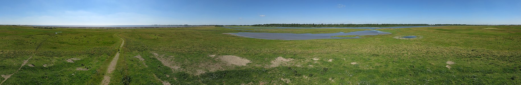
Panoramic picture from the observation tower on the Eiderdamm areas on the edge of the nature information area, near the L305 north of the Eider Barrage.

literature
- City of Tönning (Ed.): Tönning through the ages. Husum Druck- und Verlagsgesellschaft, 1990, ISBN 3-88042-498-5 .
- Holger A. Bruns: Eider Estuary natural guide . Husum Druck- und Verlagsgesellschaft, 2008, ISBN 978-3-89876-388-2 .
- Rainer Naudit: Eiderstedt and the Eiderdamm. Hansen and Hansen, 1997, ISBN 3-87980-510-5 .
- Leaflet of the Landesforsten Schleswig Holstein: Wald im Watt - A concept for the Katinger Watt.
- Further source: the nature diary of the NABU Nature Center Katinger Watt online via the website
Web links
- NABU Nature Center Katinger Watt
- Green Island Nature Reserve Profile at NABU
- Katinger Watt
- Bathing area at the Katinger Priel
- Information on the Natura 2000 area (PDF; 503 kB)
- Overview map FFH areas and bird sanctuaries (PDF; 3.4 MB)
- Voluntary agreement on the Natura 2000 areas between the district of North Friesland and the state of Schleswig-Holstein (PDF; 88 kB)
- Profile FFH area Untereider (PDF; 18 kB)
- Information about the nature experience area Katinger Watt
- Spökenkieker information center
- http://www.eider-treene-sorge.de/de/dokumente/content/Natur-und-Landschaft/Integrierte_Station_Eider_Treene_Sorge_und_Westkueste.pdf
Individual evidence
- ↑ Profile FFH area Untereider (PDF; 18 kB)
- ↑ Information on the Natura 2000 area (PDF; 503 kB)
- ↑ State ordinance on the nature reserve "Green Island with Eiderwatt" from December 15, 1989.
- ↑ Information on the nature experience area Katinger Watt
- ↑ Newspaper article of the Husumer Nachrichten in November 1944 here Tönner Stüdten by Dr. Geerkens, Tönninger City Archives
- ^ National Park Office Schleswig-Holstein Wadden Sea: Environmental Atlas Wadden Sea Volume 1. Eugen Ulmer, 1998, ISBN 3-8001-3491-8 The Eider - Ecological Consequences of the Barrier Construction P. 142 u. 143
- ↑ Torsten Beetz: For wild boars it is a land of milk and honey. In: Nordfriesland Tageblatt. May 26, 2012.
Coordinates: 54 ° 17 ′ 14 ″ N , 8 ° 54 ′ 2 ″ E