Kienbach (Kinsach)
| Kienbach | ||
|
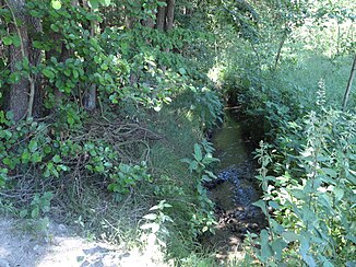
Kienbach south of Kienberg |
||
| Data | ||
| location | Lower Bavaria | |
| River system | Danube | |
| Drain over | Kinsach → Danube → Black Sea | |
| source | in Falkenfels 49 ° 0 ′ 18 " N , 12 ° 35 ′ 49" E |
|
| Source height | approx. 480 m above sea level NHN | |
| muzzle | south of Au Coordinates: 48 ° 58 ′ 55 " N , 12 ° 38 ′ 24" E 48 ° 58 ′ 55 " N , 12 ° 38 ′ 24" E |
|
| Mouth height | approx. 332 m above sea level NHN | |
| Height difference | approx. 148 m | |
| Bottom slope | approx. 33 ‰ | |
| length | 4.5 km | |
| Catchment area | 3.29 km² | |
| Communities | Falkenfels, Ascha | |
The Kienbach is a four and a half kilometer long stream in the district of Straubing-Bogen in Lower Bavaria , which flows into the Kinsach from the right and northwest in the district of Au in the municipality of Ascha .
geography
course
The headwaters of the Kienbach are located in the Falkenfels area at around 480 m above sea level. NHN . From here the stream runs south-east throughout with only small changes in direction. After about 0.7 km past the outskirts of Falkenfels and through the corridor, it comes to about 450 m above sea level. NHN enters its Kerbtal section in the Schönbirket forest , which fills the valley with two interruptions; In one of the two clearings, just above the left foot of the slope, there is a scattered settlement yard of Willersberg , of which three further settlement groups stand on the left slope of the valley, which is already widening at the top; at the beginning of the second, the longest of several forest tributaries flows with a little over half a kilometer from sources mainly on the right slope. To the south of Kienberg , which stands in the open corridor that descends as far as the brook, at medium altitude on the left mountain spur, the brook occurs at a little over 340 m above sea level. NHN again briefly out of the forest, then flat and in a wider hollow between Schwarzholz left and Spitalwald right to the federal road 20 , which he at the other end of the forest to a little over 335 m above sea level. Below NHN . Then it passes the district of Au of the municipality of Ascha on the lower and flat left estuary and finally flows out at about 332 m above sea level. NHN from the right and northwest into a right and parallel branch of the Kinsach , which flows back into it around 0.3 km further below.
Catchment area
The catchment area of the Kienbach (3.3 km²) has roughly the contour of a narrow wedge that ends towards the south-east and ends at a point, through which the creek flows almost exactly on the central axis. The western watershed runs roughly from the southeastern boundary of the Falkenfelser residential area Oberhof to about 500 m above sea level. NHN over the wooded summit of the Kühberg to a southeastern spur of the Steinberg at about 522 m above sea level. NHN winding northwards through Falkenfels; it separates from the catchment area of the Kößnach in the west. The adjoining northeastern watershed slopes steadily to the southeast and separates from the drainage area first the Sockabach , which flows further up into the Kinsach , then briefly the small re- ditch and finally even smaller tributaries of the same. The southwestern watershed rises again from the mouth to Oberhof and separates first into the Spitalwald from a short inlet to the Kinsach near Gschwendt , then further uphill from the competitor Steinachbach, which flows further down into the Kinsach, and its left tributaries.
Web links
- Basic data on Bavarian rivers. Map of the catchment area. Bavarian State Office for the Environment, accessed on June 10, 2014 .
- Course and catchment area of the Kienbach on the BayernAtlas
Individual evidence
- ↑ a b c Height according to the contour line image on the BayernAtlas. See the → web links
- ↑ a b List of brook and river areas in Bavaria - Naab to Isar river area, page 99 of the Bavarian State Office for the Environment, as of 2016 (PDF; 2.8 MB)
- ↑ Height according to black lettering on the BayernAtlas.
