
Kinnel Water
| Kinnel Water | ||
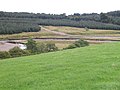
 The Kinnel Water around three kilometers from its mouth |
||
| Data | ||
| location | Dumfries and Galloway , Scotland | |
| River system | Annan | |
| Drain over | Annan → Solway Firth → Irish Sea | |
| source | On the southern edge of the Lowther Hills, 55 ° 18 ′ 56 ″ N , 3 ° 35 ′ 35 ″ W |
|
| muzzle | North-east of Lochmaben in the Annan Coordinates: 55 ° 8 ′ 20 " N , 3 ° 24 ′ 56" W 55 ° 8 ′ 20 " N , 3 ° 24 ′ 56" W
|
|
| length | 32 km | |
| Right tributaries | Water of Ae | |
The Kinnel Water is a river in the Scottish Council Area Dumfries and Galloway , or the traditional county of Dumfriesshire .
course
The river rises on the southern edge of the Lowther Hills about two kilometers north of the summit of the Queensberry near the border with the neighboring Council Area South Lanarkshire . A headwaters of the Clyde, which flows to the northwest, rises around 400 m away . After its upper course primarily follows a south-easterly direction through a hilly landscape, its course takes a southerly direction after around nine kilometers. For a few kilometers, the A701 runs largely parallel to the left bank before it crosses the river. After its lower course has led the Kinnel Water through a fertile stretch of land, it flows into the Annan around two kilometers northeast of Lochmaben , which finally drains into the Irish Sea via the Solway Firth . With a total length of around 32 km, the river overcomes a height difference of 402 m.
However, opening onto its run numerous streams in the Kinnel Water, it has except at Templand leading- Water of Ae no significant inflows. The Kinnel Water runs through a sparsely populated region, so that it affects a few localities, of which Templand is the most populous.
Upper course of the Kinnel Water

The Kinnel Bridge


Buildings
With the Kinnel Bridge , a category A monument protected bridge spans the river near Templand. The three-arched stone bridge was built in 1723 and expanded around 100 years later. At Templand, the river also passes the listed Ross Mains farmhouse. Further upstream, Raehills House, a mansion of the Earls of Annandale and Hartfell, is located near the right bank.
Web links
Individual evidence
- ↑ a b c Entry in the Gazetteer for Scotland
- ↑ a b Kinnel Water in: FH Groome: Ordnance Gazetteer of Scotland: A Survey of Scottish Topography, Statistical, Biographical and Historical. , Grange Publishing, Edinburgh, 1885.
- ↑ Listed Building - Entry . In: Historic Scotland .
- ↑ Listed Building - Entry . In: Historic Scotland .
- ↑ Listed Building - Entry . In: Historic Scotland .
- ↑ Garden and Designed Landscape - entry . In: Historic Scotland .