Kirjat Malʾachi
| Kirjat Mal'achi | ||
|---|---|---|
|
||

|
||
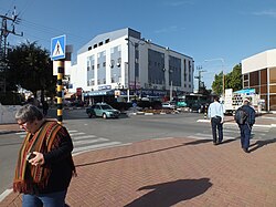
| Street scene in Kiryat Mal'achi | ||
| Basic data | ||
| hebrew : | קריית מלאכי | |
| State : |
|
|
| District : | south | |
| Founded : | 1951 | |
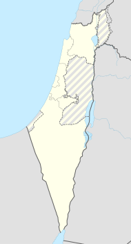
| Coordinates : | 31 ° 44 ' N , 34 ° 45' E | |
| Height : | 60 m | |
| Area : | 4.632 km² | |
| Residents : | 23,124 (as of 2018) | |
| Population density : | 4,992 inhabitants per km² | |
| Community code : | 1034 | |
| Time zone : | UTC + 2 | |
| Postal code : | 83001 - 83127 | |
| Community type: | city | |
| Website : | ||
|
|
||
Kirjat Malʾachi ( Hebrew קריית מלאכי) is a city in Israel , about 40 kilometers south of Tel Aviv in the hill country of the Shefela .
history
Kirjat Mal'achi (City of the Prophet Malachi ) was founded as a development city in the early 1950s .
Moshe Katzav became mayor in 1969 and, at the age of 24, was the youngest mayor in Israel at the time.
By December 31, 2005, Kirjat Mal'achi had a population of 19,400, this number rose to 23,124 in 2018.
On November 15, 2012 during the Palestinian operation, stones made of baked clay ( Arabic حجارة سجيل, DMG ḥiǧārat siǧīl ) killed three people in a rocket fired from the Gaza Strip .
Town twinning
|
|
Golmud ( People's Republic of China ), since June 25, 1997 |
|
|
Piatra Neamț ( Moldova Region , Romania ) |
Web links
Commons : Kirjat Mal'achi - Collection of images, videos and audio files
Individual evidence
- ↑ אוכלוסייה ביישובים 2018 (population of the settlements 2018). (XLSX; 0.13 MB) Israel Central Bureau of Statistics , August 25, 2019, accessed May 11, 2020 .
- ↑ אוכלוסייה ביישובים 2018 (population of the settlements 2018). (XLSX; 0.13 MB) Israel Central Bureau of Statistics , August 25, 2019, accessed May 11, 2020 .
- ↑ Gil Ronen: Did Iron Dome Malfunction Let In Lethal Rocket? IsraelNationalNews , November 19, 2012, accessed November 21, 2012 .

