Knot (Carinthia)
| node | ||
|---|---|---|
|
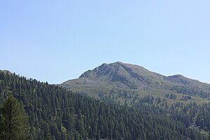
The knot, seen from the south side. |
||
| height | 2214 m above sea level A. | |
| location | Carinthia | |
| Mountains | Kreuzeckgruppe | |
| Dominance | 1.3 km → Hohe Grenten | |
| Notch height | 138 m ↓ Ochsentörl | |
| Coordinates | 46 ° 46 '53 " N , 13 ° 6' 46" E | |
|
|
||
| rock | Mica schist , paragneiss | |
The knot is a mountain in the Kreuzeck group in the Austrian state of Carinthia . It has a height of 2214 m above sea level. A.
It is located southwest of the significantly higher Hochtristen ( 2536 m ) and north of the village of Berg im Drautal . From the Emberger Alm and from the Oberberger Alm it can be easily reached in less than two hours on foot; only the last stretch to the summit requires surefootedness when climbing.
The summit offers an excellent view of the Drautal and the Reisskofel Group and the Jauken, opposite the valley .
literature
- Manfred Posch : Reißeck, Kreuzeck. The most beautiful tours. Kärntner Druck- und Verlagsgesellschaft mbH, Klagenfurt 2000, ISBN 3-85391-176-5 .


