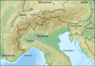
Reisskofel group
| Reisskofel group | ||
|---|---|---|
| Highest peak | Reisskofel ( 2371 m above sea level ) | |
| location | Carinthia , Austria | |
| part of | Gailtal Alps (Drauzug), Southern Eastern Alps | |
| Classification according to | Trimmel 3720/3722 | |
|
|
||
| Coordinates | 46 ° 41 ′ N , 13 ° 9 ′ E | |
| rock | Reef limestone | |
The Reisskofel Group is part of the limestone range of the Gailtal Alps (Drauzug) in Carinthia and is therefore included in the eastern part of the Southern Limestone Alps .
The name is also used for the central subgroup.
Location and landscape
The mountain range extends from the Gailbergsattel to the Kreuzbergsattel and borders in the north on the upper Drautal and in the south on the upper Gailtal . The Reisskofel is the highest mountain in the group with a height of 2371 m and consists largely of reef limestone .
Boundary and neighboring mountain groups
According to the Austrian mountain group structure according to Trimmel , the group bears the number 3720, as part of the Gailtal Alps (Trimmel 3700, AVE 56), and is defined as follows:
- in the south the Gailtal from Kötschach-Mauthen to Möderndorf near Hermagor to the Carnic Alps (3800, with Kellerspitzen , Polinik , Findeigkofel , Hochwipfel )
- in the east Gösseringbach - Weißbriach - Waisacheralm - Maßgraben - Bruggen (municipality of Greifenburg) on the Drau to the Spitzegelgruppe (3731, in Graslitzengruppe 3730, near Seeger Mittlere Gailtaler Alpen )
- in the north the Drautal to Oberdrauburg to the Kreuzeck group (2250, with Hochtristen , Scharnik )
- in the east Silberbach - Gailbergsattel - Kötschach-Mauthen to the Lienz Dolomites (3710, Hochstadelgruppe )
structure
The Reisskofel group is divided - also according to Trimmel - into three sections (each from west to east):
- Torkofel Group (No. 3721): the Jauken massif, interspersed with dolomite, with the peaks Jaukenhöhe ( 2234 m ), Torkofel ( 2276 m ), Mitterkofel ( 2247 m ) and Spitzkofel ( 2223 m ) and various foothills, such as the Jukbühel ( 1888) m ) against the Gailbergsattel
- Reisskofel group ( i.e. S. No. 3722): Gratzug with the Reisskofel ( 2371 m ) and the Sattelnock ( 2033 m ) and foothills
- Kreuther Höhe-Zug (No. 3723): low foothills towards the lower Gitschtal, with Hochwarter Höhe ( 1688 m ) and Kreuther Höhe ( 1440 m )
The first two are separated along the Grafendorf - Wiesergraben - Finstergraben - Jaukensattel ( 1600 m ) - Ochsenschluchtalm - Ochsenschlucht - Feistritzbach - Berg im Drautal line, the latter from Kirchbach an der Gail - Kirchbachgraben - Möslalm ( 1197 m ) - Schwarzenbach - Weißbriach.
Paths and huts
The whole mountain range is opened up with numerous paths, in particular crossing the entire length from Gailberg to Kreuzbergsattel as well as to Weißbriach, a section of the Gailtaler Höhenweg . Huts are the Dellacheralm (priv. 1567 m ), Jaukenalm (Jausenstation, 1934 m ), E.-T.-Compton-Hut (OeAV, 1585 m ) and the Weißbriacher Hut (OeAV, 1567 m ), which structure this high trail - in between there is an emergency shelter with the bivouac box ( 1825 m ) above the Jaukensattels. The area is also interesting for mountain bikers .
Individual evidence
- ↑ a b c Hubert Trimmel : Mountain group structure for the Austrian cave directory . Ed .: Association of Austrian Speleologists. Vienna 1962. WGEV working basis 2005/2006. In: Environment → Water. Federal Environment Agency , 2010, archived from the original on May 26, 2006 ; accessed on April 17, 2016 (on the Water Quality Survey Ordinance ; list (PDF; 23 kB), map , each pdf).
- ↑ the Grafenwegerhöhe ( 1438 m ), and with it the Kreuzbergsattel itself, which leads over to the Weissensee , Trimmel counts as part of the Spitzegelzug for hydrographic reasons
- ↑ Martin Seger: Introduction to regional studies and geographical structure . In: Paul Mildner, Helmu Zwander (Ed.): Carinthia - Nature. The diversity of a country in the south of Austria . 2nd Edition. Publishing house of the Natural Science Association for Carinthia, Klagenfurt 1999, ISBN 3-85328-018-8 , p. 25-62, especially 34 f .
- ↑ via Carnic Tourism, naturarena.at
- ↑ Weißbriacher Hütte , OeAV

