Kolochava
| Kolochava | ||
| Колочава | ||

|
|
|
| Basic data | ||
|---|---|---|
| Oblast : | Zakarpattia Oblast | |
| Rajon : | Mishhirja Rajon | |
| Height : | 631 m | |
| Area : | Information is missing | |
| Residents : | 5,029 (2004) | |
| Postcodes : | 90043 | |
| Area code : | +380 3146 | |
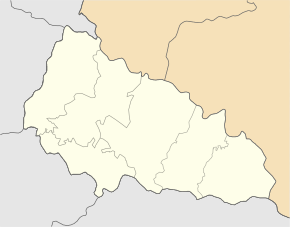
| Geographic location : | 48 ° 26 ' N , 23 ° 44' E | |
| KOATUU : | 2122482101 | |
| Administrative structure : | 3 villages | |
| Mayor : | Wassyl Chudynez | |
| Address: | вул. Шевченка 78 90 043 с. Колочава |
|
| Website : | http://www.kolochava.com | |
| Statistical information | ||
|
|
||
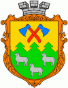
Kolotschawa (Ukrainian and Russian Колочава ; Slovak Lazy or older Nižná Koločava , Hungarian Alsókalocsa ) is a village in Mishhirja Raion in the Transcarpathian Oblast in western Ukraine with about 5000 inhabitants (2004).
The place was first mentioned in writing in 1365 and is located in the Tereblja valley in the middle of the Carpathian Forest . Together with the neighboring towns of Horb ( Горб ⊙ ) with about 1400 inhabitants and Mereschor ( Мерешор ⊙ ) with about 700 inhabitants, it forms the district council of the same name .
Until 1919 the place belonged to the Empire Austria-Hungary or Hungary , afterwards as part of the Carpathian-Ukraine to Czechoslovakia . With the annexation he came back to Hungary in 1939–1945, from 1946 the place has been part of the Ukrainian Soviet Socialist Republic and since 1991 of the Ukraine .
From 1976 to 1992 the place had the status of an urban-type settlement , but this was revoked on March 6, 1992.
The place is best known for its open-air museum, Museum Altes Dorf , and it is a popular hiking destination in the Synewyr National Park .


