Kochkor
|
Kochkor Кочкор |
||||
|
||||
| Basic data | ||||
|---|---|---|---|---|
| State : |
|
|||
| Territory : | Naryn | |||
| Coordinates : | 42 ° 13 ' N , 75 ° 45' E | |||
| Height : | 1767 m | |||
| Residents : | 9,863 (2009 (census)) | |||
| Structure and administration | ||||
| Community type : | Village | |||
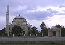
Kotschkor (Kirg .: Кочкор, English Kochkor) is a large village with around 10,000 inhabitants in the north of the Naryn region (Oblast) in the Central Asian Republic of Kyrgyzstan . The place is the administrative center of Kochkor Rajons . Earlier names were Stolypin (Russian: Столыпин) during the time of the Russian Empire and Kotschkorka (Russian: Кочкорка) during the time of the Soviet Union .
Kotschkor is located about 185 km (driving distance) east of Bishkek at almost 1800 m altitude at the southern foot and eastern end of the Kyrgyz mountains on both banks of the Tschüi , which arises here from the union of its source rivers Dschoon-Aryk and Kotschkor . The place is the starting point for trekking tours in the surrounding mountains and especially to the picturesque mountain lake Songköl , and the tourism infrastructure (accommodation, restaurants, tour operators and guides) is relatively well developed.
The A365 trunk road , one of the two larger roads in Naryn Oblast, runs from the Chüi area (with a connection to Bishkek) in the north through Kochkor to the south over the 3,030 m high Dolon Pass to Naryn, the capital of the area, and further south, to the 3752 m high Turugart Pass and the border there with China . The second major road in Naryn Oblast, the A367 , branches off from the A365 to the west about 4 km west of Kochkor, crosses the north of the Naryn area and connects Kochkor with the Suusamyr Valley , where it joins the M41 ( Kara-Balta - Jalalabad ), which crosses the 3586 m high Töö pass in a tunnel.
About 25 km northeast of Kochkor is the Ortotokoi Dam on the Tschüi River and the A365 and about 45 km northeast of the A365 is the city of Balyktschy at the western end of Lake Issyk Kul .
Footnotes
- ↑ 2009 Census, Naryn Area
- ↑ Named after Pyotr Arkadyevich Stolypin (1862–1911), the former Russian Prime Minister .


