Krivodanowka
| Village
Krivodanowka
Криводановка
|
||||||||||||||||||||||||||||||||
|
||||||||||||||||||||||||||||||||
|
||||||||||||||||||||||||||||||||
| List of large settlements in Russia | ||||||||||||||||||||||||||||||||
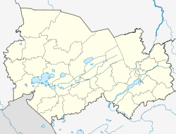
Kriwodanowka ( Russian Криводановка ) is a village (selo) in Novosibirsk Oblast in Russia with 10,051 inhabitants (as of October 14, 2010).
geography
The place is about 20 km as the crow flies northwest of the center of the oblast capital Novosibirsk , about 8 km from the left bank of the main arm of the Ob and a little southwest of its small left branch Kriwodanowka. A stream that flows through the village and flows into the Ob-Arm bears the same name.
Kriwodanowka belongs to the Novosibirsky district , whose administrative seat is also Novosibirsk. The village is the seat of the rural community Krivodanowskoje selskoje posselenije, which also includes the village of Marussino (8 km southeast) and the settlement Pawino (8 km south, only formally: the location was established in connection with the expansion of the Novosibirsk-Tolmachovo airport located immediately to the south from It was abandoned in the 1990s and is now uninhabited).
history
The place was founded in 1700 and in 1918 the seat of a village soviet . From the last decades of the 20th century its importance grew with the settlement of large, predominantly agricultural utilities and construction companies for the nearby metropolis of Novosibirsk.
Population development
| year | Residents |
|---|---|
| 1868 | 227 |
| 1926 | 2,851 |
| 2002 | 9.123 |
| 2010 | 10.051 |
Note: from 1926 census data
traffic
Kriwodanowka is connected by a road to the districts of Novosibirsk on the left of the Ob River and the regional road 50K-12 Novosibirsk - Kolyvan - border to Tomsk Oblast (from there towards Melnikowo - Tomsk ). To the northwest of the village, it continues to the extensive northern bypass of Novosibirsk running 6 km to the northwest along the federal highways R254 Irtysh and R255 Sibir (formerly M51 / M53).
The nearest train station is Novosibirsk-Sapadny ("West") on the Trans-Siberian Railway . From there a freight connection line leads to the industrial park southeast of Kriwodanowka; an earlier extension to the sand pits northwest of the village was dismantled.
Web links
- Official website of the local government (Russian)
Individual evidence
- ↑ a b Itogi Vserossijskoj perepisi naselenija 2010 goda. Tom 1. Čislennostʹ i razmeščenie naselenija (Results of the All-Russian Census 2010. Volume 1. Number and distribution of the population). Tables 5 , pp. 12-209; 11 , pp. 312–979 (download from the website of the Federal Service for State Statistics of the Russian Federation)

