Ksamil
| Ksamil | ||
|
Coordinates: 39 ° 46 ' N , 20 ° 0' E |
||
| Basic data | ||
|---|---|---|
| Qark : | Vlora | |
| Municipality : | Saranda | |
| Height : | 25 m above sea level A. | |
| Area : | 63.6 km² | |
| Residents : | 2994 (2011) | |
| Population density : | 47 inhabitants / km² | |
| Postal code : | 9706 | |
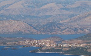
 Seen from Corfu across the sea |
||
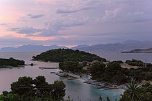
Ksamil ( Albanian also Ksamili , Greek Εξαμίλιο Examilio ) is a seaside resort in the very south of Albania on the shores of the Ionian Sea , but also the name of four small islands and the long peninsula between the Butrintsee in the east and the sea on which the place is about 15 Kilometers south of Saranda . The peninsula, which is very narrow up to Ksamil, widens south of the town and forms an attractive coastline with many bays with sandy beaches and a few small islands. From Ksamil, which is at the narrowest point of the Corfu Strait , it is less than four kilometers to the Greek island of Corfu . The municipality, to which the village of Manastir belongs, has 2994 inhabitants (2011 census). Local authorities give a much higher number of 7716 inhabitants.
Four kilometers further south, at the very end of the peninsulas, are the ruins of the ancient city of Butrint , which are a UNESCO World Heritage Site . The Butrint National Park, created in 2000, begins right on the southern outskirts and includes the southeastern end of the peninsula at 232 m above sea level. A. high mountain Sotira and wetlands south of the Vivar Canal .
Since the year 2000, Ksamil has rapidly developed into a summer seaside resort that primarily attracts Albanian tourists from home and abroad. The small community has grown a lot as a result. Many small hotels and restaurants emerged, and many locals rent rooms or entire houses. Since 2009 there is also a campsite in Ksamil. The once hardly touched beauty of the area has suffered greatly from the haphazard construction activity.
The place has an ancient name: Heksamilion . But Ksamil goes back to a start-up in the 1960s. At that time, large parts of the peninsula were terraced and cultures with citrus fruits and olive groves were created. Ksamil was created as a residence for the state farm workers. Before that, the peninsula was barren land overgrown with thorn bushes, which only served as grazing land for goats and sheep. For the visit of the Soviet Prime Minister Nikita Khrushchev , a road to Butrint was laid in 1959, which also opened up the Ksamil peninsula.
Web links
Individual evidence
- ↑ Ines Nurja: Censusi i popullsisë dhe banesave / Population and Housing Census - Vlorë 2011 . Results Kryesore / Main Results. Ed .: INSTAT . Pjesa / Part 1. Adel Print, Tirana 2013 ( instat.gov.al [PDF; accessed April 14, 2019]).
- ↑ Komuna Ksamil. In: Këshilli i Qarkut Vlorë. Archived from the original on March 7, 2016 ; Retrieved July 25, 2011 (Albanian).
- ↑ Gilian Gloyer: Albania Bradt Travel Guide , Bucks, 2006 (second edition), ISBN 978-1-84162-149-4
- ↑ James Pettifer: Albania & Kosovo , London 2001, ISBN 0-7136-5016-8
- ^ Butrint Foundation, Butrint National Park (Ed.): Butrint National Park - A guide to the Environment and Walking Trails
- ^ Hans Joachim Röhm, Rüdiger Pier: Albanien als Reiseland , Munich / Hamburg 1986, ISBN 3-925297-15-4
- ^ Archeology.org: The Discovery of Butrint. Retrieved April 12, 2009 .

