
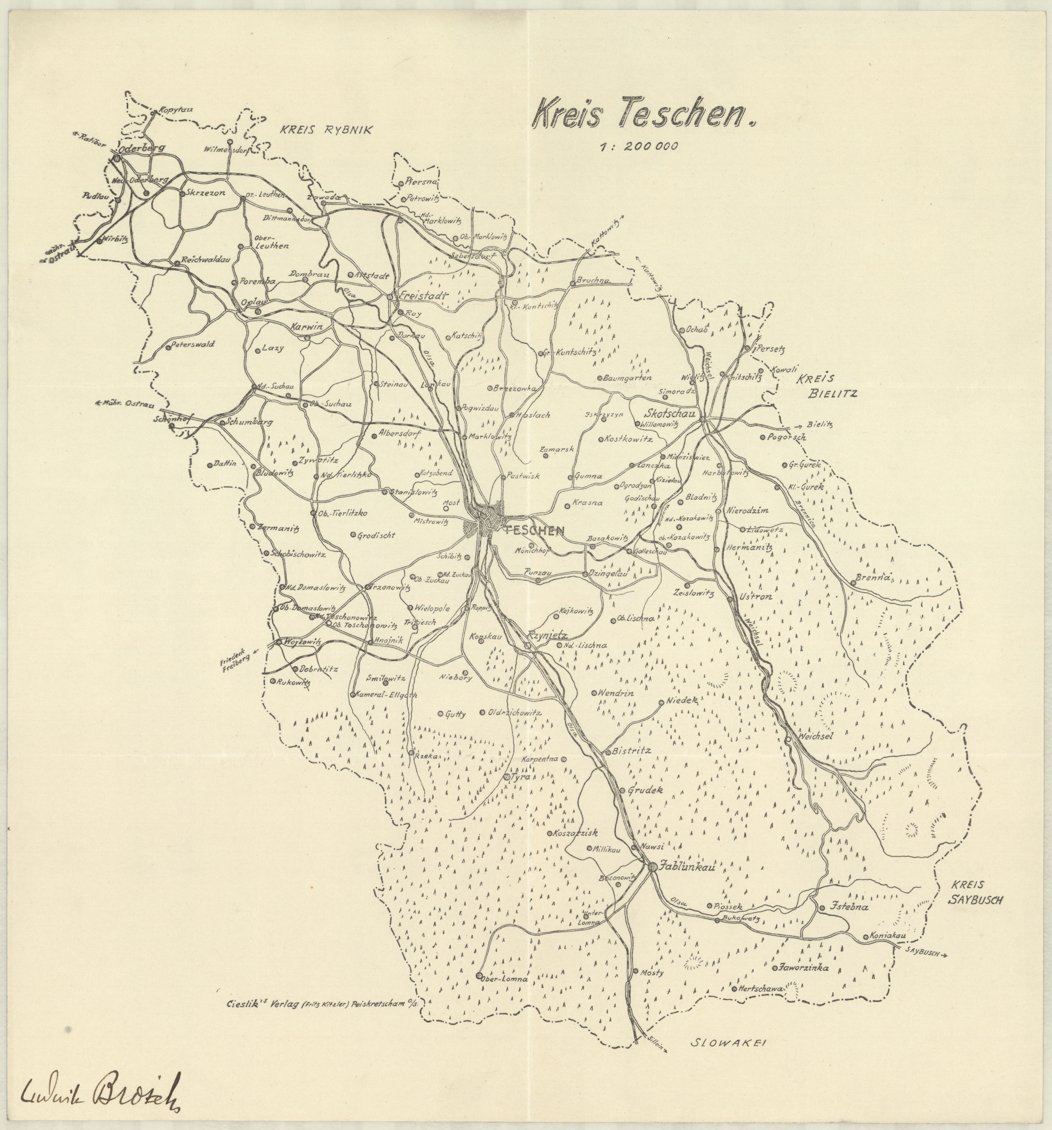
Teschen district
The district of Teschen (also Olsaland or Olsa area in the documents ) existed between 1939 and 1945 in the German Reich occupied Poland and Sudeten Silesia . It covered 1462 km 2 (the second largest district in the empire), on January 1, 1945, 16 municipalities administered according to the German municipal code of January 30, including seven cities and 115 other municipalities combined in administrative districts.
Administrative history
Austria and Czechoslovakia
Until 1918 the area belonged to the Austro-Hungarian dual monarchy as the district of Teschen (later the district of Freistadt was also spun off) , then partially fell to Czechoslovakia , which had successfully prevented a referendum . The subsequent Polish-Czechoslovak border war was lost by Poland , which annexed the larger south-western part of the Teschen district and the majority of the Freistadt district to Czechoslovakia. After Czechoslovakia had to cede the Sudetenland as a result of the Munich Agreement of October 1938 , Poland occupied the Czech part.
Poland
At the beginning of the Second World War , the districts of Cieszyn - including the Czechoslovakian Olsa region ( Zaolzie in Polish ), which was occupied in 1938 - and Freistadt (also Czech until 1938) belonged to Poland , namely to the Silesian Voivodeship .
After the German occupation of Poland in September 1939, both districts belonged to the military district of Upper Silesia before they were incorporated into the German Reich . They have already been jointly administered by a land commissioner.
German Empire
On October 26, 1939, these previously Polish districts were now part of the newly formed administrative district of Katowice in the Prussian province of Silesia as a district with the name Teschen .
The district office was in the reunified city of Teschen .
On January 18, 1941, the province of Silesia was dissolved. The new province of Upper Silesia was formed from the previous administrative districts of Katowice and Opole .
In the spring of 1945 the district was occupied by the Red Army and then rejoined Poland and Czechoslovakia. The city of Teschen was thus divided again.
politics
Land Commissioner
- 1939 :?
District administrators
- 1939–1940:?
- 1940–1945: Udo Krüger
Local constitution
After incorporation into the German Reich , the towns of Jablunkau , Karwin , Neu Oderberg, Orlau , Skotschau , Teschen and Trzynietz , as well as the communities of Dombrau, Lazy, Peterswald, Poremba, Reichwaldau, Steinau, Suchau, Ustron and Weichsel, became the in the Altreich until 1945 subject to the valid German municipal code of January 30, 1935, which provided for the enforcement of the Führer principle at the municipal level. The city of Freistadt was merged with the city of Karwin in 1944 .
All other cities and municipalities were grouped together in administrative districts and were administered by office commissioners.
Place names
By unpublished decree of December 29, 1939, the Austrian place names valid until 1918 were provisionally valid with regard to the previously Polish place names. This global renaming was possible because the entire German map series for the areas ceded to Poland and Czechoslovakia in 1920 (also) continued to use the previous German and Austrian place names.
There was no final assignment of purely German place names until the end of the war. However, this was already prepared in detail. These were phonetic adjustments, translations, new creations or improvements to the names that have been valid since 1939, for example:
- Bistritz : Bistritz (Olsa),
- Groß Gurek : Brenntal,
- Hnojnik : Steinendorf,
- Istebna : Bergstuben,
- Lazy : Heinrichshalden,
- New Oderberg : Oderberg (Upper Silesia),
- Nieder Bludowitz : Blaudental,
- Nieder Tierlitzko : Niederzierlau,
- Orlau : Orlau OS,
- Peterswald : Peterswald OS,
- Poremba : Grabenhau,
- Reichwaldau : Reichwaldau OS or Reichwaldau (Kr.Teschen),
- Seibersdorf : Seibersdorf (Vistula),
- Steinau : Olsasteinau,
- Trzynietz : Olsahütte,
- Vistula : Hohen Weichsel .
literature
- Josef Bartoš, Jindřich Schulz, Miloš Trapl: Historický místopis Moravy a Slezska v letech 1848-1960. Sv. 15, okresy: Frýdek-Místek, Český Těšín . Univerzita Palackého v Olomouci, Olomouc 2000.
- Josef Bartoš, Jindřich Schulz, Miloš Trapl: Historický místopis Moravy a Slezska v letech 1848-1960. Sv. 16, okresy: Ostrava, Fryštát, Hlučín . Univerzita Palackého v Olomouci, Olomouc 2011.
Web links
- Teschen district administrative history and the district administrators on the website territorial.de (Rolf Jehke), as of August 20, 2013.
- Map of the Teschen district , 1940