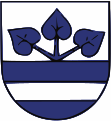
Rychvald
| Rychvald | ||||
|---|---|---|---|---|
|
||||
| Basic data | ||||
| State : |
|
|||
| Region : | Moravskoslezský kraj | |||
| District : | Karviná | |||
| Area : | 1703 ha | |||
| Geographic location : | 49 ° 52 ' N , 18 ° 23' E | |||
| Height: | 220 m nm | |||
| Residents : | 7,457 (Jan 1, 2019) | |||
| Postal code : | 735 32 | |||
| structure | ||||
| Status: | city | |||
| Districts: | 1 | |||
| administration | ||||
| Mayor : | Šárka Kapková (status: 2011) | |||
| Address: | Orlovská 678 735 32 Rychvald |
|||
| Municipality number: | 599107 | |||
| Website : | www.rychvald.cz | |||
Rychvald (German Reichwaldau, Polish Rychwałd ) is a town with 6780 inhabitants in the Czech Republic . It is located on the northeastern city limits of Ostrava at 220 m above sea level. M. and belongs to the Okres Karviná . The cadastral area is 1704 ha.
geography
The city is located on the right bank of the Stružka in a pond landscape in Moravian-Silesia in the Ostrava pan. It belongs to the Ostrava Metropolitan Region . Neighboring towns are the Ostrava districts Michálkovice and Heřmanice in the southwest. Záblatí and Bohumín join in the north, Lutyně, Poruba and Orlová in the east and Podlesí and Dvorek in the south.
history
The first mention of Reichwaldau in the Duchy of Teschen comes from the tithe list of the Diocese of Breslau from 1305.
In 1577, the owner of the estate, Bernard Barsky von Barště, had the Starý Dvůr chateau built. In 1595 the Church of St. Anna was built.
Until the 19th century, Reichwaldau was a purely farming village, which was transformed into a miners' settlement due to the coal mining in the area. In the second half of the 19th century the castle was rebuilt.
After the collapse of the Austro-Hungarian monarchy , Reichwaldau was assigned to Poland when the Teschener Land was divided up in 1918, and after the end of the Polish-Czechoslovak border war , the town became part of Czechoslovakia in 1920 . After the Munich Agreement , the Polish army occupied Rychvald on October 11, 1938. On September 1, 1939, the Wehrmacht followed and until May 1, 1945, Reichwaldau belonged to the German district of Teschen .
In 1945 the lord of the castle Georg Starhemberg was expropriated. Rychvald has been a town since 1985. Starý Dvůr Castle is currently in a very dilapidated condition.
City structure
The localities Dvorek, Jarošovice and Podlesí belong to Rychvald.
Web links
- Website (Czech)


