Langis
| Langis | ||
|
Marais de Bourges |
||
| Data | ||
| Water code | FR : K5566200 | |
| location | France , Center-Val de Loire region | |
| River system | Loire | |
| Drain over | Yèvre → Cher → Loire → Atlantic Ocean | |
| source | in the municipality of Soulangis 47 ° 11 ′ 43 ″ N , 2 ° 30 ′ 23 ″ E |
|
| Source height | approx. 184 m | |
| muzzle | in the municipality of Bourges in the Yèvre coordinates: 47 ° 5 ′ 36 ″ N , 2 ° 24 ′ 25 ″ E 47 ° 5 ′ 36 ″ N , 2 ° 24 ′ 25 ″ E |
|
| Mouth height | approx. 127 m | |
| Height difference | approx. 57 m | |
| Bottom slope | approx. 3 ‰ | |
| length | approx. 19 km | |
| Medium-sized cities | Bourges | |
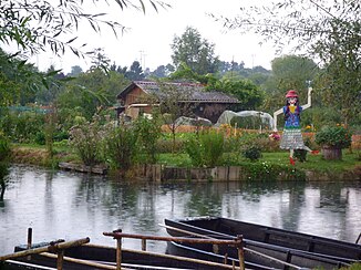
The Langis is a river in France that runs in the Cher department in the Center-Val de Loire region . It rises in the municipality of Soulangis , generally drains in a south-westerly direction and flows into the Yèvre as a right tributary after around 19 kilometers in the municipality of Bourges . In its estuary section, the Langis crosses the widely ramified wetland Marais de Bourges , which is now used for various leisure activities.
Places on the river
(Order in flow direction)
Web links
Commons : Marais de Bourges - Collection of images, videos and audio files
