
Leitersdorf (Laberweinting)
|
Leitersdorf
Municipality Laberweinting
Coordinates: 48 ° 44 ′ 55 ″ N , 12 ° 18 ′ 36 ″ E
|
||
|---|---|---|
| Height : | 410 m above sea level NHN | |
| Residents : | 16 (Oct. 1, 2012) | |
| Incorporation : | 1970 | |
| Postal code : | 84082 | |
| Area code : | 08772 (Mallersdorf) | |
Location of Leitersdorf in Bavaria |
||
 Leitersdorf
|
||

Leitersdorf is a district of the municipality of Laberweinting in the Lower Bavarian district of Straubing-Bogen .
location
Leitersdorf lies seven kilometers south of Laberweinting on the Asbach river, seven kilometers east of Mallersdorf and seven kilometers northeast of Bayerbach .
history
The first known mention of Leitersdorf was found in a visitation protocol of the parish Hofkirchen from 1861. At that time 16 people lived there. Leitersdorf was united with the village of Haimelkofen since May 17, 1818. On September 10, 1845, the towns of Asbach and Leitersdorf applied to the Mallersdorf royal district court to form an independent community. (H St AM MI nu 54 262)
Until 1970 Leitersdorf belonged to the municipality of Asbach. In 1970 the community of Asbach voluntarily joined the community of Hofkirchen. Until the regional reform, Asbach was part of the then independent municipality of Hofkirchen, which was dissolved in 1972. The Mallersdorf district. The last mayor of Asbach was Alfons Stadler, Leitersdorf. († November 7, 1989).
Personalities
- Vinzenz Kammermeier Leitersdorf (* April 19, 1905 - † October 17, 1997). Farmer, haulier, radio technician and photographer.
Pictures of Leitersdorf
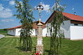
Obermeier Cross

literature
- Joseph Urban, pastor, visitation protocol of the parish Hofkirchen dated December 30, 1861
- Chronicle of the place and the Asbach volunteer fire brigade, commemorative publication for the flag consecration in 1981.
Web links
- Website of Hofkirchen
- Leitersdorf in the location database of the Bavarian State Library Online . Bavarian State Library

Allkofen | Arnkofen | Asbach | Aumühle | Crush | Bruckhof | Eckenthal | Eitting | Francs | Grafentraubach | Haader | Habelsbach | Haimelkofen | Hakirchen | Hard | Hinterbach | Hofkirchen | Kreuth | Laberweinting | Leitersdorf | Neuhofen | Obergraßlfing | Wasteland | Osterham | Poschenhof | Reichermühle | Reuth | Ruhstorf | Untergraßlfing | Soft | Zeißlhof