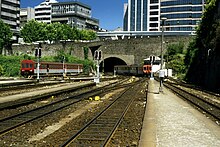
Linha de Guimarães
| Postage – Fafe | |||||||||||||||||||||||||||||||||||||||||||||||||||||||||||||||||||||||||||||||||||||||||||||||||||||||||||||||||||||||||||||||||||||||||||||||||||||||||||||||||
|---|---|---|---|---|---|---|---|---|---|---|---|---|---|---|---|---|---|---|---|---|---|---|---|---|---|---|---|---|---|---|---|---|---|---|---|---|---|---|---|---|---|---|---|---|---|---|---|---|---|---|---|---|---|---|---|---|---|---|---|---|---|---|---|---|---|---|---|---|---|---|---|---|---|---|---|---|---|---|---|---|---|---|---|---|---|---|---|---|---|---|---|---|---|---|---|---|---|---|---|---|---|---|---|---|---|---|---|---|---|---|---|---|---|---|---|---|---|---|---|---|---|---|---|---|---|---|---|---|---|---|---|---|---|---|---|---|---|---|---|---|---|---|---|---|---|---|---|---|---|---|---|---|---|---|---|---|---|---|---|---|---|
| Route length: | 80.7 km | ||||||||||||||||||||||||||||||||||||||||||||||||||||||||||||||||||||||||||||||||||||||||||||||||||||||||||||||||||||||||||||||||||||||||||||||||||||||||||||||||
| Gauge : |
(until 2002) 1000 mm (Lousado – Guimarães) 1668 mm (Trindade – ISMAI) 1435 mm |
||||||||||||||||||||||||||||||||||||||||||||||||||||||||||||||||||||||||||||||||||||||||||||||||||||||||||||||||||||||||||||||||||||||||||||||||||||||||||||||||
| Power system : | (Lousado – Guimarães) 25 kV 50 Hz ~ | ||||||||||||||||||||||||||||||||||||||||||||||||||||||||||||||||||||||||||||||||||||||||||||||||||||||||||||||||||||||||||||||||||||||||||||||||||||||||||||||||
|
|||||||||||||||||||||||||||||||||||||||||||||||||||||||||||||||||||||||||||||||||||||||||||||||||||||||||||||||||||||||||||||||||||||||||||||||||||||||||||||||||
The Linha de Guimarães is a railway line that connects Guimarães with Porto . In addition, a pair of Intercidades trains to and from Lisbon will run on the modernized route .
history
The construction of this railway line began in the 19th century. Originally, the meter- gauge line to Guimarães began at Trindade station , where the line merged with the Linha da Póvoa to Senhora da Hora station. From here the lines separated, one going in the direction of Póvoa de Varzim to the sea and the other mainly following the river Minho towards Trofa . In the city of Trofa, the line then came together with the broad-gauge Linha do Minho and then separated again at the Lousado station. There was a four-rail track between the two stations . From here the line went its own way in the valley of the Rio Ave and later along the river Rio Vizela to Guimarães . In Guimarães, the line turned towards the Serra da Penha mountains to the Fafe terminus .
Opening dates:
| route | length | date |
|---|---|---|
| Trofa - Vizela | 25,300 km | 12/31/1883 |
| Vizela - Guimarães | 8.130 km | 04/14/1884 |
| Guimarães - Fafe | 21.45 km | 07/21/1907 |
| Senhora da Hora - Trofa | 22.230 km | 03/14/1932 |
| Boavista - Porto-Trindade | 2,350 km | 10/31/1938 |
Although there were plans to continue the line to Chaves to meet the Linha do Tâmega and the Linha do Corgo , they were never put into practice.
On January 1, 1990, the section between Guimarães and Fafe was closed and parts of it were converted into an Ecopista (cycle path). After that, other fundamental changes were made that completely changed the appearance of the line.
The Linha de Guimarães was split into two parts. The section from Trindade to Trofa was from the Porto Metro over to standard gauge umgespurt , electrified and in its light rail network included. The section between Lousado and Guimarães was converted to Iberian broad gauge , also electrified, partially neutrated and provided with new access points. This led to an increase in the permitted line speed and made it possible to connect trains to the rest of the railway network.
Todays situation
Currently, only the route between Lousado and Guimarães is referred to as "Linha de Guimarães". In addition to the regional trains, which take an hour and 15 minutes to travel between Porto and Guimarães, a daily pair of Intercidades trains connects Guimarães with the capital Lisbon in four hours and 15 minutes . The trains to and from Guimarães have been running via the Linha do Minho since the gauge change between Lousado and Porto São Bento or Campanhã .
The Porto Metro uses the section of Porto Trindade to the campus of the Instituto Superior da Maia (ISMAI) between the existing stations Castêlo da Maia and Muro for the urban rail system. For this purpose, the line was expanded to double-track throughout, in addition to being changed over to the standard gauge. In the local area of Maia and the »Zona industrial« to the north, it was relocated over a length of around two kilometers to improve the development function. Between the sweeping system north of ISMAI and Trofa, the planum is currently unused; in the Trofa location with the site of the old train station, it is to be used for the »Alameda Trofa« green corridor.
panorama
literature
- Jose Riberio da Silva e Manuel Ribeiro: Os Comboios em Portugal, Tom II, Lisboa 2009, ISBN 978-972-710-417-8
- Herbert Stemmler: The narrow-gauge railways in northern Portugal . In: Wolfgang Messerschmidt (Ed.): Locomotive magazine . No. 68 . Franckh'sche Verlagshandlung, W. Keller & Co. , 1974, ISSN 0458-1822 , p. 372-384 .

