List of cultural monuments in Arnstadt
In the list of cultural monuments in Arnstadt are cultural monuments of the Thuringian county seat Arnstadt ( Ilm-Kreis ) and its districts listed. There are no possible cultural monuments in the area of the former municipality of Wipfratal .
Arnstadt
Status: 11/2006
| image | designation | location | Dating | description | ID |
|---|---|---|---|---|---|
 |
Memorial to the fallen of the Mathematikverein | Alteburg (map) |
1926 |
|
|
 More pictures |
Alteburgturm | Alteburg (map) |
1902 | The Alteburgturm is a tower that was inaugurated in 1902 and stands on the Alteburg mountain . |
|
 |
Assumption Church | Old cemetery (map) |
|
||
 |
Gravedigger House | Old cemetery (map) |
|
||
 |
Willibald Alexis tomb | Old graveyard |
|
||
 |
Tomb of the John family ( Marlitt ) | Old graveyard |
|
||
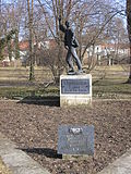 |
Cenotaph for the victims of fascism | Old graveyard |
|
||
 |
Jewish stele | Old graveyard |
|
||
 |
Water tower | At the train station |
|
||
 |
Hotel zur Krone, facade, stairs, foyer | At the train station 8 |
|
||
 |
villa | Am Häckerstieg 11 (map) |
|
||
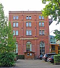 |
Brewery building, former Felsenkeller brewery, ensemble | Am Häckerstieg 12 (map) |
|
||
 More pictures |
Bach Church | At the market (map) |
|
||
 |
House with property fence (11/99) | Am Mispelgütchen 1a (map) |
|
||
 |
former kindergarten | At the fountain art 1 (map) |
|
||
 |
House (with remains of the basement) | At the fountain art 3 (map) |
|
||
 More pictures |
Liebfrauenkirche with equipment | At the Liebfrauenkirche (map) |
|
||
 |
Prinzenhof with walling | At the Liebfrauenkirche 2 (map) |
|
||
 More pictures |
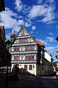
Paper mill | At the Liebfrauenkirche 4 (map) |
1633 |
|
|
 |
House | At the New Church 10 (map) |
|
||
 |
Fountain | At the New Church (map) |
|
||
 |
Waidhaus | At the White 1, 3 (card) |
|
||
 |
House | At the White 18 (card) |
|
||
 |
Tanner's house | At the White 36 (card) |
|
||
 |
Water tower | Arnsberg (map) |
1926 |
|
|
 |
former gravedigger house | Bahnhofstrasse 2a (map) |
|
||
 |
former forester's house, with wrought iron property fence | Bahnhofstrasse 21 (map) |
|
||
 |
Housing estate with a former employment office and fire station | Bärwinkelstrasse 4, 6, 8, 10 (map) |
1928 | (with Oberbaurat-Acker-Straße 5, 7, 8, 9, 11, 12, 13, 14, 15, 16, 18) |
|
 |
Residential building | Eichfelder Weg 16 (map) |
|
||
 |
House | Erfurter Strasse 9 (map) |
|
||
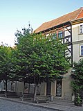 |
House | Erfurter Strasse 10 (map) |
|
||
 |
House | Erfurter Strasse 12 (map) |
|
||
 |
House | Erfurter Strasse 14 (map) |
|
||
 |
House | Erfurter Strasse 15 (map) |
|
||
 |
House | Erfurter Strasse 19 (map) |
|
||
 |
St. George Hospital | Erfurter Strasse 39 (map) |
|
||
 |
House (Wenderoth, Heyer, Behrendt) | Erfurter Strasse 40 (map) |
|
||
 More pictures |
Hop well | Erfurter Strasse (map) |
|
||
 |
Pheasant garden area, residential complex | Pheasant garden 1–9 (map) |
1923 |
|
|
| Portal (to the Längwitz wall) | Pheasant Garden (Map) |
|
|||
 |
Catherine fountain | Pheasant Garden (Map) |
|
||
 |
House | Fleischgasse 17 (map) |
|
||
 |
House | Friedensstrasse 5 (map) |
|
||
 |
House | Gothaer Strasse 2 (map) |
|
||
 |
villa | High wall 4 (map) |
|
||
 |
Shepherd's house | High wall 6 (map) |
|
||
| House | Hersfelder Strasse 1 | Staircase with Art Nouveau painting |
|
||
 |
Henneberg residential and commercial building | Holzmarkt 7 (map) |
|
||
 |
Residential and commercial building with courtyard buildings, Fischer bakery | Holzmarkt 6 (map) |
|
||
 |
House | Holzmarkt 10 (map) |
|
||
 |
House | Holzmarkt 17 (map) |
House "Zur Tanne" |
|
|
 |
House | Holzmarkt 19 (map) |
|
||
 |
Holzmarktbrunnen | Holzmarkt (map) |
|
||
| villa | Ichtershäuser Strasse 2 |
|
|||
| pavilion | Ilmenauer Strasse 30 |
|
|||
 More pictures |
Jacobskirchturm | Jakobsgasse (map) |
|
||
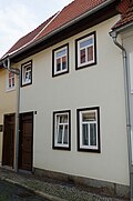 |
Kaspar Bach's house | Jakobsgasse 13 (map) |
|
||
 |
Kaspar Bach's house | Jakobsgasse 15 (map) |
|
||
 More pictures |
Memorial to the victims of fascism | Jonastal |
|
||
 |
House | Karolinenstrasse 2 (map) |
|
||
 |
House | Karolinenstrasse 7 (map) |
|
||
 |
House | Karolinenstrasse 11 (map) |
|
||
 |
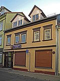
school-building | Kasseler Strasse 10 (map) |
former Polytechnic |
|
|
 |
Residential building | Klausstrasse 13 (map) |
|
||
 |
House | Kirchgasse 1 (map) |
|
||
 |
Residential and commercial building with courtyard building | Coal Market 8 (map) |
|
||
 |
House | Coal Market 20 (map) |
|
||
 |
Courtyard | Kohlgasse 2 (map) |
Hülsemannhaus |
|
|
 |
Residential house with outbuildings | Kohlgasse 4 (map) |
House "Zum Falkenstein" |
|
|
 |
House | Kohlgasse 6 (map) |
|
||
 |
House | Kohlgasse 7 (map) |
Christoph and J. Ernst Bach |
|
|
 |
House | Kohlgasse 8 (map) |
|
||
 |
House | Kohlgasse 11 (map) |
|
||
 |
House (front door) | Kohlgasse 15 (map) |
|
||
 |
Old rectorate | Kohlgasse 17 (map) |
|
||
 |
Residential and commercial building with courtyard building | Längwitzer Strasse 3 (map) |
Tanner's house |
|
|
 |
Courtyard | Längwitzer Strasse 11 (map) |
Mühlhof |
|
|
 |
Courtyard | Längwitzer Strasse 13 (map) |
Juniper tree |
|
|
 |
House | Längwitzer Strasse 18 (map) |
|
||
 |
Residential building | Längwitzer Strasse 19 (map) |
|
||
 |
House and parts of the pheasant garden wall, coat of arms | Längwitzer Strasse 22 (map) |
|
||
 |
House | Leather market 1 (map) |
|
||
 |
Councilor | Leather market 3 (map) |
|
||
 |
House | Leather market 5 (map) |
|
||
 |
Residential and commercial building | Leather market 7 (map) |
House "Zur Krone" |
|
|
 |
House | Ledermarktgasse 1 (map) |
|
||
 |
Residential and commercial building | Lessingstrasse 20 (map) |
|
||
 |
Residential and commercial building | Lindenallee 2 (map) |
|
||
 |
Arnstadt bank | Lindenallee 3a (map) |
1902 | The Art Nouveau banking house, built in 1902, has been formative for Arnstadt with a banking tradition going back over 100 years. Six different institutes were based at the address. After the builder of the bank, the Arnstädter Bank, von Külmer, Czarnikow & Comp. followed by the private bank to Gotha, the Deutsche Bank, the GDR state bank, the Dresdner Bank AG, which merged with the Commerzbank AG. Today the building is a modern office and commercial building. Background to the story: Bankhaus Arnstadt |
|
 |
school | Lindenallee 10 (map) |
|
||
 |
Monument to Willibald Alexis | Lindenallee (map) |
|
||
 |
Villa Minner | Lohmühlenweg 2 (map) |
1910 | 1910 by Paul Schultze-Naumburg |
|
 |
House | Lohmühlenweg 3 (map) |
|
||
 |
House | Lohmühlenweg 4 (map) |
|
||
 |
House | Lohmühlenweg 10 (map) |
|
||
 |
House | Lohmühlenweg 17 (map) |
|
||
 |
House (Herda) | Lohmühlenweg 23 (map) |
|
||
 |
Villa (Fast) | Lohmühlenweg 25 (map) |
|
||
 |
Town Hall (Post Office) | Market 1 (map) |
1882 by architect Prof. Hubert Stier (1838–1907) from Hanover |
|
|
 |
town hall | Market 2 (map) |
|
||
 |
House | Market 3 (map) |
1589 | House "Zum Palmbaum" |
|
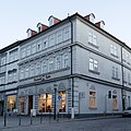 |
House | Market 4 (map) |
House "Zum Osterlamm" |
|
|
 |
House | Market 6 (map) |
House "Zum Grimmen Löwen" |
|
|
 |
House | Market 7 (map) |
|
||
 |
Residential and commercial building | Market 8 (map) |
with courtyard buildings and pharmacy equipment |
|
|
 |
Courtyard | Market 9 (map) |
|
||
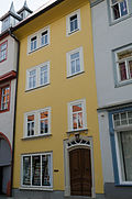 |
front door | Market 10 (map) |
|
||
 More pictures |
House | Market 11 (map) |
House "Güldener Greif" |
|
|
 |
House | Market 12-14 (map) |
|
||
 |
Residential and commercial building | Marktstrasse 11 (map) |
"Zur Rosenburg" residential and commercial building |
|
|
 More pictures |
Villa Marlitt | Marlittstrasse 9 (map) |
|
||
 |
House | Marlittstrasse 11 (map) |
|
||
 |
Villa with enclosure and retaining wall | Marlittstrasse 17 (map) |
|
||
 |
House and factory building with fencing on Marlittstrasse / Plauesche Strasse | Marlittstrasse 19 (map) |
|
||
 |
Residential building with outbuildings | Mittelgasse 1 (map) |
|
||
 |
House and outbuildings | Mittelgasse 14 (map) |
|
||
 |
House and factory building with enclosure, enclosure on Marlittstrasse / Plauesche Strasse | Mittelgasse 19 (map) |
|
||
| Cemetery complex (monument ensemble) | New cemetery (map) |
Enclosing wall, iron gates, celebration hall with administration building and crematorium , Soviet cemetery of honor, Jewish cemetery, sales pavilion of the former Herda flower shop, gravestones, etc. |
|
||
 |
Ensemble Oberbaurat-Acker-Straße | Oberbaurat-Acker-Strasse 5–18 (map) |
1928 |
|
|
 |
former brewery building | Parkweg 2 (map) |
|
||
 More pictures |
Upper church with equipment | Vicarage (map) |
|
||
 |
House |
Pfarrhof 1 (map) |
|
||
 |
House | Rectory 2/4 (map) |
|
||
 |
House | Pfarrhof 3/5 (map) |
|
||
 |
House | Pfarrhof 4 (map) |
|
||
 |
House | Pfarrhof 6 (map) |
|
||
 |
House | Pfarrhof 8 (map) |
|
||
 |
House | Pfarrhof 10 (map) |
|
||
 |
House | Pfarrhof 12 (map) |
|
||
 |
House | Pfarrhof 14 (map) |
|
||
 |
Fountain | Vicarage (map) |
|
||
 |
House (random vote) | Pfortenstrasse 37 (map) |
|
||
 |
House with enclosure | Plauesche Strasse 2 (map) |
|
||
 More pictures |
Plaque | Plauesche Strasse 3 (map) |
|
||
 More pictures |
House with park | Plauesche Strasse 4 (map) |
|
||
 More pictures |
Riedquelle memorial stone | Plauesche Strasse 7 (map) |
|
||
 |
House | Plauesche Strasse 7 (map) |
|
||
 |
House | Plauesche Strasse 10 (map) |
|
||
 More pictures |
former dairy farm | Quenselstrasse 16 (map) |
1929 |
|
|
 |
House | Rankestrasse 2 (map) |
|
||
 |
Residential and commercial building | Rankestrasse 18 (map) |
|
||
 |
former depot | Rehestädter Weg (map) |
Locomotive shed |
|
|
 |
school-building | Richard-Wagner-Strasse 6 (map) |
“Arnsberg School”, 1910 by Schilling & Graebner |
|
|
 |
House | Ried 1 (map) |
House "to the burnt offering" |
|
|
 More pictures |
Residential and commercial building | Ried 2 (map) |
1524 | House "Zum Bären" |
|
 |
House | Ried 7 (map) |
|
||
 |
House | Ried 9 (map) |
approx. 15th century | House "Zum Christophorus" |
|
 |
House | Ried 10 (map) |
|
||
 |
House | Ried 11 (map) |
|
||
 |
House | Ried 14 (map) |
|
||
 |
House | Ried 17 (map) |
|
||
 |
Industrial building | Riedmauer 1a (map) |
with Fleischgasse 21, ENAG |
|
|
 |
House | Riedmauer 14 (map) |
belongs to the city fortifications |
|
|
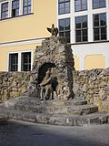 |
Neptune grotto | Ritterstrasse (map) |
|
||
 |
House (Schellhorn) | Ritterstrasse 3/5 (map) |
|
||
 |
Residential and commercial building with courtyard building | Ritterstrasse 7 (map) |
|
||
 |
House | Ritterstrasse 9 (map) |
|
||
 |
House | Ritterstrasse 10 (map) |
|
||
 More pictures |
court House | Ritterstrasse 14 (map) |
|
||
 |
Basement of the former detention building | Ritterstrasse 14 |
|
||
 |
Bower | Rosenstrasse (map) |
|
||
 |
House | Rosenstrasse 19-25 (map) |
|
||
 |
building | Rosenstrasse 45 (map) |
|
||
 More pictures |
The falconer | Castle garden |
|
||
 |
Gardener's house | Castle garden (map) |
|
||
 |
Neideck ruin | Castle garden (map) |
|
||
 |
Neideck Tower | Castle garden (map) |
|
||
 |
New palace | Schlossplatz 1 (map) |
|
||
 More pictures |
school-building | Schlossplatz 2 (map) |
Former reform high school ("Fürst-Günther-Schule") with the director's villa, 1915 |
|
|
 |
House | Schlossstrasse 1 (map) |
|
||
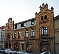 |
Residential and commercial building (Enders) | Schlossstrasse 1a (map) |
|
||
| Residential and commercial building | Schlossstrasse 5 |
|
|||
 |
House | Schönbrunn 2 (map) |
|
||
 |
House | Schönbrunn 4 (map) |
|
||
 |
Transformer tower | Schönbrunn 9 (map) |
|
||
 |
House | Schönbrunn 11 (map) |
|
||
| Villa with enclosure | Schönbrunnstrasse 4 (map) |
canceled |
|
||
 |
House | Schulgasse 1 (map) |
|
||
 |
primary school | School plan 1 |
|
||
 |
former orphanage | School plan 2 |
|
||
 |
former monastery | Untergasse 1–3 (map) |
|
||
 |
House | Under market 1 (map) |
|
||
 |
House | Under market 2 (map) |
music school |
|
|
 |
House | Under market 3 (map) |
House "Zum Pfau" |
|
|
 |
House | Unterm Markt 4 (map) |
|
||
 |
House | Under market 6 (map) |
|
||
 |
House | Unterm Markt 10 (map) |
House "to the red door" |
|
|
 |
Villa with memorial plaques | In front of Riedtor 2 (map) |
|
||
 |
House | In front of Riedtor 7 (map) |
|
||
 |
Residential house with enclosure | In front of Riedtor 9 (map) |
|
||
 |
former brewery | In front of the Riedtor 11a (map) |
with outbuildings and chimney |
|
|
| Residential building | In front of Riedtor 11 (map) |
|
|||
 |
Residential building | In front of Riedtor 13 (map) |
|
||
 |
Industrial building | Wagnergasse 18 (map) |
|
||
| House | Wool market 1 |
|
|||
 More pictures |
Ley Villa | Wollmarkt 10 (map) |
|
||
 More pictures |
House | Wollmarkt 14 (map) |
circa 1553 | Fischtor (former city gate) |
|
 |
Stadtbad | Wollmarkt 19 (map) |
1895 |
|
|
 |
two barns | Wollmarkt (map) |
|
||
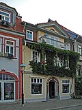 |
House | Zimmerstrasse 4 (map) |
|
||
 |
House | Zimmerstrasse 5 (map) |
|
||
 |
House | Zimmerstrasse 6 (map) |
|
||
 |
House | Zimmerstrasse 7 (map) |
|
||
 |
House | Zimmerstrasse 8 (map) |
|
||
 |
House | Zimmerstrasse 12 (map) |
|
||
 |
House (front door) | Zimmerstrasse 14 (map) |
|
||
 |
House | Zimmerstrasse 16 (map) |
|
||
 |
House | Zimmerstrasse 17 (map) |
|
||
 |
House | Zimmerstrasse 19 (map) |
|
- Parks and gardens
- Old graveyard
- Fountain
- Rectory
- Riedplatz
- Zimmerstrasse
- Towers and gates
- Riedtor
- Neutorturm
- Riedmauer 14 (city fortifications)
- Längwitz wall - tower, (city fortifications) Erfurt wall, tower, (city fortifications)
- Other monuments (incomplete)
- Carolinian Monument, 1857
- Bismarck fountain, 1909 by Georg Wrba
- Monument ensemble Altstadt, southern urban expansion
Districts
| image | designation | location | Dating | description | ID |
|---|---|---|---|---|---|
| Rectory |
Angelhausen-Oberndorf , Am Vorwerk 1 (map) |
|
|||
| House & barn | Angelhausen-Oberndorf, Angelhäuser Strasse 61 (map) |
|
|||
| Residential building | Angelhausen-Oberndorf, Angelhäuser Strasse 67 |
|
|||
| Homestead | Angelhausen-Oberndorf, Angelhäuser Strasse 76 (map) |
|
|||
| Residential building | Angelhausen-Oberndorf, Angelhäuser Strasse 84 (map) |
|
|||
 More pictures |
Church & furnishings & inventory & churchyard & tomb | Angelhausen-Oberndorf, Burggasse (Map) |
|
||
| Homestead | Angelhausen-Oberndorf, Burggasse 7 (map) |
|
|||
 More pictures |
Church & furnishings & inventory & churchyard | Angelhausen-Oberndorf, Glockengasse (map) |
|
||
| Bakehouse | Dosdorf , Dorfstrasse |
|
|||
 More pictures |
church | Dosdorf, Dorfstrasse 1 (map) |
|
||
| Homestead | Dosdorf, Dorfstrasse 12 |
|
|||
| Residential building | Dosdorf, Dorfstrasse 25 |
|
|||
| Homestead | Dosdorf, Dorfstrasse 56 |
|
|||
| Residential house & portal | Dosdorf, Dorfstrasse 8 |
|
|||
 |
Honorary cemetery for murdered concentration camp prisoners | Espenfeld , outside |
|
||
| Ensemble / tombs | Espenfeld, historical cemetery |
|
|||
| Death March Memorial | Espenfeld, at the cemetery |
|
|||
 More pictures |
church | Espenfeld, Dorfstrasse 1 (map) |
|
||
| Ensemble church & cemetery & rectory & former school | Espenfeld, Dorfstrasse 1, 2, 3 |
|
|||
| Rectory | Espenfeld, Dorfstrasse 3 |
|
|||
| Homesteads | Espenfeld, Dorfstrasse 36, 37 |
|
|||
| Residential building | Espenfeld, Dorfstrasse 44 |
|
|||
 More pictures |
church |
Rudisleben (map) |
|
||
 |
Residential house & gate | Rudisleben, Hauptstrasse 22 |
|
||
| Death March Memorial | Siegelbach , Dorfstrasse |
|
|||
 More pictures |
Church & churchyard wall | Siegelbach, Dorfstrasse (map) |
|
||
| Homestead | Siegelbach, Dorfstrasse 10 |
|
|||
| Homestead | Siegelbach, Dorfstrasse 2 |
|
|||
| Ensemble village center | Siegelbach, Dorfstrasse 2 & 3 & 77 & 78 |
|
|||
| Roll mill & residential and outbuildings | Siegelbach, Dorfstrasse 49 & 49a & 49b |
|
Web links
Commons : Kulturdenkmale in Arnstadt - Collection of pictures, videos and audio files