
Wipfratal

Wipfratal was a municipality in the Ilm district in Thuringia , which was incorporated into the district town of Arnstadt in January 2019 .
The community was located between the three largest cities in the district: Arnstadt in the north, Ilmenau in the south and Stadtilm in the east. It was formed in 1994 and comprised twelve districts, of which Marlishausen is by far the largest. However, the seat of the municipal administration was in the village of Branchewinda . The district town of Arnstadt was the fulfilling municipality . The community was named after the river Wipfra , on which seven of the twelve districts are located.
geography
The community lay between the Thuringian Basin in the north and the Thuringian Forest in the south at an altitude of 319 m above sea level. NHN. The last 2907 inhabitants lived in the municipal area of 49.86 km². (As of December 31, 2017) Wipfratal was divided into two parts by an approximately 500 meter high ridge in the middle. To the north of it lie the villages of Roda, Görbitzhausen, Hausen, Marlishausen and Ettischleben in the relatively flat land on the Wipfra and to the west of the river the villages of Branchewinda and Dannheim. The agricultural landscape here is poorly forested and lies at an altitude of 300 to 400 meters.
The southern part of the community was already hilly and houses the places Wipfra and Neuroda an der Wipfra as well as the western villages Schmerfeld, Reinsfeld and Kettmannshausen. This poorly forested valley basin is bordered in the west by the Reinsberg mountains, which are over 600 meters high. To the north, a forested chain of hills connects the Reinsberge in the west and the Willinger Berg in the east. The eastern boundary are Willinger and Sandberg, in the south lies the Heyda dam . The predominant tree species are spruce and pine, the soil consists of shell limestone and belongs to the Ohrdrufer Platte.
Neighboring communities
Clockwise, starting in the north: Alkersleben , Bösleben-Wüllersleben , Stadtilm , Ilmenau , Plaue , Arnstadt , Dornheim
Community structure
The twelve districts of the municipality were:
| District | Residents 2013 |
surface | Height above NN | First mention | |
|---|---|---|---|---|---|
| Branchewinda | 153 | 3.33 km² | 387 m | 876 | |
| Dannheim | 267 | 6.47 km² | 377 m | 750 | |
| Et table life | 148 | 3.49 km² | 312 m | 750 | |
| Goerbitzhausen | 116 | 1.62 km² | 341 m | 1186 | |
| Hausen | 176 | 1.67 km² | 332 m | 932 | |
| Kettmannshausen | 89 | 2.01 km² | 414 m | 1450 | |
| Marlishausen | 1210 | 7.74 km² | 319 m | 750 | |
| Neuroda | 201 | 5.12 km² | 402 m | 1378 | |
| Reinsfeld | 174 | 5.49 km² | 448 m | 1209 | |
| Roda | 62 | 2.81 km² | 340 m | 1239 | |
| Schmerfeld | 96 | 2.99 km² | 430 m | 1303 | |
| Wipfra | 172 | 5.06 km² | 402 m | 1348 |

history
The municipality Wipfratal was formed on March 25, 1994. The places are partly well over 1000 years old and characterized by half-timbered farmsteads. The places in the northern part of the municipality belonged to the Arnstadt office of the Principality of Schwarzburg-Sondershausen until 1920 . The southern part was split up: Schmerfeld and Wipfra belonged to the Amt Ilmenau in the Grand Duchy of Saxe-Weimar-Eisenach , Neuroda and Kettmannshausen to the Duchy of Saxe-Coburg and Gotha and Reinsfeld to the Principality of Schwarzburg-Sondershausen. In the newly formed state of Thuringia , the area of the municipality initially belonged to the Arnstadt district , which was divided in 1952. The locations of the community remained in now to Erfurt district belonging Arnstadt circle . In 1994 this went up in the Ilm district. The city of Arnstadt was the fulfilling municipality for Wipfratal .
A positive vote was taken in March 2018 for the merger with the district town.
On January 1, 2019, Wipfratal was incorporated into the district town of Arnstadt.
- Population development
|
|
|
|
December 31st each; Data source from 1994
religion
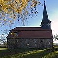
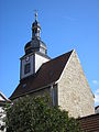
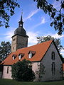
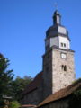
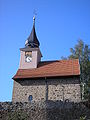
26% of the population are Evangelical Lutheran, 2% Catholic. Protestant churches exist in all twelve districts; are part of the Arnstadt-Ilmenau parish of the Evangelical Church in Central Germany .

Branchewinda

Dannheim

Et table life
Goerbitzhausen

Hausen
Kettmannshausen
Marlishausen
Reinsfeld

Roda

Schmerfeld
Wipfra


.jpg)


The few Catholics are assigned to the parish of St. Elisabeth in Arnstadt , Diocese of Erfurt .
politics
Former councilor
Since the local elections on May 25, 2014 , the council of the municipality of Wipfratal consisted of 11 councilors, who were distributed among the individual seats as follows:
| CDU | 2 seats |
| The left | 2 seats |
| Free list | 3 seats |
| Civic alliance | 4 seats |
Former mayor
The honorary mayor Werner Schmidt (SPD) was elected on June 27, 2004.
Economy and Infrastructure
The economy of the municipality was characterized by agriculture and livestock. There are only a very small number of industrial companies, but there are 2 metal construction companies in the Marlishausen district. Many residents commute to work in the surrounding cities, of which the municipality of Wipfratal with its relatively inexpensive building land has been able to gain significantly in recent years. Thus, the population increased since the community foundation in 1994 by about 400 people, in Marlishausen emerged bigger family house settlements . In the Hausen district, an old farm has been redesigned as the Hausen Nature Experience Farm .
traffic
About 300 meters west of Marlishausen is the Anstadt-Süd junction of the A 71 motorway and thus the northern end of the Thuringian Forest motorway , which crosses the community approximately in a north-south direction. The high-speed line Nuremberg – Erfurt runs parallel to this .
The car and bus traffic within Wipfratal runs on state and district roads. Marlishausen has a train station on the Arnstadt – Saalfeld railway line .
In the north there is a cycle path that connects Stadtilm with Arnstadt. At its endpoints it has connections to the Ilm Valley and Gera Cycle Paths . The From Bach to Goethe themed hiking trail from Arnstadt to Ilmenau runs along the western border of Wipfratal .
Historical monuments
A memorial stone in the cemetery in Reinsfeld commemorates six victims of a death march by concentration camp inmates that passed through the municipality towards the end of the Second World War . They, like the other victims who are buried in Kettmannshausen and Dannheim, were murdered by members of the SS .
Individual evidence
- ↑ Thuringian Law and Ordinance Gazette No. 14/2018 p. 795 ff. , Accessed on January 3, 2019
- ^ Source for Schwarzburgische and Saxon places: Johann Friedrich Kratzsch : Lexicon of all localities of the German federal states . Naumburg, 1843. Available online from Google Books . Source for Prussian places: Handbook of the Province of Saxony. Magdeburg, 1843. Available online at Google Books
- ^ Michael Rademacher: German administrative history from the unification of the empire in 1871 to the reunification in 1990. Population figures. (Online material for the dissertation, Osnabrück 2006).
- ↑ Population development since 1989 (TLUG) ( Memento of the original from October 29, 2012 in the Internet Archive ) Info: The archive link has been inserted automatically and has not yet been checked. Please check the original and archive link according to the instructions and then remove this notice. (PDF; 18 kB)
- ↑ database. In: Statistics Thuringia. Retrieved September 9, 2019 .
- ↑ 2011 census
- ↑ ilmenau.de: Qualitätsweg From Bach to Goethe
- ↑ Thuringian Association of the Persecuted of the Nazi Regime - Association of Antifascists and Study Group of German Resistance 1933-1945 (Ed.): Heimatgeschichtlicher Wegweiser zu places of resistance and persecution 1933-1945, series: Heimatgeschichtliche Wegweiser Volume 8 Thüringen, Erfurt 2003, p. 149ff ., ISBN 3-88864-343-0