List of neighborhoods in Altenburg
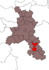
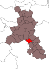
The East Thuringian skat and residence city of Altenburg is divided into ten statistical districts. Three of them represent the districts Ehrenberg , Kosma and Zetzscha represents that pursuant to § 45 para. 1 of the Thuringian municipal order (ThürKO) own district councils and district mayors have. These are in turn subdivided into several localities. The remaining seven statistical districts are subdivided into municipal parts, which, however, are only partially based on historical districts.
Statistical districts
| No. | Statistical district part of the municipality |
Area in km² | Population Dec. 31, 2000 |
Population Dec. 31, 2010 |
Change 2000-2010 in% |
Population density 2010 |
|---|---|---|---|---|---|---|
| 01 | center | 0.95 | 3,653 | 3,736 | 2.3 | 3,928 |
| 001 | Old town / center I | 0.27 | 1,282 | 1,360 | 6.1 | 5,045 |
| 002 | Old town / center II | 0.28 | 1,496 | 1,529 | 2.2 | 5,542 |
| 003 | Center III | 0.41 | 875 | 847 | −3.2 | 2,088 |
| 02 | North suburb | 1.66 | 5,035 | 5,048 | 0.3 | 3,034 |
| 021 | Nordvorstadt I | 0.11 | 687 | 650 | −5.4 | 6,099 |
| 022 | Nordvorstadt II | 0.14 | 1,069 | 1,170 | 9.4 | 8,226 |
| 023 | Nordvorstadt III | 0.14 | 891 | 1,013 | 13.7 | 7,479 |
| 024 | Lerchenberg / Nordvorstadt IV | 0.76 | 1,439 | 1.313 | −8.8 | 1,729 |
| 025 | Kauerndorf / Nordvorstadt V | 0.52 | 949 | 902 | −5.0 | 1,734 |
| 03 | North | 3.50 | 11,758 | 7,549 | −35.8 | 2.157 |
| 031 | Zschernitzsch / Kauerndorf | 2.55 | 2,532 | 1.939 | −23.4 | 761 |
| 032 | Albert-Levy-Strasse | 0.10 | 1,557 | 1,083 | −30.4 | 10,725 |
| 033 | Siegfried-Flack- / Albert-Levy-Strasse | 0.05 | 1.009 | 526 | −47.9 | 9,846 |
| 034 | Elie Wiesel Street | 0.06 | 1,084 | 734 | −32.3 | 13,182 |
| 035 | Nordplatz / Liebermannstrasse | 0.26 | 1,183 | 632 | −46.6 | 2,421 |
| 036 | Ludwig-Hayne-Strasse | 0.09 | 1,125 | 505 | −55.1 | 5,773 |
| 037 | Rembrandtstrasse / Luckaer Strasse | 0.23 | 962 | 492 | −48.9 | 2.133 |
| 038 | Barlachstrasse / An der Glashütte | 0.06 | 1,253 | 953 | −23.9 | 15,507 |
| 039 | Stauffenbergstrasse / Barlachstrasse | 0.10 | 1,053 | 685 | −34.9 | 6,679 |
| 04 | east | 4.60 | 4140 | 3580 | −13.5 | 779 |
| 041 | Researcher quarter | 0.11 | 833 | 983 | 18.0 | 8,722 |
| 042 | Poschwitz / East II | 1.37 | 1,396 | 1,421 | 1.8 | 1,035 |
| 043 | Poschwitz / Rasephas / East III | 3.11 | 1.911 | 1,176 | −38.5 | 378 |
| 05 | Southeast | 1.09 | 5,618 | 4,551 | −19.0 | 4.163 |
| 051 | At the city forest | 0.45 | 754 | 623 | −17.4 | 1,397 |
| 052 | Beech ring | 0.04 | 603 | 542 | −10.1 | 12,966 |
| 053 | Poplar Street | 0.33 | 1,367 | 1,127 | −17.6 | 3,467 |
| 054 | Ahornstrasse | 0.10 | 1,056 | 851 | −19.4 | 8,388 |
| 055 | Birkenstrasse | 0.09 | 1,145 | 849 | −25.9 | 9,406 |
| 056 | Plane road | 0.09 | 693 | 559 | −19.3 | 6.315 |
| 06 | Südvorstadt | 2.99 | 5,246 | 4,943 | −5.8 | 1,655 |
| 061 | Südvorstadt I | 1.11 | 943 | 943 | 0.0 | 852 |
| 062 | Südvorstadt II | 1.58 | 1,243 | 1,092 | −12.1 | 691 |
| 063 | Gründerzeitviertel / Südvorstadt III | 0.08 | 846 | 852 | 0.7 | 10,631 |
| 064 | Sperlingsberg / Südvorstadt IV | 0.06 | 814 | 758 | −6.9 | 12,957 |
| 065 | Dichterviertel / Südvorstadt V | 0.16 | 1,400 | 1,298 | −7.3 | 8,134 |
| 07 | west | 4.97 | 3,316 | 3,284 | −1.0 | 660 |
| 071 | West I. | 0.92 | 1,569 | 1,521 | −3.1 | 1,648 |
| 072 | Drescha / Steinwitz / West II | 4.05 | 1,747 | 1,763 | 0.9 | 435 |
| 11 | Ehrenberg | 14.10 | 1,257 | 1,095 | −12.9 | 78 |
| 21st | Zetzscha | 5.40 | 638 | 598 | −6.3 | 110 |
| 31 | Kosma | 6.34 | 401 | 353 | −12.0 | 56 |
| Altenburg | 45.60 | 41.097 | 34,737 | −15.5 | 762 |
Districts
| district | Location in the city area |
Incorporation | Resident on Dec. 31, 2000 |
Resident on Dec. 31, 2010 |
Area in km² |
Population density 2010 |
|---|---|---|---|---|---|---|
| Old town |

|
–– | 1,483 | 1,606 | 0.31 | 5,181 |
| Thresha |

|
October 1, 1922 | 229 | 187 | 0.6 | 312 |
| Kauerndorf |

|
October 1, 1922 | 1,200 | 1,098 | 0.73 | 1,504 |
| Lerchenberg |

|
1958 * | 1,372 | 1,185 | 0.2 | 5,925 |
| Medieval suburbs |

|
1831 | 2,170 | 2.130 | 0.64 | 3,328 |
| North |

|
1975 * | 9.226 | 5,610 | 1.45 | 3,869 |
| North suburb |

|
1865 * | 3,266 | 3,466 | 1.1 | 3.151 |
| east |

|
2,505 | 1.936 | 1.87 | 1,035 | |
| Eastern suburbs |

|
1874 * | 3,893 | 3,891 | 1.4 | 2,779 |
| Poschwitz |

|
October 1, 1938 | 116 | 107 | 0.98 | 109 |
| Rasephas |

|
October 1, 1922 | 607 | 481 | 2.21 | 218 |
| Steinwitz |

|
4th January 1953 | 49 | 41 | 0.98 | 42 |
| Southeast |

|
1971 * | 5,681 | 4,551 | 1.09 | 4.175 |
| Südvorstadt |

|
2,186 | 2,035 | 2.69 | 757 | |
| west |

|
3,038 | 3,056 | 3.43 | 891 | |
| Zschernitzsch |

|
October 1, 1922 | 234 | 226 | 1.46 | 155 |
* Year of construction / first building
Districts
| District locality |
Location in the city area |
Incorporation | Area in km² | Population Dec. 31, 2000 |
Population Dec. 31, 2010 |
Change 2000-2010 in% |
Population density 2010 |
|---|---|---|---|---|---|---|---|
| Ehrenberg | July 14, 1993 | 14.10 | 1,257 | 1,095 | −12.9 | 78 | |
| Ehrenberg |  |
July 14, 1993 | 1.17 | 379 | 359 | −5.3 | 307 |
| Greipzig |  |
1.1.1963 | 1.32 | 56 | 43 | −23.2 | 33 |
| Lehnitzsch |  |
1923 | 1.20 | 75 | 70 | −6.7 | 58 |
| Mocky |  |
1.6.1965 | 3.93 | 334 | 289 | −13.5 | 74 |
| Model joke |  |
1.7.1950 | 1.57 | 91 | 80 | −12.1 | 51 |
| Paditz |  |
September 7, 1973 | 1.62 | 126 | 103 | −18.3 | 64 |
| Stünzhain |  |
1.7.1950 | 2.00 | 74 | 62 | −16.2 | 31 |
| Zschaiga |  |
1.1.1963 | 1.18 | 21st | 9 | −57.1 | 8th |
| Zschechwitz |  |
1.7.1950 | 0.80 | 101 | 80 | −20.8 | 100 |
| Zetzscha | February 11, 1994 | 5.40 | 638 | 598 | −6.3 | 111 | |
| Knau |  |
1.7.1950 | 2.14 | 221 | 202 | −8.6 | 94 |
| Oberzetzscha |  |
1.7.1950 | 0.75 | 248 | 236 | −4.8 | 315 |
| Rautenberg |  |
1.7.1950 | 1.48 | 71 | 68 | −4.2 | 46 |
| Unterzetzscha |  |
April 1, 1935 | 1.03 | 98 | 92 | −6.1 | 89 |
| Kosma | December 31, 1996 | 6.34 | 401 | 353 | −12.0 | 56 | |
| Altendorf |  |
April 1, 1935 | 1.92 | 22nd | 21st | −4.5 | 11 |
| Kosma |  |
December 31, 1996 | 2.12 | 310 | 267 | −13.9 | 126 |
| Pumpkin |  |
April 1, 1938 | 2.30 | 69 | 65 | −5.8 | 28 |
See also
Sources and web links
Commons : City and districts of Altenburg - collection of images, videos and audio files
- Statistical yearbook of the city of Altenburg 2011 (PDF; 1.1 MB)
- Statistical yearbook of the city of Altenburg 2001 (PDF; 822 kB)

