
Oberzetzscha
|
Oberzetzscha
City of Altenburg
Coordinates: 51 ° 0 ′ 56 ″ N , 12 ° 25 ′ 8 ″ E
|
|
|---|---|
| Height : | 165-195 m |
| Area : | 75 ha |
| Residents : | 236 (Dec. 31, 2010) |
| Population density : | 315 inhabitants / km² |
| Incorporation : | July 1, 1950 |
| Incorporated into: | Zetzscha |
| Postal code : | 04600 |
| Area code : | 03447 |
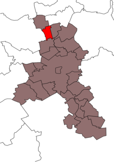  Location of Oberzetzscha in the city of Altenburg
|
|
 Renaissance mansion and seat of the district administration
|
|
As one of four locations, Oberzetzscha is the main town in the Zetzscha district of the Skat and residence town of Altenburg in East Thuringia .
location
South of the Kammerforst and the state road 1355 and north of the federal road 180 are not only Oberzetzscha, but also Unterzetzscha and the other two rural districts Rautenberg and Knau , which were incorporated into the city of Altenburg with Zetzscha in 1994. This rural area is located in the agricultural Altenburger-Zeitzer-Lösshügelland adjacent to the Leipzig lowland bay .
history
The village of Oberzetscha was first mentioned on November 10, 1290. The place belonged to the Wettin office of Altenburg , which was under the sovereignty of the following Ernestine duchies from the 16th century due to several divisions in the course of its existence : Duchy of Saxony (1554 to 1572), Duchy of Saxony-Weimar (1572 to 1603), Duchy of Saxony- Altenburg (1603 to 1672), Duchy of Saxe-Gotha-Altenburg (1672 to 1826). When the Ernestine duchies were reorganized in 1826, the place came back to the duchy of Saxony-Altenburg. After the administrative reform in the duchy, it belonged to the eastern district (until 1900) and to the Altenburg district office (from 1900). From 1918 the village belonged to the Free State of Saxony-Altenburg , which was added to the State of Thuringia in 1920. In 1922 it came to the district of Altenburg .
On July 1, 1950, with the incorporation of Knau with Unterzetzscha and Rautenberg, the municipality of Zetzscha was formed, which was incorporated into Altenburg on February 11, 1994. During the second district reform in the GDR in 1952, the existing states were dissolved and the districts were redesigned. Thus Oberzetscha came as the district of Zetzscha with the district Altenburg at the Leipzig district , since 1990 as a county belonged to Altenburg Thuringia and opened in 1994 Altenburger in the district of the country.
In 2008 230 people lived in the village. The manor from the manor dates back to 1567. The renovation was completed in 2012, so that the district mayor of Zetzscha moved his official residence to the manor. Previously this was the former consumption, which was demolished in 2012.
Personalities
- Theodor Suhnel (1886–1965), architect
- Hellmut Peitsch (1906–1950), politician of the NSDAP
Web links
Individual evidence
- ^ Wolfgang Kahl: First mention of Thuringian towns and villages. A manual. Verlag Rockstuhl, Bad Langensalza, 2010, ISBN 978-3-86777-202-0 , p. 211.
- ^ The Altenburg Office in the book "Geography for all Stands", from p. 201
- ^ The locations of the Altenburg district from p.83
- ↑ The eastern district of the Duchy of Saxony-Altenburg in the municipal directory 1900
- ^ The Altenburg district office in the municipality register 1900
Districts:
Old Town |
Drescha |
Kauerndorf |
Lerchenberg |
North |
Poschwitz |
Rasephas |
Southeast |
Suburbs |
Zschernitzsch
district Steinwitz
Ehrenberg: Ehrenberg | Greipzig | Lehnitzsch | Mockzig with Prisselberg | Model joke | Paditz | Stünzhain | Zschaiga | Zschechwitz
Kosma: Altendorf | Kosma | Pumpkin
Zetzscha: Knau | Oberzetzscha | Rautenberg | Unterzetzscha