List of listed objects in Peggau
The list of listed objects in Peggau contains the 17 listed , immovable objects of the municipality of Peggau in the Styrian district of Graz-Umgebung .
Monuments
| photo | monument | Location | description | Metadata |
|---|---|---|---|---|

|
Fellinger Schlössl with farm buildings ObjectID : 112738 |
Alte Landstrasse 14 KG location : Peggau |
ObjektID : 112738 Status : Notification Status of the BDA list: 2020-02-29 Name: Fellinger Schlössl with farm buildings GstNr .: 257/1; .42; .43 / 2; 259 |
|

|
Defense system (tower hill) Badl ObjektID : 84571 |
Badl location KG: Peggau |
presumed medieval tower hill in the area of a spur system at the northern beginning of the Badlwand |
ObjektID : 84571 Status : Notification Status of the BDA list: 2020-02-29 Name: Weir system (tower hill) Badl GstNr .: 363/2; 551/2 |

|
Badlwandgalerie ObjektID : 49402 |
Peggau location KG: Peggau |
The former railway gallery with the street above was built in 1842/43 as part of the construction of the Mürzzuschlag - Graz railway line. It is 400 meters long and has 35 arched openings. It is the oldest railway art building of this size in Austria. |
ObjectID : 49402 Status : Notification Status of the BDA list: 2020-02-29 Name: Badlwandgalerie GstNr .: 551/2 Badlwandgalerie |

|
Town hall / municipal office, formerly Gasthaus Hochhuber ObjektID : 112747 |
Grazer Straße 20 KG location : Peggau |
ObjectID : 112747 Status: § 2a Status of the BDA list: 2020-02-29 Name: Town hall / municipal office, formerly Gasthaus Hochhuber GstNr .: .24 / 3 |
|

|
Bowling alley with pavilion ObjectID : 104590 |
at Hinterbergstrasse 40, KG location : Peggau |
ObjectID : 104590 Status : Notification Status of the BDA list: 2020-02-29 Name: Bowling alley with pavilion GstNr .: .112 |
|

|
Castle ruins Peggau ObjectID : 47811 |
Mittereggstrasse location KG: Peggau |
The castle ruins are located east of the village on a rock spur that slopes steeply on three sides. From the 12th century to 1362 the castle was owned by the Free von Peggau, the later Counts of Pfannberg , from 1373 to 1596 it belonged to the Counts of Montfort and has been owned by the Vorau Abbey since 1652 . The castle was left to decay at the beginning of the 19th century.
The three residential wings of the castle were on the west side above the rock face, the main building on top with the Lucia chapel mentioned in 1404. Are obtained from the castle of lying behind the living quarters keep and Alchimistenküche with their high six-sided and outside the pyramid-shaped chimney. |
ObjectID : 47811 Status: § 2a Status of the BDA list: 2020-02-29 Name: Burgruine Peggau GstNr .: 501/1; .12 Peggau castle ruins |

|
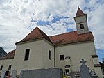
Catholic branch church hl. Margaretha ObjectID : 57470 |
St. Margarethenstrasse 3 KG location : Peggau |
ObjectID : 57470 Status: § 2a Status of the BDA list: 2020-02-29 Name: Kath. Filialkirche hl. Margaretha GstNr .: .64 Filialkirche hl. Margaretha, Peggau |
|

|
Mesnerhaus ObjektID : 112685 |
St. Margarethenstrasse 3 KG location : Peggau |
ObjectID : 112685 Status: § 2a Status of the BDA list: 2020-02-29 Name: Mesnerhaus GstNr .: .63 Mesnerhaus, Peggau |
|

|
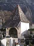
Cemetery and cemetery chapel ObjectID : 112683 |
Location KG: Peggau |
The former cemetery chapel with outer pulpit dates from the 2nd half of the 16th century and was originally built as a Protestant chapel. Rectangular building with a tent roof . |
ObjektID : 112683 Status: § 2a Status of the BDA list: 2020-02-29 Name: Friedhof und Friedhofskapelle GstNr .: .64; 440/2 Peggau cemetery |

|
Evang. Parish church AB, Friedenskirche with rectory ObjectID : 57469 |
St. Margarethenstrasse 4 KG location : Peggau |
The Protestant parish church was built in 1906 by Otto Bartning . The altar wall relief is by Fritz Hartlauer from 1966, the tower from 1967 by Karl Bieber . |
ObjectID : 57469 Status: § 2a Status of the BDA list: 2020-02-29 Name: Evang. Parish church AB, Friedenskirche with rectory GstNr .: .122 Friedenskirche, Peggau |

|
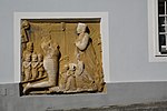
Gravestone ObjectID : 129251 |
Tannebenstrasse 4 KG location : Peggau |
Note: Until 2011, the entire Moarhof (so-called Moarhof (former Meierhof residential building and storage building)) was protected under this entry, with the additional GstNr. 522/3 |
ObjectID : 129251 Status : Notification Status of the BDA list: 2020-02-29 Name: Gravestone GstNr .: .13 |

|
Road bridge ObjectID : 107086 |
Location KG: Peggau |
Note: The bridge leads over the Mur, which here separates Peggau from Deutschfeistritz . |
ObjectID : 107086 Status: § 2a Status of the BDA list: 2020-02-29 Name: Straßenbrücke GstNr .: 548/1; 556 |

|
Ferdinand's Chapel (Memorial Chapel ) ObjectID : 112735 |
Location KG: Peggau |
The Ferdinand's Chapel, also known as Badlkapelle, was built in 1847 by the gallery's builder Felix Tallachini to commemorate the 41 workers who died during the construction of the Badlwandgalerie , most of whom came from Bohemia, Moravia and Italy . The stone building, built in the neo-classical style, shows an oil painting of St. Ferdinand, in honor of the then Emperor Ferdinand . The chapel was restored in 1967 by the owner ÖBB . |
ObjectID : 112735 Status: § 2a Status of the BDA list: 2020-02-29 Name: Ferdinandskapelle (Gedächtniskapelle) GstNr .: .81 Ferdinandskapelle |

|
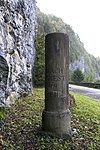
Former Post Milestone ObjectID : 112737 |
Location KG: Peggau |
ObjectID : 112737 Status: § 2a Status of the BDA list: 2020-02-29 Name: Former Post milestone GstNr .: 551/2 Former post milestone, Peggau |
|

|
Mur Bridge ObjectID : 72425 |
Location KG: Peggau |
Note: The railway bridge leads over the Mur, which separates Peggau from Deutschfeistritz here . |
ObjectID : 72425 Status : Notification Status of the BDA list: 2020-02-29 Name: Murbrücke GstNr .: 548/1; 551/1 |

|
Altweg (Römerweg) above the Badlgalerie ObjektID : 84580 |
Location KG: Peggau |
Part of the preserved route of the road that led in the Mur valley from Flavia Solva to Poedicum and Stiriate . A traffic-related connection with the nearby Römerbrücke in the municipality of Frohnleiten is obvious. |
ObjektID : 84580 Status : Notification Status of the BDA list: 2020-02-29 Name: Altweg (Römerweg) above the Badlgalerie GstNr .: 551/2; 545/1 |
| Early medieval burial ground Hinterberg ObjectID : 36471 |
Hinterberg location KG: Peggau |
ObjektID : 36471 Status : Notification Status of the BDA list: 2020-02-29 Name: Early medieval grave field Hinterberg GstNr .: 186/1 |
literature
- Kurt Woisetschläger, Peter Krenn: Dehio Handbook - The Art Monuments of Austria: Styria (excluding Graz). Topographical inventory of monuments, ed. from the Federal Monuments Office, Department for Monument Research. Publisher Anton Schroll. Vienna 1982. ISBN 3-7031-0532-1 .
Web links
Individual evidence
- ↑ a b Styria - immovable and archaeological monuments under monument protection. (PDF), ( CSV ). Federal Monuments Office , as of February 18, 2020.
- ^ Deanery Rein: "Grenzkapelle" Badl. (No longer available online.) 2005, formerly in the original ; Retrieved December 17, 2011 . ( Page no longer available , search in web archives ) Info: The link was automatically marked as defective. Please check the link according to the instructions and then remove this notice.
- ↑ § 2a Monument Protection Act in the legal information system of the Republic of Austria .
