List of listed objects in Radstadt
The list of listed objects in Radstadt contains the 61 listed , immovable objects of the municipality of Radstadt .
Monuments
| photo | monument | Location | description | Metadata |
|---|---|---|---|---|

|
French Cross ObjectID : 24439 |
at Mandlingstrasse 15, KG location : Mandling |
Gneiss mica cross with inscription 1680 (?) |
ObjectID : 24439 Status: § 2a Status of the BDA list: 2020-02-29 Name: Franzosenkreuz GstNr .: 804/4 Franzosenkreuz Mandling |

|
Sacred Heart Chapel ObjectID : 24445 |
Ennswald location KG: Mandling |
The small rectangular chapel stands a few kilometers east of Radstadt and was built in 1902/03. |
ObjectID : 24445 Status: § 2a Status of the BDA list: 2020-02-29 Name: Herz-Jesu-Kapelle GstNr .: .103 Herz Jesu Kapelle, Radstadt |

|
Passport system, passport Mandling ObjektID : 48840 |
KG location : Mandling |
Note: Three non-contiguous lot numbers, they concern the left wall to the Mandling , but not the gate, the back of the department store and the whole ridge towards the northwest. It must be clarified whether remains of the system can be found on the ridge. |
ObjectID : 48840 Status : Notification Status of the BDA list: 2020-02-29 Name: Pass facility, Pass Mandling GstNr .: 3/1; 6/2; 38/2 Mandlingpass fortifications |

|
Passport system, passport Mandling ObjektID : 48841 |
KG location : Mandling |
ObjectID : 48841 Status : Notification Status of the BDA list: 2020-02-29 Name: Pass facility, Pass Mandling GstNr .: 807/3 Mandlingpass fortifications |
|

|
Passport system, passport Mandling ObjektID : 48842 |
KG location : Mandling |
ObjectID : 48842 Status : Notification Status of the BDA list: 2020-02-29 Name: Pass facility, Pass Mandling GstNr .: 853/2 Mandlingpass fortifications |
|
|
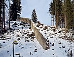
Passport system, passport Mandling ObjektID : 48843 |
KG location : Mandling |
ObjectID : 48843 Status : Notification Status of the BDA list: 2020-02-29 Name: Pass facility, Pass Mandling GstNr .: 1/1 Mandlingpass fortifications |
|

|
Passport system, passport Mandling ObjektID : 48844 |
KG location : Mandling |
ObjectID : 48844 Status : Notification Status of the BDA list: 2020-02-29 Name: Pass facility, Pass Mandling GstNr .: 35/2 Mandlingpass fortifications |
|
|
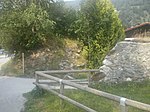
Passport, Pass Mandling ObjektID : 48845 |
KG location : Mandling |
Note: a remnant of the wall about 70 meters long, pulling NS |
ObjectID : 48845 Status : Notification Status of the BDA list: 2020-02-29 Name: Pass facility, Pass Mandling GstNr .: 17/2 Mandlingpass fortifications |
|
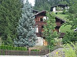
Farmhouse, House Schütte-Lihotzky ObjectID: 9525 |
Bürgerbergstrasse 3 KG location : Radstadt |
ObjectID: 9525 Status: Notification Status of the BDA list: 2020-02-29 Name: Farmhouse, Haus Schütte-Lihotzky GstNr .: 280/2 |
|

|
Walled- in cast plate ObjectID : 35485 |
Ernest-Thun-Gasse 2 KG location : Radstadt |
ObjectID : 35485 Status : Notification Status of the BDA list: 2020-02-29 Name: Walled- in cast plate GstNr .: .48 Stadtapotheke Radstadt |
|

|
Walls, part of the city wall ObjectID : 35491 |
Ernest-Thun-Gasse 2 KG location : Radstadt |
ObjectID : 35491 Status : Notification Status of the BDA list: 2020-02-29 Name: Walls, part of the city wall GstNr .: .48 City wall of Radstadt |
|

|
Walls, part of the city wall ObjectID : 35492 |
Ernest-Thun-Gasse 6 KG location : Radstadt |
ObjectID : 35492 Status : Notification Status of the BDA list: 2020-02-29 Name: Walls, part of the city wall GstNr .: 3 City wall of Radstadt |
|

|
Walls, part of the city wall ObjectID: 35493 |
Ernest-Thun-Gasse 8 KG location : Radstadt |
ObjectID: 35493 Status: Notification Status of the BDA list: 2020-02-29 Name: Walls, part of the city wall GstNr .: .45 City wall of Radstadt |
|

|
Walls, part of the city wall ObjectID : 35494 |
Ernest-Thun-Gasse 10 KG location : Radstadt |
ObjectID : 35494 Status : Notification Status of the BDA list: 2020-02-29 Name: Walls, part of the city wall GstNr .: .44 City wall of Radstadt |
|

|
Walls, part of the city wall ObjectID : 35495 |
Ernest-Thun-Gasse 14 KG location : Radstadt |
ObjectID : 35495 Status : Notification Status of the BDA list: 2020-02-29 Name: Walls, part of the city wall GstNr .: .43 / 2 City wall of Radstadt |
|

|
Walls, part of the city wall ObjectID : 35497 |
Ernest-Thun-Gasse 20 KG location : Radstadt |
ObjectID : 35497 Status : Notification Status of the BDA list: 2020-02-29 Name: Walls, part of the city wall GstNr .: .41 / 1 City wall of Radstadt |
|

|
Walls, part of the city wall ObjectID : 35498 |
Ernest-Thun-Gasse 22 KG location : Radstadt |
ObjectID : 35498 Status : Notification Status of the BDA list: 2020-02-29 Name: Walls, part of the city wall GstNr .: .40 City wall of Radstadt |
|

|
Walls, part of the city wall ObjectID : 35500 |
Hofhaimergasse 1 KG location : Radstadt |
ObjectID : 35500 Status : Notification Status of the BDA list: 2020-02-29 Name: Walls, part of the city wall GstNr .: .109 City wall of Radstadt |
|
|
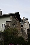
Walls, part of the city wall ObjectID : 35501 |
Hofhaimergasse 3 KG location : Radstadt |
ObjectID : 35501 Status : Notification Status of the BDA list: 2020-02-29 Name: Walls, part of the city wall GstNr .: .110 City wall of Radstadt |
|

|
Walls, part of the city wall ObjectID : 35502 |
Hofhaimergasse 7 KG location : Radstadt |
ObjectID : 35502 Status : Notification Status of the BDA list: 2020-02-29 Name: Walls, part of the city wall GstNr .: 28; .111 City wall of Radstadt |
|

|
City wall ObjectID : 74342 |
Hofhaimergasse 9, 11 KG location : Radstadt |
The witch tower forms the southwest corner of the city fortifications, which were renewed in the 16th century. |
ObjektID : 74342 Status : Notification Status of the BDA list: 2020-02-29 Name: Stadtmauer GstNr .: .112; .113; 36 City wall of Radstadt |

|
Walls, part of the city wall ObjectID : 35503 |
Hofhaimergasse 13 KG location : Radstadt |
ObjektID : 35503 Status : Notification Status of the BDA list: 2020-02-29 Name: Walls, part of the city wall GstNr .: .30; 37 City wall of Radstadt |
|

|
Walls, part of the city wall ObjectID : 35504 |
Hofhaimergasse 17 KG location : Radstadt |
ObjectID : 35504 Status : Notification Status of the BDA list: 2020-02-29 Name: Walls, part of the city wall GstNr .: .31 City wall of Radstadt |
|

|
Walls, part of the city wall ObjectID : 35505 |
Hofhaimergasse 19 KG location : Radstadt |
ObjectID : 35505 Status : Notification Status of the BDA list: 2020-02-29 Name: Walls, part of the city wall GstNr .: .32 City wall of Radstadt |
|

|
Walls, part of the city wall ObjectID : 35506 |
Hoheneggstrasse 12 KG location : Radstadt |
ObjectID : 35506 Status : Notification Status of the BDA list: 2020-02-29 Name: Walls, part of the city wall GstNr .: .39 City wall of Radstadt |
|
|
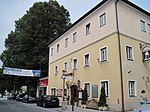
Gasthaus, Torwirt ObjectID : 24488 |
Hoheneggstrasse 12 KG location : Radstadt |
The core of the three-storey building near the city fortifications dates from the 16th century. |
ObjectID : 24488 Status : Notification Status of the BDA list: 2020-02-29 Name: Gasthaus, Torwirt GstNr .: .39 Torwirt, Radstadt |

|
Walls, part of the city wall (Torbäckenhaus) ObjektID : 35507 |
Hoheneggstrasse 17 KG location : Radstadt |
ObjectID : 35507 Status : Notification Status of the BDA list: 2020-02-29 Name: Walls, part of the city wall (Torbäckenhaus) GstNr .: .37 City wall of Radstadt |
|

|
Walls, part of the city wall ObjectID : 35508 |
Karl-Berg-Gasse 1 KG location : Radstadt |
ObjectID : 35508 Status : Notification Status of the BDA list: 2020-02-29 Name: Walls, part of the city wall GstNr .: .51 City wall of Radstadt |
|

|
Mesnerhaus ObjektID : 24472 |
Karl-Berg-Gasse 14 KG location : Radstadt |
ObjectID : 24472 Status : Notification Status of the BDA list: 2020-02-29 Name: Mesnerhaus GstNr .: .80 Messnerhaus Radstadt |
|

|
Catholic branch church Maria Loreto ObjektID : 24506 |
Lerchen location KG: Radstadt |
The small baroque hall church with a gable tower on the west side stands on a slope northwest of the city center. Construction began in 1677, but was not consecrated until 1750 after two extensions. The high altar is from the end of the 18th century. |
ObjectID : 24506 Status: § 2a Status of the BDA list: 2020-02-29 Name: Kath. Filialkirche Maria Loreto GstNr .: .143 Church Maria Loreto Radstadt |

|
Schweigerkapelle ObjektID : 24470 |
opposite Loretostraße 14 KG location : Radstadt |
ObjectID : 24470 Status: § 2a Status of the BDA list: 2020-02-29 Name: Schweigerkapelle GstNr .: .264 |
|

|
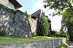
Färberturm, Teichturm, Amtmannturm ObjectID : 27227 |
Margarethe-Schütte-Lihotzky-Platz 1 KG location : Radstadt |
The Amtmann tower forms the north-western corner of the city fortifications and is designated 1534. |
ObjectID : 27227 Status : Notification Status of the BDA list: 2020-02-29 Name: Färberturm, Teichturm, Amtmannturm GstNr .: .224; 45 Dye Tower, Radstadt |
|
Walls, part of the city wall ObjectID : 35509 |
Paris-Lodron-Gasse 2 KG location : Radstadt |
ObjectID : 35509 Status : Notification Status of the BDA list: 2020-02-29 Name: Walls, part of the city wall GstNr .: .107 City wall of Radstadt |
|

|
Walls, part of the city wall ObjectID : 35510 |
Paris-Lodron-Gasse 6 KG location : Radstadt |
ObjectID : 35510 Status : Notification Status of the BDA list: 2020-02-29 Name: Walls, part of the city wall GstNr .: .105 / 1 City wall of Radstadt |
|

|
Former Castle, former Capuchin monastery, rectory ObjectID: 24500 |
Prehauserplatz 1 KG location : Radstadt |
ObjectID: 24500 Status : Notification Status of the BDA list: 2020-02-29 Name: Former Castle, former Capuchin monastery, rectory GstNr .: .70 Former Capuchin monastery Radstadt |
|

|
City gate, residential building, Steirertor (gatehouse with Pecherker) ObjektID : 24501 |
Prehauserplatz 2 KG location : Radstadt |
The house forms the southeast corner of the castle-monastery complex and previously served as the city gate. On its east side there is a flat bay window with two coats of arms. |
ObjectID : 24501 Status : Notification Status of the BDA list: 2020-02-29 Name: City gate, residential building, Steirertor (gatehouse with Pecherker) GstNr .: .73 Steiertor, Radstadt |

|
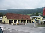
Federal forests; former archiepiscopal bulk box ObjectID: 7966 |
Prehauserplatz 3 KG location : Radstadt |
The broad three-story building on the eastern edge of the city was rebuilt in the second half of the 18th century. |
ObjectID: 7966 Status : Notification Status of the BDA list: 2020-02-29 Name: Bundesforste; former archiepiscopal bulk box GstNr .: 60; 62; .74; 14; 494/1 Schüttkasten, Radstadt |
|
Road keeper's house , road maintenance facility ObjektID : 24448 |
Salzburger Straße 18 KG location : Radstadt |
ObjectID : 24448 Status: § 2a Status of the BDA list: 2020-02-29 Name: Road caretaker's house , road maintenance department GstNr .: .275 |
|

|
Walls, part of the city wall ObjectID : 35512 |
Schernbergstrasse 12 KG location : Radstadt |
ObjectID : 35512 Status : Notification Status of the BDA list: 2020-02-29 Name: Walls, part of the city wall GstNr .: 18 City wall of Radstadt |
|

|
Walls, part of the city wall ObjectID : 35513 |
Schernbergstrasse 14 KG location : Radstadt |
ObjektID : 35513 Status : Notification Status of the BDA list: 2020-02-29 Name: Walls, part of the city wall GstNr .: 17; .91 City wall of Radstadt |
|

|
Walls, part of the city wall ObjectID : 35514 |
Schernbergstrasse 16 KG location : Radstadt |
ObjectID : 35514 Status : Notification Status of the BDA list: 2020-02-29 Name: Walls, part of the city wall GstNr .: 16 City wall of Radstadt |
|

|
Walls, part of the city wall ObjectID : 35515 |
Schernbergstrasse 18 KG location : Radstadt |
ObjectID : 35515 Status : Notification Status of the BDA list: 2020-02-29 Name: Walls, part of the city wall GstNr .: 15; .214; 494/6; 494/5 City wall of Radstadt |
|

|
Lerchen Castle ObjectID : 24507 |
Schloßstraße 1 KG location : Radstadt |
ObjectID : 24507 Status: § 2a Status of the BDA list: 2020-02-29 Name: Schloss Lerchen GstNr .: .133 Schloss Lerchen |
|

|
Attachment Castle Wall ObjectID : 24510 since 2013 |
at Schloßstraße 79, KG location : Radstadt |
ObjectID : 24510 Status : Notification Status of the BDA list: 2020-02-29 Name: Anlage Schloss Mauer GstNr .: .192; 436 Mauer Castle, Radstadt |
|

|
District Court ObjectID : 24511 |
Stadtplatz 1 KG location : Radstadt |
The wide building on the main square shows a simple classical architecture. It was built in 1785 and renovated in 1865. |
ObjectID : 24511 Status : Notification Status of the BDA list: 2020-02-29 Name: District court GstNr .: .1; .2 Radstadt District Court |

|
Walls, part of the city wall ObjectID : 35516 |
Stadtplatz 2 KG location : Radstadt |
ObjectID : 35516 Status : Notification Status of the BDA list: 2020-02-29 Name: Walls, part of the city wall GstNr .: .49 City wall of Radstadt |
|

|
Walls, part of the city wall ObjectID : 35517 |
Stadtplatz 3 KG location : Radstadt |
ObjectID : 35517 Status : Notification Status of the BDA list: 2020-02-29 Name: Walls, part of the city wall GstNr .: .50 City wall of Radstadt |
|

|
House sign, guest house sign ObjectID : 35486 |
Stadtplatz 4, 5 KG location : Radstadt |
The inn sign on the building on the main square dates from the late 18th century. |
ObjectID : 35486 Status : Notification Status of the BDA list: 2020-02-29 Name: House sign, guest house sign GstNr .: .53; .54 |

|
Walls, part of the city wall ObjectID : 35518 |
Stadtplatz 12 Location KG: Radstadt |
ObjectID : 35518 Status : Notification Status of the BDA list: 2020-02-29 Name: Walls, part of the city wall GstNr .: 27 City wall of Radstadt |
|

|
Walls, part of the city wall ObjectID : 35519 |
Stadtplatz 13 KG location : Radstadt |
ObjectID : 35519 Status : Notification Status of the BDA list: 2020-02-29 Name: Walls, part of the city wall GstNr .: .108 City wall of Radstadt |
|

|
Town Hall ObjectID : 24492 |
Stadtplatz 16, 17 KG location : Radstadt |
The eleven-axis building on the main square essentially dates from the 16th and 17th centuries. It received its facade structure at the end of the 18th century and was rebuilt again in the 19th century. |
ObjectID : 24492 Status: § 2a Status of the BDA list: 2020-02-29 Name: Rathaus GstNr .: .11; .23 |

|
Catholic parish church Mariae Himmelfahrt ObjectID : 24502 |
KG location : Radstadt |
The parish church is surrounded by the cemetery in the north of the old town. It is a late Romanesque building with a Gothic choir and high north tower. The nave has three aisles, and the choir adjoins it with a ribbed vault in the east. In addition to baroque carved figures, the interior also contains works from the 20th century. |
ObjectID : 24502 Status: § 2a Status of the BDA list: 2020-02-29 Name: Catholic parish church Mariae Himmelfahrt GstNr .: .67 Catholic parish church Mariae Himmelfahrt, Radstadt |

|
Light column, shoemaker's column ObjectID : 24503 |
KG location : Radstadt |
The late Gothic light column stands east of the parish church in the cemetery area and is marked 1513 above the pointed arched door. |
ObjectID : 24503 Status: § 2a Status of the BDA list: 2020-02-29 Name: Lichtsäule , Schustersäule GstNr .: 5/1 Schustersäule, Radstadt cemetery |

|
Katharinenkapelle / funeral hall ObjectID : 24504 |
KG location : Radstadt |
The mortuary is built on the city wall to the northwest of the parish church and was once the church of the hospital founded in the 14th century. |
ObjectID : 24504 Status: § 2a Status of the BDA list: 2020-02-29 Name: Katharinenkapelle / Aufbahrungshalle GstNr .: .68 Friedhof Radstadt |

|
Churchyard / cemetery of the former property ID: 24505 |
KG location : Radstadt |
ObjectID : 24505 Status: § 2a Status of the BDA list: 2020-02-29 Name: Kirchhof / Friedhof former GstNr .: 5/1 Friedhof Radstadt |
|

|
Capuchin Tower ObjectID : 26049 |
KG location : Radstadt |
The Capuchin Tower forms the northeast corner of the city fortifications, which were renewed in the early 16th century. |
ObjectID : 26049 Status: § 2a Status of the BDA list: 2020-02-29 Name: Kapuzinerturm GstNr .: .71 Kapuzinerturm, Radstadt |

|
City wall ObjectID : 27236 |
KG location : Radstadt |
The early modern city fortifications include the city wall on the north side of the western part of the cemetery by the parish church (former passage to the shooting range, plot 5/2, location ) and between the cemetery and the former Capuchin monastery (plot 6/1, location ). |
ObjectID : 27236 Status: § 2a Status of the BDA list: 2020-02-29 Name: Stadtmauer GstNr .: 5/2; 6/1 City wall of Radstadt |

|
City wall ObjectID : 27237 |
KG location : Radstadt |
The early modern city fortifications include a passage to Paris-Laudon-Gasse (plot 71/2, location ), the area between Hexenturm and Hofhaimergasse (plot 89, location ) and the city wall on the north side of the eastern part of the cemetery at the parish church (plot 6/2 , Location ). |
ObjectID : 27237 Status: § 2a Status of the BDA list: 2020-02-29 Name: Stadtmauer GstNr .: 71/2; 89; 6/2 City wall of Radstadt |

|
Former Capuchin Church Immaculate Conception Mariae ObjectID : 24499 |
KG location : Radstadt |
The simple church in the northeast of the old town is a hall building from the years 1629 to 1634. The church was expanded around 1749; The altars inside also date from that time. |
ObjectID : 24499 Status : Notification Status of the BDA list: 2020-02-29 Name: Former Capuchin Church Immaculate Conception Mariae GstNr .: .72 Capuchin Church Immaculate Conception Mariae, Radstadt |

|
Gerberturm, Stadtturm, Hexenturm ObjectID : 27225 |
KG location : Radstadt |
The witch tower forms the southwest corner of the city fortifications, which were renewed in the early 16th century. |
ObjectID : 27225 Status : Notification Status of the BDA list: 2020-02-29 Name: Gerberturm, Stadtturm, Hexenturm GstNr .: .29 Hexenturm, Radstadt |

|
Residence, Tandalier Castle ObjectID : 24398 |
Tandalierstrasse 12 KG location : Schwemmberg |
ObjectID : 24398 Status : Notification Status of the BDA list: 2020-02-29 Name: Ansitz, Schloss Tandalier GstNr .: 902 Schloss Tandalier |
Web links
Commons : Listed objects in Radstadt - collection of images, videos and audio files
Commons : City wall of Radstadt - album with pictures, videos and audio files
Individual evidence
- ↑ a b Salzburg - immovable and archaeological monuments under monument protection. (PDF), ( CSV ). Federal Monuments Office , as of February 17, 2020.
- ↑ according to Sagis; .106 according to BDA does not exist.
- ↑ § 2a Monument Protection Act in the legal information system of the Republic of Austria .