List of listed objects in St. Margarethen an der Raab
The list of listed objects in St. Margarethen an der Raab contains the 8 listed , immovable objects of the municipality of St. Margarethen an der Raab in the Styrian district of Weiz .
Monuments
| photo | monument | Location | description | Metadata |
|---|---|---|---|---|

|
Medieval castle stable ObjectID : 36521 |
Kroisbach, on Gogitschweg, Fleischhackerweg KG location : Kroisbach |
ObjectID : 36521 Status : Notification Status of the BDA list: 2020-02-29 Name: Medieval Burgstall GstNr .: 80/1; 80/2 |
|

|
Grave field, burial mound in the field forests ObjectID : 70365 |
Feldwälder location KG: St. Margarethen an der Raab |
ObjectID : 70365 Status : Notification Status of the BDA list: 2020-02-29 Name: Grave field, grave mound in the field forests GstNr .: 302/3 Grave field, grave mound in the field forests, St. Margarethen an der Raab |
|

|
Figure shrine St. Anna ObjectID : 97945 |
near St. Margarethen an der Raab 163 KG location : St. Margarethen an der Raab |
ObjectID : 97945 Status: § 2a Status of the BDA list: 2020-02-29 Name: Figurine picture stick hl. Anna GstNr .: .21 / 2 |
|

|
Parsonage Object ID: 57669 |
Pfarrhausweg location KG: St. Margarethen an der Raab |
The spacious building is marked 1802 on the portal. |
ObjectID : 57669 Status: § 2a Status of the BDA list: 2020-02-29 Name: Pfarrhof GstNr .: .56 |

|
Catholic parish church hl. Margarethe ObjectID : 57670 |
KG location : St. Margarethen an der Raab |
The parish church replaced an older, smaller building around 1510. The date 1513 on the south portal indicates this. The dating 1322 on the west tower may come from the old building. The church was probably renewed at the end of the 19th century, an overall restoration took place in 1970, the last renovation in 1991. The church is one of the few preserved Gothic country churches in the region.
The three-bay nave with ribbed vaults is closed off by a drawn-in, single-bay choir with a 3/6 end and half diamond star vault on consoles. The presented square west tower has a ribbed vault in the basement, the bell chamber dates from 1616. The west portal was renewed in 1871, the richly structured keel arch portal on the south side is bricked up. There are stepped buttresses around the entire building, two side chapels and a sacristy from the 18th century on the third yoke. The organ gallery was built around 1800. On the fron arch a fresco from 1931 by Ludwig Kurz-Goldenstein . The furnishings were partially renewed in the course of the regotisation according to plans by the architect Hans Pascher in 1896/97, only the high altar and parts of the left side altar date from the second half of the 18th century. Pulpit, baptismal font and a figure of St. Christophorus on the outside of the south portal were made by Alfred Schlosser in 1970/71. In 1998, Adolf Osterider designed two windows on the themes of baptism and resurrection and the sculptor Fred Höfler designed a holy water kettle and a sacrificial candle stand. |
ObjectID : 57670 Status: § 2a Status of the BDA list: 2020-02-29 Name: Catholic parish church hl. Margarethe GstNr .: .53 Parish Church Sankt Margarethen an der Raab |

|
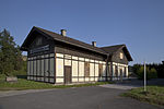
Admission building of the Takern train station ObjectID : 47240 |
Location KG: Takern I |
ObjectID : 47240 Status : Notification Status of the BDA list: 2020-02-29 Name: Admission building of the Takern train station GstNr .: .90 |
|

|
Grave mound group in the Blumental ObjectID : 70519 |
Blumental location KG: Takern II |
ObjectID : 70519 Status : Notification Status of the BDA list: 2020-02-29 Name: Grave mound group in the Blumental GstNr .: 217 Grave mound group in the Blumental |
|

|
Corridor / path chapel ObjectID : 98087 |
KG location : Zöbing |
ObjectID : 98087 Status: § 2a Status of the BDA list: 2020-02-29 Name: Flur- / Wegkapelle GstNr .: 285/2 Wegkapelle, Zöbing |
literature
- Kurt Woisetschläger , Peter Krenn : The art monuments of Austria. Dehio-Handbuch Steiermark: (excluding Graz) . Ed .: Federal Monuments Office . Anton Schroll & Co, Vienna 1982, ISBN 3-7031-0532-1 , p. 468-469 .
Web links
Individual evidence
- ↑ a b Styria - immovable and archaeological monuments under monument protection. (PDF), ( CSV ). Federal Monuments Office , as of February 18, 2020.
- ^ Kurt Woisetschläger, Peter Krenn: Die Kunstdenkmäler Österreichs. Dehio-Handbuch Steiermark: (excluding Graz) . Ed .: Federal Monuments Office. Anton Schroll & Co, Vienna 1982, ISBN 3-7031-0532-1 , p. 469 .
- ^ Kurt Woisetschläger, Peter Krenn: Die Kunstdenkmäler Österreichs. Dehio-Handbuch Steiermark: (excluding Graz) . Ed .: Federal Monuments Office. Anton Schroll & Co, Vienna 1982, ISBN 3-7031-0532-1 , p. 468 .
- ↑ Profile of the Church and Parish. In: Market town of St. Margarethen an der Raab. Retrieved December 9, 2012 .
- ↑ § 2a Monument Protection Act in the legal information system of the Republic of Austria .
