Loban (river)
|
Loban Лобань |
||
|
|
||
| Data | ||
| Water code | RU : 10010300512111100039689 | |
| location | Kirov Oblast ( Russia ) | |
| River system | Volga | |
| Drain over | Kilmes → Vyatka → Kama → Volga → Caspian Sea | |
| Confluence of |
Belaja Loban and Tschornaja Loban 57 ° 41 ′ 32 " N , 50 ° 37 ′ 24" E |
|
| Source height | 117 m | |
| muzzle | in Kilmes coordinates: 56 ° 59 ′ 43 " N , 51 ° 12 ′ 20" E 56 ° 59 ′ 43 " N , 51 ° 12 ′ 20" E |
|
| Mouth height | 77 m | |
| Height difference | 40 m | |
| Bottom slope | 0.24 ‰ | |
| length | 169 km | |
| Catchment area | 2810 km² | |
| Outflow location: 56 km above the mouth |
MQ |
14.3 m³ / s |
|
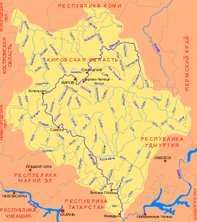
Course of the Loban (Лобань) in the catchment area of the Vyatka |
||
The Loban ( Russian Лобань ) is a right tributary of the Kilmes in the Kirov Oblast in the European part of Russia .
It arises at the confluence of its two source rivers Belaja Loban ("White Loban", 38 km, from the right) and Chornaya Loban ("Black Loban", 33 km, from the left). It flows in a south-southeast direction through a swampy lowland. Finally, 10 km east of the village of Kilmes, it meets the west-flowing Kilmes River, 71 km above its confluence with the Vyatka .
The Loban has a length of 169 km. It drains an area of 2810 km². The river is mainly fed by the snowmelt . 56 km above the mouth, the mean discharge is 14.3 m³ / s. There are maximum discharges of up to 625 m³ / s.
At least in the past, rafting has been practiced on the Loban .
