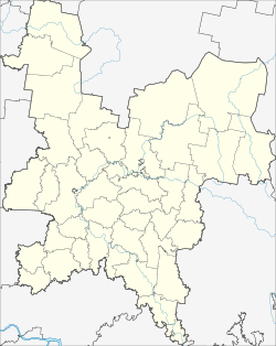
Kilmes (Kirov)
| Urban-type settlement
Kilmes
Кильмезь
|
||||||||||||||||||||||||||||||||||
|
||||||||||||||||||||||||||||||||||
|
||||||||||||||||||||||||||||||||||
Kilmes ( Russian Кильме́зь ) is an urban-type settlement in Kirov Oblast in Russia with 5956 inhabitants (as of October 14, 2010).
geography
The place is about 200 km as the crow flies southeast of the Kirov Oblast Administrative Center on the left bank of the eponymous left Vyatka tributary Kilmes . It is not to be confused with the village of Kilmes , which is also located on the river almost 20 km northeast directly across the border with the Udmurt Republic .
Kilmez is the administrative center of the Rajons Kilmesski and seat and only town of the municipality Kilmesskoje gorodskoje posselenije.
history
The place has been known since 1666 and was probably founded by Mari at the beginning of the 17th century. From the end of the 18th century on the old trade of belonging Kazan to Perm situated village under the name Kilmesi Bolshie (also Bolshaya Kilmez, "Greater Kilmez"; the village of Malaya Kilmez, "Little Kilmez" is little southwest) to Ujesd Malmysh of the Vyatka Governorate .
On July 29, 1929, Kilmes became the administrative seat of a newly created Rajons named after him. In 1965 the place received urban-type settlement status.
Population development
| year | Residents |
|---|---|
| 1897 | 1426 |
| 1939 | 3194 |
| 1959 | 4066 |
| 1970 | 4620 |
| 1979 | 5223 |
| 1989 | 6151 |
| 2002 | 6064 |
| 2010 | 5956 |
Note: census data
traffic
Kilmes is located on the regional road 33K-001, which leads from the border of the Republic of Tatarstan in the direction of Kazan via Malmysh to the border of the Udmurt Republic, from there in the direction of Igra . To the north, the 33K-016 branches off to the neighboring district center of Nema , which continues to connect to the 33K-002 in the direction of Kirov.
The nearest train station is a good 20 km east in Sjurek on the route from Lyukschudja near Izhevsk to Kilmes in Udmurtia.
Web links
Individual evidence
- ↑ a b Itogi Vserossijskoj perepisi naselenija 2010 goda. Tom 1. Čislennostʹ i razmeščenie naselenija (Results of the All-Russian Census 2010. Volume 1. Number and distribution of the population). Tables 5 , pp. 12-209; 11 , pp. 312–979 (download from the website of the Federal Service for State Statistics of the Russian Federation)

