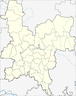
Bogorodskoye (Kirov)
| Urban-type settlement
Bogorodskoye
Богородское
|
||||||||||||||||||||||||||||||
|
||||||||||||||||||||||||||||||
|
||||||||||||||||||||||||||||||
Bogorodskoje ( Russian Богоро́дское ) is an urban-type settlement in Kirov Oblast in Russia with 2875 inhabitants (as of October 14, 2010).
geography
The place is about 110 km as the crow flies southeast of the Kirov Oblast Administrative Center . It is located on the upper reaches of the Belaja Loban (White Loban), the right source river of the Loban .
Bogorodskoje is the administrative center of the Rajons Bogorodsky and seat of the municipality Bogorodskoje gorodskoje posselenije, (km 4 southwest) which also includes the villages Chodyri, Mucha Chi (6 km northwest), Rjabiny (6 km northeast) and Sarapuly (4 km northwest) and Weiler ( chutor) belong to Privolny.
history
The place was founded in 1700. He subsequently belonged to the Ujesd Nolinsk of the Vyatka Governorate .
On July 29, 1929 Bogorodskoje became the administrative seat of a newly created Rajons named after him. From 1959 to April 19, 1965, the Rajon was temporarily dissolved. In 1971 Bogorodskoye received urban-type settlement status.
Population development
| year | Residents |
|---|---|
| 1939 | 1655 |
| 1970 | 2649 |
| 1979 | 3576 |
| 1989 | 3731 |
| 2002 | 3221 |
| 2010 | 2875 |
Note: census data
traffic
In Bogorodskoje, the regional roads 33N-040 intersect, which branches off from 33R-002 Kirov - Vyatskije Polyany at the northwestern neighboring district center of Kumyony and continues to the southeastern neighboring district center Uni , as well as the 33N-041 also from 33R-002 near Nolinsk to Sujewka . In Sujewka, a good 60 km north, on the main line of the Trans-Siberian Railway, the nearest train station is located.
Web links
Individual evidence
- ↑ a b Itogi Vserossijskoj perepisi naselenija 2010 goda. Tom 1. Čislennostʹ i razmeščenie naselenija (Results of the All-Russian Census 2010. Volume 1. Number and distribution of the population). Tables 5 , pp. 12-209; 11 , pp. 312–979 (download from the website of the Federal Service for State Statistics of the Russian Federation)

