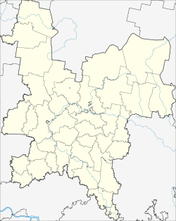
Nema (Russia)
| Urban-type settlement
Nema
Нема
|
||||||||||||||||||||||||||||||||
|
||||||||||||||||||||||||||||||||
|
||||||||||||||||||||||||||||||||
Nema ( Russian Не́ма ) is an urban-type settlement in Kirov Oblast in Russia with 3,650 inhabitants (as of October 14, 2010).
geography
The place is about 130 km as the crow flies south-south-east of the Kirov Oblast Administrative Center on the left bank of the left Vyatka tributary Nemda .
Nema is the administrative center of the Rajons Nemški and seat of the municipality Nemskoje gorodskoje posselenije. In addition to the settlement, the surrounding villages Arskoye, Britkino, Jelowschtschina, Konovalovo, Michino, Nesamai, Nikolajewka, Pisman, Prokoschewo, Wachruschi, Werkhoruby and Vorontschichino as well as the settlement Beryosowka, of which only Nezamaiwest (3 km west-south) and Werkhoruby belong to the municipality km west-northwest) have more than 100 inhabitants (as of October 14, 2010).
history
The place was founded in 1710. From the end of the 18th century it belonged to the Ujesd Nolinsk of the Vyatka governorate and in the 19th century it became the seat of a Volost as Nemskoye .
On January 14, 1929, Nema became the administrative seat of a newly created Rajons named after him. In 1981 the place received the status of an urban-type settlement.
Population development
| year | Residents |
|---|---|
| 1897 | 571 |
| 1939 | 1549 |
| 1970 | 2224 |
| 1979 | 3524 |
| 1989 | 4141 |
| 2002 | 3916 |
| 2010 | 3650 |
Note: census data
traffic
Nema is located on the regional road 33K-016, which branches off 25 km northwest of the 33K-002 Kirow - Wjatskije Polyany and continues to the south-east neighboring district of Kilmes . In this direction, the nearest train station Sjurek is located a good 80 km away on the route from Lyukschudja near Izhevsk to Kilmes , already in the neighboring Republic of Udmurtia .
Web links
Individual evidence
- ↑ a b Itogi Vserossijskoj perepisi naselenija 2010 goda. Tom 1. Čislennostʹ i razmeščenie naselenija (Results of the All-Russian Census 2010. Volume 1. Number and distribution of the population). Tables 5 , pp. 12-209; 11 , pp. 312–979 (download from the website of the Federal Service for State Statistics of the Russian Federation)

