Santschursk
| Urban-type settlement
Santschursk
Санчурск
|
||||||||||||||||||||||||||||||||||||
|
||||||||||||||||||||||||||||||||||||
|
||||||||||||||||||||||||||||||||||||
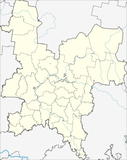
Santschursk ( Russian Са́нчурск ) is an urban-type settlement and a former city in Kirov Oblast in Russia with 4,727 inhabitants (as of October 14, 2010).
geography
The place is a good 230 km as the crow flies southwest of the Kirov Oblast Administrative Center, about 10 km from the border with the Republic of Mari El . It is located on both sides of the left Volga tributary Great Kokschaga (Great Kokschaga): the main part of the village on the right bank and a district about two kilometers away on the left bank.
Santschursk is the administrative center of the Rajons Santschurski and seat and only town of the municipality Santschurskoje gorodskoje posselenije.
history
The place was founded in 1584 under Boris Godunow as one of the fortresses that were supposed to secure the control of Tsarist Russia over the Tatars , Mari , Udmurts and Mordvines settling there in the Volga region , around the same time as Ziwilsk and Urschum . He was named Zarjowosantschursk, about " Tsar -Santschursk". As the administrative seat of a Ujesd , Zaryovosantschursk was considered a city, even after the formation of the governorship of Vyatka in 1780. Largely destroyed by fire in 1794, the place lost its administrative function when the governorship was converted into a governorate of the same name in 1796, but remained a city in the holdings of Ujesd Jaransk .
On November 5, 1923, the place was given its current name when it was converted into a village (selo). On July 15, 1929, Santschursk became the administrative seat of a newly created Rajons named after him. Santschursk has been an urban-type settlement since 1942.
Population development
| year | Residents |
|---|---|
| 1897 | 1266 |
| 1939 | 3594 |
| 1959 | 4889 |
| 1970 | 6603 |
| 1979 | 6899 |
| 1989 | 6490 |
| 2002 | 5718 |
| 2010 | 4727 |
Note: census data
traffic
The 33R-029 regional road leads to Santschursk from Jaransk, a good 50 km northeast, towards the border with the Republic of Mari El and there in its capital, Yoshkar-Ola, which is also about 50 km away . To the southwest, a road branches off to Kilemary , 30 km away , also in Mari El.
The closest train station, Nuschjaly, on the Zelenodolsk - Joschkar Ola - Jaransk line , is 30 km away via the road to Yoshkar-Ola .
Web links
Individual evidence
- ↑ a b Itogi Vserossijskoj perepisi naselenija 2010 goda. Tom 1. Čislennostʹ i razmeščenie naselenija (Results of the All-Russian Census 2010. Volume 1. Number and distribution of the population). Tables 5 , pp. 12-209; 11 , pp. 312–979 (download from the website of the Federal Service for State Statistics of the Russian Federation)


