Kirov
| city
Kirov
Киров
|
||||||||||||||||||||||||||||||||||||||||||||
|
||||||||||||||||||||||||||||||||||||||||||||
|
||||||||||||||||||||||||||||||||||||||||||||
| List of cities in Russia | ||||||||||||||||||||||||||||||||||||||||||||
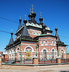
Kirow ( Russian Ки́ров ; formerly Vjatka, Russian Вя́тка ; before that Chlynow, Russian Хлы́нов ) is the regional capital of Kirov Oblast in Russia and has 473,695 inhabitants (as of October 14, 2010).
geography
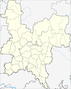
The city lies on the Trans-Siberian Railway and the navigable river Vyatka (tributary of the Kama and thus in the catchment area of the Volga ). Kirov is about 800 km as the crow flies east-northeast of Moscow . The nearest town is a good 20 km east of Kirovo-Chepetsk .
The urban area of Kirow is administratively divided into four districts ( Rajons ), in addition, eight rural districts with a total of 135 localities are subordinate to the city administration.
| Kirov | ||||||||||||||||||||||||||||||||||||||||||||||||
|---|---|---|---|---|---|---|---|---|---|---|---|---|---|---|---|---|---|---|---|---|---|---|---|---|---|---|---|---|---|---|---|---|---|---|---|---|---|---|---|---|---|---|---|---|---|---|---|---|
| Climate diagram | ||||||||||||||||||||||||||||||||||||||||||||||||
| ||||||||||||||||||||||||||||||||||||||||||||||||
|
Average monthly temperatures and rainfall for Kirov
Source:
|
|||||||||||||||||||||||||||||||||||||||||||||||||||||||||||||||||||||||||||||||||||||||||||||||||||||||||
history
The city was first mentioned in documents from 1374. It was originally established as an outpost called Chlynov (Хлынов) during the campaigns of Nizhny Novgorod settlers against cities of the Golden Horde . City historians assume that it was founded at the end of the 12th century. As was customary for Russian border towns at that time, a fortress in the style of an old Russian Kremlin was built in Chlynow with a surrounding wall about two meters high.
In the 14th and 15th centuries, the area on the river Vyatka, from which Chlynow later received its name, which was still valid until 1934, represented a politically comparatively autonomous entity owned by the Nizhny Novgorod principality. After a campaign by troops of the Moscow Grand Duke Ivan III . in 1489 Chlynov finally came to the Grand Duchy of Moscow . Until the middle of the 16th century, when Russia conquered the remains of the former Golden Horde (including the nearby Kazan Khanate ), Chlynow was an important border post. At the same time, crafts and trade in agricultural products developed there. In the 17th century, Chlynow was also used for the first time as a place of exile for disgraced nobles and later for unwelcome political activists. It retained this function into the early 20th century.
In 1781 the city, which at the end of the 17th century was considered to be the largest town in the northeast of the European part of Russia, was officially renamed Vyatka (Вятка). In 1796 the Vyatka Governorate was formed.
In the course of the Russian Civil War in the 1920s, Vyatka was severely damaged, as the governorate was fiercely contested due to its convenient location on important railway lines. On December 7, 1934, the city was given its current name after the statesman Sergei Kirov , whose murder almost a week earlier triggered the Stalinist terrorist measures . At the same time, it became the capital of the newly formed Kirov region (Russian Ки́ровский край / Kirowski krai ) on the former territory of the Vyatka Governorate (Sergei Kirov grew up here in the city of Urschum ), which two years later - with the outsourcing of Udmurtia - in Kirov Oblast was renamed.
In the city of Kirov there were two POW camps 101 and 307 for German POWs from World War II . The two prisoner-of-war hospitals 3007, Volosnitsa, and 3171, Chalturin , were assigned to camp 307 .
In 1991 there were attempts to rename the city back to Vyatka, but the name did not catch on in everyday life.
Population development
| year | Residents | Novovyatsk |
|---|---|---|
| 1897 | 25.008 | |
| 1926 | 62.097 | |
| 1939 | 143,558 | 3,411 (Vyatsky) |
| 1959 | 252,416 | 19,401 |
| 1970 | 332.503 | 26,408 |
| 1979 | 389,533 | 31,866 |
| 1989 | 440.240 | 37,880 |
| 2002 | 457.578 | |
| 2010 | 473,695 |
Note: census data
The urban-type settlements of Vyatsky and Lessosavodskoi , which emerged in the 1930s, were combined to form the city of Novovyatsk on March 28, 1955, which was incorporated into Kirov on November 1, 1989.
economy
Kirov has been an important industrial city since the early 20th century. The largest companies are in the fields of machine and device construction, electrical engineering, electronics, microbiological industry, wood processing, food and light industry. The traditional toy production (Dymkower clay figures), which has been practiced in today's Kirow since the 16th century, is also known nationwide.
traffic
Kirov is connected to the Russian trunk road network via the federal trunk road R176 "Vyatka" . Here it is crossed by the R243 , which leads from Kostroma to Perm . It also has a train station on the Trans-Siberian Railway , an inland port on the Vyatka and an airport called Pobedilowo .
In May 1937 it was decided to set up a tram network with 6 lines. Construction began in May 1940. The opening was planned for November 1, 1941. By the summer of 1941, the depot for 200 cars and 3 km of the planned Line 1 had been completed, but no electrical systems had been installed. As a result of the start of the war in June 1941, the work was stopped. The depot was handed over to the municipal waterworks in 1943, the track tracks were still on the street plan until the 1960s.
The relocation of war-important industries to Kirov increased the need for a more efficient transport system. In December 1942 the construction of a trolleybus network with material evacuated from Leningrad was decided and approved on March 30, 1943. At the end of April, the first delivery of 6 used JaTB-1 cars (built in 1936) and operating equipment arrived from Leningrad, but was damaged by a bomb attack. Construction began at the end of June, and after just 3 months, the first 4.2 km stretch between the train station and the Hotel Zentral was completed on November 5, 1943. The opening took place as part of the festivities for the anniversary of the October Revolution on November 7, 1943 at 6.15 p.m. with two festively illuminated floats.
Today (2007) routes with 816 km (695 km bus, 92 km trolleybus, 58 km marshrutki ) are operated in public transport . 545 buses, 120 trolleybuses and 39 marshrutki are available as vehicles. In 2008 more than 121.6 million passengers were carried.
culture and education
Kirov is the seat of several colleges and universities as well as the regional government for the administrative region of Kirov Oblast . It has several theaters and museums (including the writers Grin and Saltykov-Shchedrin ).
Further educational institutions

- Faculty of the Moscow State Law Academy
- Faculty of the All-Russian Distance Institute of Finance and Economics
- Branch of the University of the Russian Academy of Education
- Branch of the Moscow Humanities and Economic Institute
- Branch of the Institute for External Economic Relations, Economics and Law in Saint Petersburg
- Institute for Social Development and Regional Studies
- Kirov State Medical Academy
- Kirov State Medical Institute
- State Agricultural Academy
- State Humanities University
- State University
- Technical University
Sports
The football club FK Dynamo Kirov is based in Kirov and represents the city in the third highest Russian league . The bandy club HK Rodina Kirow takes part in the game operations of the super league .
Town twinning
Kirow maintains a town partnership with the Polish city of Siedlce .
sons and daughters of the town
- Vladimir Karawayev (1811-1892), surgeon and ophthalmologist
- Marija Corsini (1815–1859), writer and translator
- Matwei Gusew (1826–1866), astronomer
- Nikolai Tchaikovsky (1851–1926), Social Revolutionary
- Alexander Galizki (1863–1921), country doctor and chess composer
- Vladimir Senilov (1875–1918), composer
- Alexei Radakov (1877–1942), caricaturist
- Sergei Troinitsky (1882–1948), genealogist, art historian and heraldist
- Juri Wasnezow (1900–1973), painter and illustrator
- Alexander Milchakov (1903–1973), politician
- Michail Porai-Koschiz (1918–1994), chemist, crystallographer and university professor
- Marija Issakowa (1920–2011), speed skater
- Svetlana Pletnjowa (1926–2008), historian, archaeologist and university professor
- Valentin Janin (1929–2020), historian, numismatist, archaeologist and university professor
- Dmitri Kotschkin (* 1934), Nordic combined athlete
- Vyacheslav Drjagin (1940-2002), Nordic combined athlete
- Andrei Towmassjan (1942–2014), jazz musician
- Boris Kuznetsov (* 1944), lawyer
- Wladimir Urin (* 1947), opera director and director
- Yevgenia Gorchakova (* 1950), Russian-German artist and curator
- Valery Okulov (* 1952), politician
- Ilmar Taska (* 1953), Estonian film director, producer, screenwriter and writer
- Alexei Borowitin (* 1954), ski jumper
- Olga Kuragina (* 1959), track and field athlete
- Oleg Pervakov (* 1960), grand master of chess composition
- Pavel Schabalin (* 1961), mountaineer
- Valery Dudin (* 1963), luge rider
- Alexei Kuzmichev (* 1963), manager
- Dmitri Schakulin (* 1968), basketball coach
- Igor Obukhov (* 1969), Soviet-Belarusian cross-country skier
- Alexei Solodjankin (* 1972), ski jumper
- Alexander Volkov (* 1978), ski jumper
- Ekaterina Atalık (* 1982), chess player
- Iwan Schefer (* 1983), ice dancer
- Ekaterina Schichowa (* 1983), speed skater
- Oxana Domnina (* 1984), ice dancer
- Anna Alminowa (* 1985), middle-distance runner
- Alexei Sitnikow (* 1986), ice dancer
- Julija Slobina (* 1989), ice dancer
- Alexandra Babinzewa (* 1993), judoka
- Alexandra Baranzewa (* 2001), ski jumper
- Lidija Jakowlewa (* 2001), ski jumper
Web links
- Official website of the city administration (Russian)
- City Portal (Russian)
- Kirov on mojgorod.ru (Russian)
- German Teaching Aids and Culture Center Kirov
- Первый городской - Роднополисы / Chë: Musical advertising short film for Kirov (Wiatka) with the group “Rodnopolissy” on YouTube , September 1, 2011, accessed on October 18, 2018 (5:36 min.).
Individual evidence
- ↑ a b Itogi Vserossijskoj perepisi naselenija 2010 goda. Tom 1. Čislennostʹ i razmeščenie naselenija (Results of the All-Russian Census 2010. Volume 1. Number and distribution of the population). Tables 5 , pp. 12-209; 11 , pp. 312–979 (download from the website of the Federal Service for State Statistics of the Russian Federation)
- ↑ Географическое положение, административно-территориальное деление. In: admkirov.ru. Kirov City Council, archived from the original on May 16, 2009 ; Retrieved October 18, 2018 (Russian).
- ↑ Roshydromet: Kirov. In: worldweather.wmo.int, accessed October 18, 2018.
- ↑ Maschke, Erich (Ed.): On the history of the German prisoners of war of the Second World War. Verlag Ernst and Werner Gieseking, Bielefeld 1962–1977.
- ↑ Denis Turaev: Tram or trolleybus. In: troll.kirov.ru. Archived from the original on March 21, 2007 ; Retrieved October 18, 2018 (Russian).
- ↑ Окулов, Валерий , lenta.ru (Russian)


