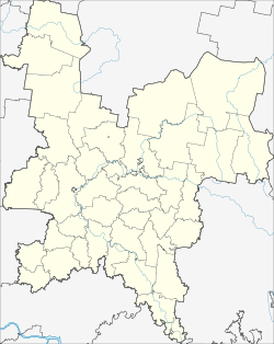
Kiknur
| Urban-type settlement
Kiknur
Кикнур
|
||||||||||||||||||||||||||||||||
|
||||||||||||||||||||||||||||||||
|
||||||||||||||||||||||||||||||||
Kiknur ( Russian Ки́кнур ) is an urban-type settlement in Kirov Oblast in Russia with 4970 inhabitants (as of October 14, 2010).
geography
The place is a good 200 km as the crow flies southwest of the Kirov Oblast Administrative Center on the right bank of the left Volga tributary Great Kokshaga (Great Kokshaga), directly above the confluence of the right tributary Waschtranga.
Kiknur is the administrative center of the Rajons Kiknurski and seat of the municipality Kiknurskoje gorodskoje posselenije, (east 2 km) which also includes the villages of Bolshoye Scharygino, Jermolkino (3 km northwest), Kuknur (4 km south), Kokschaga (northeast then) Krjaschewo (9 km north), Maloje Scharygino (2 km southeast), Orlowo (5 km northeast), Pelesnur (2 km northeast), Putinowo (2 km south), Turussinowo (9 km northeast) and Urma (5 km northeast).
history
A place in the place of today's settlement was first mentioned in 1555 as a village inhabited by Mari . From the 18th century it belonged to the Ujesd Jaransk of the Vyatka governorate . Alternatively, the Russian names Oschminskoje and - until the early 20th century - Voznesenskoje (after the local Vosnesenskoje church, from Russian Vosnessenije for " Ascension of Christ ") were in use at times .
On July 14, 1929, Kiknur became the administrative seat of a newly created Rajons named after him. Since 1966 the place has had the status of an urban-type settlement.
Population development
| year | Residents |
|---|---|
| 1939 | 1716 |
| 1970 | 4130 |
| 1979 | 5841 |
| 1989 | 6654 |
| 2002 | 5410 |
| 2010 | 4970 |
Note: census data
traffic
The regional road 33R-015 passes to the north of the settlement and branches off 40 km east in Jaransk from the federal trunk road R176 Vyatka Cheboksary - Yoshkar-Ola - Kirov - Syktyvkar . The regional road continues to the border with Nizhny Novgorod Oblast , about 30 km away from Kiknur, from there as 22R-0159 via Shachunja and Semjonow to Nizhny Novgorod .
The nearest train station is in Jaransk, the end point of a route from Zelenodolsk near Kazan via Yoshkar-Ola.
Sons and daughters of the place
- Boris Kordemski (1907–1999), mathematician
Web links
Individual evidence
- ↑ a b Itogi Vserossijskoj perepisi naselenija 2010 goda. Tom 1. Čislennostʹ i razmeščenie naselenija (Results of the All-Russian Census 2010. Volume 1. Number and distribution of the population). Tables 5 , pp. 12-209; 11 , pp. 312–979 (download from the website of the Federal Service for State Statistics of the Russian Federation)

